When people search for “Atlanta GA cities”, they’re usually trying to figure out how Atlanta fits together with all the surrounding cities and suburbs that make up metro Atlanta. If you live here, are planning a move, or are visiting, it helps a lot to understand how the city and its neighbors are laid out and what each area is known for.
This guide walks through Atlanta itself, the major nearby cities, how the metro area is organized, and what you can expect from different parts of town.
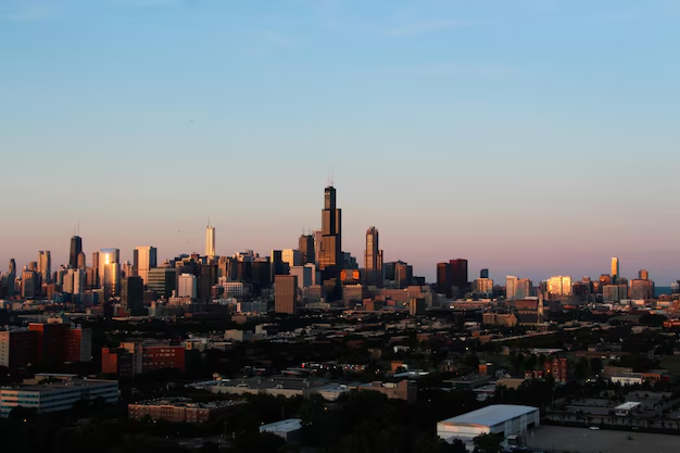
Atlanta is both:
The City of Atlanta sits mainly in Fulton County, with a small portion in DeKalb County. It includes well-known intown neighborhoods such as:
If your address says Atlanta, GA and you pay City of Atlanta taxes and utilities, you’re inside the city limits. Many nearby places still use “Atlanta” in mailing addresses but are legally separate cities.
“Metro Atlanta” usually refers to the broader Atlanta Metropolitan Area, which spans multiple counties such as:
Each county has its own set of cities, many of which function like mini-hubs with their own downtowns, schools, and identities.
Below is a simple overview of some of the most commonly mentioned cities around Atlanta and what they’re generally known for.
| City / Area | Direction from Downtown Atlanta | Quick Character Snapshot |
|---|---|---|
| Atlanta | — (center) | Urban core, major jobs, culture, nightlife |
| Sandy Springs | North | Corporate hubs, Chattahoochee parks, suburbs |
| Roswell | North | Historic downtown, family-friendly, river access |
| Alpharetta | Far north | Tech corridor, Avalon, newer subdivisions |
| Marietta | Northwest | Historic Square, suburban neighborhoods |
| Smyrna | Northwest | Braves stadium area (adjacent), town feel |
| Decatur | East | Walkable downtown, colleges, older neighborhoods |
| Dunwoody | North | Perimeter Center business/shopping district |
| College Park | South | Hartsfield-Jackson airport, historic core |
| East Point | Southwest | Close to downtown & airport, older homes |
| Forest Park | South-southeast | Industrial/warehouse mix, close to airport |
| Stone Mountain | East-northeast | Park, mountain attraction, older suburbs |
| Peachtree City | Southwest (Fayette County) | Golf-cart paths, planned community |
This isn’t a full list, but it covers many places people mean when they say “cities around Atlanta, GA.”
Locals divide the region by the I-285 loop, also called “the Perimeter.”
ITP (Inside the Perimeter)
Areas inside I-285, including most of the City of Atlanta and nearby cities like Decatur and parts of Sandy Springs.
OTP (Outside the Perimeter)
Areas outside I-285, like Alpharetta, Roswell, Marietta, and Lawrenceville.
When comparing Atlanta vs. other cities in Georgia, this ITP/OTP concept is fairly unique to the Atlanta metro conversation.
Location: Directly north of Atlanta, mostly along GA-400 and I-285.
Highlights:
Location: About 20 miles north of downtown Atlanta.
Known for:
Location: Further north along GA-400.
Known for:
Location: Just north of the Perimeter, near I-285 and GA-400.
Known for:
Location: Northwest of Atlanta in Cobb County, off I-75.
Highlights:
Location: Just inside Cobb County, close to I-285 and I-75.
Known for:
Location: West of Atlanta along I-20.
Known for:
Location: Directly east of Atlanta in DeKalb County.
Highlights:
Location: East-northeast of the city.
Known for:
Location: Immediately south of Atlanta, largely around the Hartsfield-Jackson Atlanta International Airport.
Known for:
Location: Southwest of downtown Atlanta, between the city core and College Park.
Highlights:
Further south and southeast you’ll find Forest Park, Riverdale, Jonesboro, and others:
Beyond the immediate ring around Atlanta, several independent cities are still closely tied to the metro:
People living in these places may say they’re from “Atlanta” when speaking broadly, even though they’re legally in separate cities and counties.
In the Atlanta area, services are divided between cities and counties. Depending on where you live, your:
For example:
If you’re unsure whether you’re in Atlanta or another city:
With so many cities in the Atlanta area, commuting and transit are big everyday concerns.
Major highways linking Atlanta-area cities include:
If you plan to live in a city outside Atlanta but work downtown or in Midtown, it’s worth checking whether your area has convenient access to:
If you’re deciding where in the Atlanta area to live or stay, some practical ways to compare cities include:
Commute and Transportation
Neighborhood Feel
Access to Amenities
Local Identity
If you need to confirm services, zoning, or basic city information, here are a few official government starting points in the Atlanta area:
City of Atlanta – City Hall
55 Trinity Ave SW
Atlanta, GA 30303
Main information line: (404) 330-6000
Fulton County Government Center
141 Pryor St SW
Atlanta, GA 30303
Main line: (404) 612-4000
DeKalb County Government
1300 Commerce Dr
Decatur, GA 30030
Main line: (404) 371-2000
Cobb County Government
100 Cherokee St
Marietta, GA 30090
Main line: (770) 528-1000
Gwinnett County Government
75 Langley Dr
Lawrenceville, GA 30046
Main line: (770) 822-8000
These offices can help you verify whether you’re in Atlanta or another city, what services you receive, and which local agencies to contact next.
In everyday conversation, “Atlanta” can mean the city itself or the huge web of surrounding cities that make up the metro region. Understanding where each city sits, what it’s like, and how it connects to the rest of the area makes it much easier to decide where to live, where to stay, and how to get around in and around Atlanta, GA.