Atlanta isn’t a mountain town, but it isn’t sea level either. The city’s altitude plays a quiet but important role in everything from its weather to running conditions and flight schedules. If you live in Atlanta, are planning a visit, or are just curious how “high” the city really is, understanding the elevation of Atlanta, Georgia can be surprisingly useful.
Atlanta’s elevation isn’t the same everywhere, but it falls within a fairly narrow range.
Key altitude facts for Atlanta, GA:
| Location / Area | Approximate Elevation (feet above sea level) |
|---|---|
| General City of Atlanta | ~738 ft (average) |
| Downtown (near Five Points) | ~1,050 ft |
| Hartsfield–Jackson Atlanta Intl. Airport (ATL) | ~1,026 ft |
| Midtown (Peachtree corridor) | ~950–1,050 ft |
| Buckhead | ~900–1,100 ft |
| Higher residential ridges | Up to ~1,200 ft in parts of metro area |
When people talk about the “altitude of Atlanta,” they’re usually referring to this rough 900–1,100 foot range in the core of the city.
Atlanta is often grouped with other Southern cities, but in terms of altitude it sits on the Piedmont plateau, not the coastal plain.
Compared with coastal Georgia cities that sit near sea level, Atlanta is noticeably higher, though far lower than the mountain towns of North Georgia such as Ellijay or Blue Ridge.
Atlanta’s altitude influences its climate in subtle but noticeable ways.
Because of its elevation, Atlanta is usually:
On many summer days, people traveling from the coastal areas into Atlanta notice that even a few degrees of difference can feel significant, especially in the evenings.
Atlanta still sits in a mild climate zone, but its altitude helps explain:
Higher spots around the metro—such as some hilltop neighborhoods—may see slightly more frost or earlier leaf color changes in fall compared with lower-lying surrounding areas.
Atlanta’s combination of moderate altitude and heavy tree cover shapes its air and environment.
Spring in Atlanta is well-known for its strong pollen seasons. While this is more about vegetation than altitude, the way the city’s hills and elevation mix with regional weather patterns can affect how long pollen lingers in the air.
For air-quality and environmental information tied to elevation and topography, residents sometimes refer to regional agencies such as:
These agencies offer general air-quality guidance relevant to Atlanta’s terrain and elevation.
Hartsfield–Jackson Atlanta International Airport (ATL) sits at roughly 1,000 feet above sea level. For travelers, this means:
If you see altitude listed on aviation or travel documents for Atlanta, it will usually refer to:
If you’re driving:
This gradual change is usually not dramatic enough for most people to notice physically, but it can come with shifts in temperature, wind, and cloud cover along the way.
For most day-to-day activities, Atlanta’s altitude is not high enough to cause typical “high-elevation” concerns, but it still matters in a few ways.
Runners and cyclists in Atlanta typically experience:
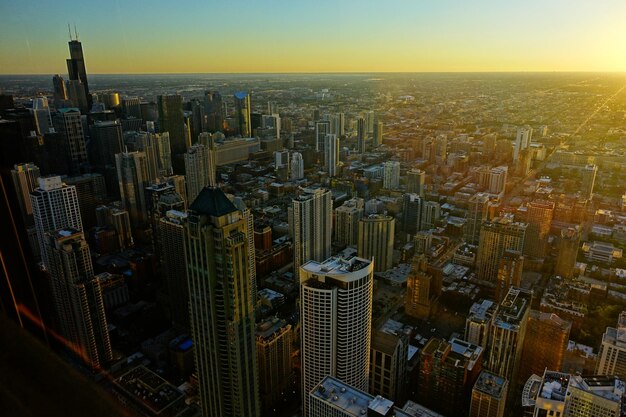
Popular intown spots such as:
all reflect the city’s elevation profile, with gently rolling ground and occasional steeper hills.
If you travel from Atlanta to significantly higher elevations—such as North Georgia mountain trails or out-of-state mountain destinations—you may notice:
Coming back down to Atlanta’s ~1,000 feet often feels easier in comparison.
Because of the city’s altitude and terrain, you’ll find:
While Atlanta doesn’t have dramatic cliffs, the altitude gives just enough relief to create scenic vantage points over the city.
Understanding Atlanta’s elevation is easier when you compare it to other areas in the state:
Atlanta sits in the middle range—high enough to have some variation, but nowhere near “high-altitude” territory.
For most people, Atlanta’s elevation has subtle, everyday effects rather than dramatic ones.
If you’re curious about the specific elevation of your home, office, or a local landmark within Atlanta, there are a few general methods people use:
While these elevations may differ by a few feet from one source to another, they’ll provide a good sense of whether your specific location is on a ridge, in a lower-lying area, or near the city’s average altitude.
Atlanta, Georgia, sits at an elevation of roughly 900–1,100 feet above sea level across much of the city, with an average altitude around 738 feet often quoted in broad references.
This moderate altitude shapes Atlanta’s:
Whether you live in Atlanta, are planning a trip, or are comparing cities, you can think of Atlanta as a mid-elevation Southern city on a plateau—high enough to matter for the landscape and climate, but not so high that it creates the challenges found in true mountain environments.