If you spend time in Atlanta, Georgia, you’ll notice it sits a little higher than many other major cities in the Southeast. Understanding Atlanta’s altitude helps explain the city’s weather, air quality, and even how you might feel during outdoor activities.
Below is a clear breakdown of how altitude in Atlanta, GA works and what it means for residents and visitors.
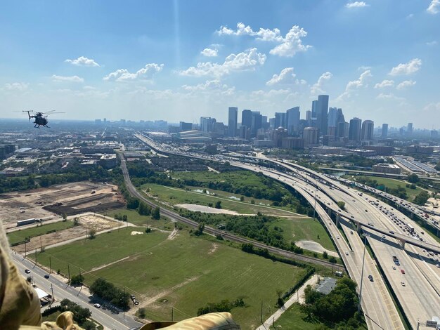
Most of the City of Atlanta sits at an elevation of around 1,000 feet (about 300 meters) above sea level.
Different parts of the metro area vary:
| Area / Landmark | Approximate Elevation (Feet) | Notes |
|---|---|---|
| Downtown Atlanta | ~1,050–1,100 ft | Around Peachtree Center, State Capitol area |
| Midtown | ~1,050–1,150 ft | Slightly higher, with gentle hills |
| Buckhead | ~1,000–1,200 ft | Some of the higher neighborhoods in the city |
| Hartsfield–Jackson Airport | ~1,020 ft | South of downtown, relatively flat |
| Stone Mountain (summit) | ~1,686 ft | Popular nearby high point, east of the city |
| Kennesaw Mountain (summit) | ~1,808 ft | North-northwest of Atlanta |
By comparison, coastal cities like Savannah or Jacksonville are close to sea level, while mountain towns in North Georgia (like Blairsville or Blue Ridge) can reach 2,000–3,000+ feet.
So Atlanta is higher than the coast, but much lower than true mountain elevations.
Because of its altitude and its position in the foothills of the Appalachians, Atlanta is often a little cooler than coastal areas at the same latitude.
Many locals notice that areas on small hills or higher neighborhoods (for example, parts of Buckhead or Druid Hills) may feel just a touch cooler or breezier than lower spots.
Atlanta’s elevation and location help shape local weather patterns:
For day-to-day weather, the National Weather Service Atlanta Forecast Office in Peachtree City provides detailed forecasts and warnings tailored to the area:
Atlanta’s altitude itself is not high enough to cause the thin, very dry air you’d find in places like Denver. However, its elevated terrain, dense development, and traffic patterns all contribute to local air quality issues.
Atlanta has periods of:
On days with limited wind, air can stagnate over the metro area despite the elevation. People who are sensitive to air quality may notice:
For air quality information, residents typically look to:
Georgia Environmental Protection Division (EPD)
Air Protection Branch
4244 International Parkway, Suite 120, Atlanta, GA 30354
Main Phone: (404) 363-7000
Atlanta–Regional Air Quality Notifications are often shared through local news outlets and weather apps.
Atlanta’s moderate elevation and tree-heavy environment (it’s often called “the city in a forest”) mean:
Those with allergies commonly track the Atlanta pollen count, which local clinics and media often report each morning in peak seasons.
At around 1,000 feet, Atlanta’s elevation is not typically high enough to cause classic altitude sickness in healthy people. Visitors coming from sea level usually:
Still, some people do perceive differences with activity.
If you run, bike, or hike in Atlanta:
Popular hilly workout spots include:
Many local runners and cyclists adjust their pace on high-pollen days or during heat advisories, which often affect comfort more than altitude itself.
For most people, Atlanta’s altitude is physiologically comfortable. Some individuals with certain heart or lung conditions may be more sensitive to air quality or weather changes rather than elevation.
If you have concerns about breathing, chest discomfort, or other health issues in Atlanta:
Well-known Atlanta hospitals with emergency services include:
While the core city sits near 1,000 feet, the greater Atlanta metro has rolling terrain with small but noticeable changes in elevation.
If you’re curious about slightly higher locations near Atlanta:
These are still lower than high mountain towns in North Georgia, but they’re noticeably higher than central Atlanta and offer a different feel, especially in cooler months.
Atlanta’s higher position compared with coastal areas provides some protection from storm surge, but local flooding can still occur due to:
Flood-prone or low-lying areas can be just a short distance downhill from higher neighborhoods. For flood risk mapping and information, residents often consult:
City of Atlanta Department of Watershed Management
72 Marietta St NW, Atlanta, GA 30303
Customer Service: (404) 546-0311
Fulton County Emergency Management Agency
130 Peachtree St SW, Suite 1101, Atlanta, GA 30303
Main Phone: (404) 612-5660
Because Atlanta’s altitude is moderate, it often serves as a transition point for people traveling between sea level and mountain destinations.
If you’re visiting from coastal areas (like Florida or the Georgia coast):
If you travel from Atlanta to North Georgia mountains, Colorado, or other high-altitude areas:
For aviation and travel logistics, Atlanta’s main airport is:
Pilots use precise elevation data for ATL’s runways, but for passengers, the ~1,020-foot altitude has minimal direct impact on flight comfort.
Here are simple ways to adapt and make the most of Atlanta’s elevation and climate:
In summary, Atlanta, GA’s altitude—around 1,000 feet above sea level—is high enough to shape its weather and landscape but not high enough to cause typical high-altitude health effects for most people. For residents and visitors, understanding this moderate elevation mainly helps explain local climate, air quality, and the city’s rolling, hilly character.