Your Guide to the Map of The Battery Atlanta (And How to Navigate It Like a Local)
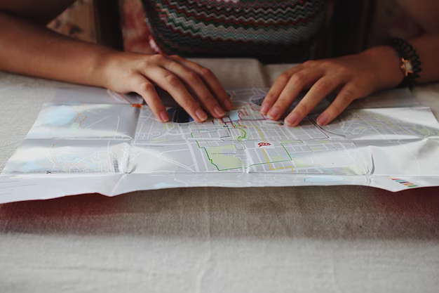
Looking for a map of The Battery Atlanta and a simple way to understand how everything fits together? Whether you’re heading to a Braves game, grabbing dinner, or planning a family outing, knowing the layout of The Battery makes your visit much smoother.
This guide walks you through the main areas, key landmarks, parking, entrances, and walking routes so you can picture the map in your head—even before you go.
Where The Battery Atlanta Is and How It’s Laid Out
The Battery Atlanta is the mixed-use development surrounding Truist Park, just northwest of the City of Atlanta near the junction of I-75 and I-285 in Cobb County.
General location overview:
- Core landmark: Truist Park (Atlanta Braves ballpark)
- Surrounding district: Restaurants, bars, retail, apartments, offices, and entertainment all radiating out from the park
- Major roads nearby:
- Cobb Parkway (U.S. 41) to the west
- Interstate 75 to the east
- Interstate 285 just to the south
- Primary access point: Around 755 Battery Ave SE, Atlanta, GA 30339 (commonly used for navigation)
On any map of The Battery Atlanta, you’ll see Truist Park at the center, with a walkable “village” wrapping around it.
Key Zones on the Map of The Battery Atlanta
While every printed or digital map looks a little different, the layout usually breaks into a few recognizable zones:
1. Truist Park: The Center of the Map
At the heart of the map is Truist Park, home of the Atlanta Braves. Most paths, plazas, and buildings are oriented around it.
What you’ll typically see on a map:
- The ballpark bowl in the middle
- Gates and entrances labeled (e.g., Home Plate Gate, Chop House Gate)
- Battery Plaza / Central gathering areas just outside certain gates
- Adjacent buildings with restaurants and rooftops overlooking the field
When using a map for game day, pay close attention to:
- Your gate number (printed on your ticket)
- Nearest parking deck or rideshare zone
- Stair, ramp, or elevator icons if accessibility is a concern
2. Main Streets and Pedestrian Areas
The Battery is very pedestrian-oriented, and most maps highlight the walkways and plazas that connect everything.
Common named streets or zones you’ll notice:
- Battery Avenue SE – The main street running through the development, lined with shops, restaurants, and parking access.
- Plaza areas – Open spaces where crowds gather before/after games and for events.
- Walkways between parking decks and the park – Often shaded or clearly marked on signage.
When you look at a map, picture a ring of activity around Truist Park, with short, walkable streets and paths connecting:
- Dining and bars
- Retail shops
- Office towers
- Residential buildings
- Parking decks
3. Parking Decks and Rideshare Zones
A map of The Battery Atlanta almost always highlights parking options, because they’re critical to planning your visit.
Major parking features you’ll see:
- Multiple labeled decks (often with letters/names and numbers)
- Color-coding or level numbers for different sections
- Game day vs. non–game day parking areas
- Rideshare pickup zones near the perimeter
Common deck types include:
- Game-day parking decks close to Truist Park
- Retail/validation decks for dining and shopping
- Reserved or permit parking for residents and office tenants
📝 Tip: Before driving from anywhere in metro Atlanta, check the official game-day parking map for the deck name, not just the address. This helps you match road signs and on-site signage with what you saw at home.
4. Dining, Bars, and Entertainment District
Surrounding the ballpark, the map will show a dense cluster of restaurants, bars, and entertainment venues. These usually line:
- Battery Avenue SE
- The main central plaza in front of Truist Park
- Side streets and ground floor levels of office/residential buildings
Maps may group or label this area as:
- Entertainment District
- Dining and Retail
- The Battery Shops & Restaurants
Some maps highlight:
- Family-friendly spots
- Late-night and bar-heavy corners
- Event stages or outdoor performance areas
For Atlanta locals, this helps you pick which side of The Battery to park or enter from, depending on whether you’re:
- Just there for dinner
- There for a show or concert
- Combining a meal with a Braves game
5. Live/Work Areas: Offices and Residences
The Battery Atlanta isn’t just for visitors; it includes apartments, condos, and office buildings that appear on more detailed maps.
You may see labeled:
- Residential buildings on the outskirts of the entertainment district
- Office towers that have retail on the ground level
- Parking decks reserved or partially reserved for tenants
For people who work or live nearby in Atlanta, these map details matter for:
- Which entrance to use in the morning
- Which decks allow long-term parking
- How to avoid the most congested areas on game days
How to Read and Use a Battery Atlanta Map Effectively
Look for Orientation Landmarks
When you arrive, compare what you see around you to a map’s big fixed landmarks:
- Truist Park – Always your main anchor
- Large parking decks – Often signed with big letters or names
- Cobb Parkway (U.S. 41) – To the west of the complex
- The I-75 / I-285 interchanges – Visible from some vantage points
Use these mental anchors so even if you don’t have a detailed printed map, you can keep track of:
- Which side of Truist Park you’re on
- How far you are from your parking deck
- The quickest way back to a main road toward your neighborhood (Midtown, Buckhead, Smyrna, Marietta, etc.)
Identify the Closest Entrance to Your Plan
On a game-day or event map, figure out where you actually need to be, then work backward:
For Braves games:
- Check which gate is listed on your ticket.
- On the map, find that gate and note the nearest parking decks and streets.
For a dinner or night out:
- Note the restaurant name and its position relative to Truist Park.
- Pick parking that lets you avoid walking around the entire stadium unless you want to.
For a quick daytime visit (coffee, lunch, errand):
- Look for retail/short-term parking on the map, often noted with special icons or validation markings.
Consider Walking Routes and Time
The Battery Atlanta is compact, but on busy days it can still take 10–20 minutes to walk from some perimeter decks to your seat or destination.
On the map, check:
- Distance between your parking deck and your gate/destination
- Stair, ramp, and elevator locations if you have mobility needs
- Crowd flow paths—primary routes tend to get congested pre- and post-event
🕒 Local tip: If you’re driving from inside the Perimeter (ITP) on a weeknight, build in extra time not just for traffic on I-75/I-285, but also for the walk from parking to your gate.
Simple Layout Snapshot of The Battery Atlanta
Here’s a simplified, text-based way to picture the map:
| Area / Feature | Where It Generally Sits on the Map | What You’ll Find There |
|---|---|---|
| Truist Park | Dead center of The Battery Atlanta | Braves games, concerts, stadium amenities |
| Main Plaza / Central | Just outside the main stadium entrances | Heavy foot traffic, events, bars, restaurants |
| Battery Avenue SE | Runs alongside/through the core district | Shops, dining, entertainment, parking access |
| Parking Decks (multiple) | Around the edges, especially north, east, and south | Game-day parking, retail parking, tenant parking |
| Retail & Dining Cluster | West, south, and northeast of Truist Park | Restaurants, shops, late-night spots |
| Residential & Offices | Outer ring of The Battery, away from main plaza noise | Apartments, office buildings, reserved parking |
| Access Roads | Perimeter (Cobb Pkwy, I-75 exits, local connectors) | Main in/out routes from the rest of metro Atlanta |
Use this as a mental map if you don’t have a printed one handy.
Getting To The Battery Atlanta From Around Metro Atlanta
While the map shows the layout of The Battery itself, it helps to understand how you’ll approach it from different parts of Atlanta:
- From Downtown/Midtown Atlanta:
- Usually via I-75 North, exiting near the Cumberland/Truist Park exits.
- From Buckhead:
- Often I-75 North or local routes via Paces Ferry or Cobb Parkway depending on traffic.
- From Sandy Springs/Dunwoody:
- Commonly down I-285 West, then connecting to Cobb Parkway or I-75.
- From Marietta / Kennesaw:
- I-75 South toward the stadium exits.
Once you exit, follow signage that matches the parking deck name or The Battery entrance you identified on your map.
Accessibility and Family-Friendly Navigation
Most maps of The Battery Atlanta highlight accessible routes and family-friendly paths. These can be especially important if you’re pushing a stroller, using a wheelchair, or visiting with small children.
Look for map icons that indicate:
- Elevators in parking decks
- Ramps and step-free paths to Truist Park entrances
- Family restrooms or larger restroom facilities
- Information or guest services areas where staff can provide printed maps and directions
For assistance on-site around Truist Park and The Battery:
- Guest services desks are typically located near main stadium entrances and key plaza areas.
- Staff can point you to accessible routes, lost and found, and family amenities.
Helpful Details to Keep in Mind When Using a Battery Atlanta Map
- Game day vs. non–game day: The parking availability and sometimes even traffic flow differ. Make sure the map you’re using matches the type of day you’re visiting.
- Event overlays: For concerts, festivals, and special events at Truist Park or The Battery, some maps will highlight temporary closures, barricades, or event zones.
- Wayfinding signs on-site: Even if your phone signal drops or your printed map gets folded the wrong way, The Battery has plenty of directional signage. Use landmarks (Truist Park, large decks, big restaurant facades) to re-orient yourself.
- Meet-up points: If you’re going with a group, pick a clear landmark visible on the map—like a specific plaza, gate, or statue—as a meeting spot in case you get separated.
Quick Reference: What to Check Before You Go
Before you leave your home, hotel, or office in Atlanta, it helps to:
- Identify your purpose: Game, dinner, shopping, concert, or a combo.
- Find your target area on the map: Restaurant or gate location.
- Pick your parking or arrival point: Note the deck name or rideshare zone.
- Plan your walking route: From parking to your destination, plus a backup path in case of crowds.
- Note a landmark meeting spot: In case phones die or signals are weak.
With a mental model of how The Battery Atlanta is laid out—Truist Park in the middle, parking and roads on the outer ring, and the dining/entertainment district in between—you can read any map of The Battery quickly and navigate it confidently, whether you’re a lifelong Atlantan or visiting for the weekend.