When you live in or visit Atlanta, Georgia, Doppler radar is one of the most useful tools for staying ahead of fast-changing weather—especially during summer thunderstorms, severe storm outbreaks, and winter mix events. Understanding Atlanta Doppler radar can help you make better decisions about commuting, outdoor plans, school pickups, flights, and game days.
This guide walks through what Doppler radar is, how it works in the Atlanta area, where it’s located, and how to use radar images to understand what’s coming your way.
Doppler radar is a type of weather radar that detects:
For Atlanta residents and visitors, it’s especially important because our area often sees:
Radar gives you a near-real-time picture of what’s happening right now, not just a forecast.
The primary National Weather Service radar that covers Atlanta is the KFFC Doppler radar, located in Peachtree City, Georgia. This radar serves the entire Atlanta metro area, including:
Key local office:
National Weather Service – Atlanta/Peachtree City Office
4 Falcon Drive
Peachtree City, GA 30269
Phone: (770) 486-1133 (general office number)
This office issues severe thunderstorm warnings, tornado warnings, flash flood warnings, and winter weather advisories for the Atlanta region, all based heavily on Doppler radar data.
Atlanta’s Doppler radar sends out pulses of energy and listens for what bounces back from:
By measuring the time and frequency shift of the returned signal, the radar can estimate both distance and motion of what it’s seeing.
Because the radar is in Peachtree City, coverage across the urban core and nearby suburbs is typically strong. As you move farther away, the radar beam is higher above the ground, which can sometimes make shallow, low-level features harder to see at long distances. Practically speaking, for most Atlanta neighborhoods, coverage is excellent for:
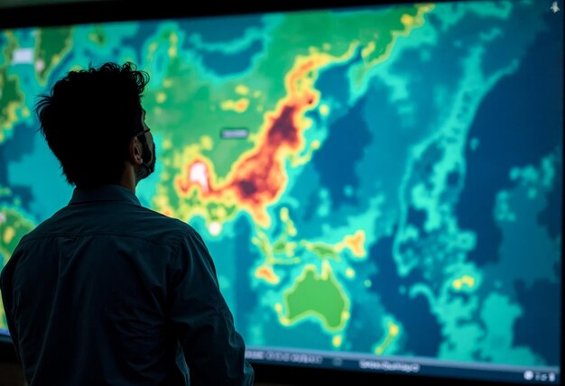
When you pull up “Atlanta Doppler radar” online or on an app, you’ll usually see a few major types of images:
This is the classic radar map with shades of green, yellow, orange, and red.
What it shows:
How to read it:
Around Atlanta, this view is most useful for:
Composite reflectivity blends multiple radar “slices” at different altitudes. It often shows larger and more intense-looking areas than base reflectivity.
In the Atlanta area, this can help you see:
This view uses the Doppler effect to show wind motion toward or away from the radar, in green and red:
Closely packed bright green/red “couplets” can indicate rotation, which is important for tornado detection.
For someone in Atlanta, you don’t need to be an expert, but it helps to know:
Atlanta’s radar is dual-polarization, meaning it sends signals horizontally and vertically. This helps distinguish:
You’ll sometimes see products like:
In winter, north metro residents sometimes watch these products to see where the rain/snow line or ice line is setting up.
Here’s a quick reference table you can keep in mind when you look at Atlanta Doppler radar reflectivity images:
| Radar Color (Base Reflectivity) | What It Usually Means in Atlanta | What You Should Consider Doing |
|---|---|---|
| Light Green | Light rain / drizzle | Outdoor plans often okay; roads just damp |
| Dark Green | Steady light to moderate rain | Allow extra drive time; pack umbrella |
| Yellow | Moderate to heavy rain | Watch for ponding on roads, slower traffic |
| Orange | Heavy rain, possible small hail | Consider delaying driving; check drainage |
| Red | Very heavy rain, strong storms | Stay indoors if possible; watch alerts |
| Purple/White cores | Intense storms, likely hail | Move cars under cover if safe; be weather-aware |
Colors look slightly different depending on app or website, but the pattern is similar.
Around metro Atlanta, afternoon storms can quickly slow traffic everywhere from Downtown Connector (I‑75/85) to I‑285.
Using radar, you can:
Look from west to east and southwest to northeast; many weather systems move in these directions across the region.
Whether you’re heading to:
Radar can help you:
On days when severe weather is possible across north and central Georgia:
⚠️ Important: Radar can show dangerous storms, but local officials and meteorologists interpret it and issue warnings. When a tornado or severe thunderstorm warning is issued, it’s best to follow official guidance for seeking safe shelter.
Atlanta has numerous creeks and low-lying areas that can flood during very heavy rainfall, especially with:
On Doppler radar, watch for:
If you live near:
radar can give you a heads-up that intense rain is falling upstream, which may lead to rapid rises in water levels.
Use these steps whenever you check “Atlanta Doppler radar”:
Find the radar site
Locate your area
Look at recent frames in motion (“loop” view)
Estimate timing
Check if storms are building or weakening
Even with good coverage, Doppler radar has some limits:
Because of these limits, meteorologists combine radar, satellite, surface observations, and reports from the public and emergency managers to understand what’s really happening.
People in the Atlanta area often find radar especially useful when:
In any of these cases, checking the latest radar loop can give much clearer insight than a generic hourly forecast.
Here are some key Atlanta-area public agencies that work closely with Doppler radar information:
National Weather Service – Atlanta/Peachtree City
4 Falcon Drive
Peachtree City, GA 30269
Phone: (770) 486-1133
Georgia Emergency Management and Homeland Security Agency (GEMA/HS)
935 E. Confederate Avenue SE
Atlanta, GA 30316
Main Phone: (404) 635-7000
City of Atlanta – Office of Emergency Preparedness
Atlanta City Hall
55 Trinity Avenue SW
Atlanta, GA 30303
Main City Info: (404) 330-6000
These agencies rely heavily on Doppler radar to monitor storms and issue warnings that affect the Atlanta region.
Understanding Atlanta Doppler radar doesn’t require deep technical knowledge. With a basic grasp of what the colors mean, where the radar is located, and how storms typically move across north and central Georgia, you can use it as a powerful tool to plan your day and stay weather-aware in and around Atlanta.