Atlanta is often called a “city in the forest,” but it could just as easily be called a city on a ridge. If you’ve ever wondered about Atlanta’s elevation, how high the city sits above sea level, or whether different neighborhoods are higher or lower, this guide walks through everything with a clear, local focus.
Short answer:
Most of the City of Atlanta sits at roughly 900–1,050 feet above sea level.
A few quick reference points:
Atlanta’s elevation is moderate—higher than many East Coast coastal cities, but lower than mountain towns in North Georgia.
Atlanta was originally founded as a railroad hub, and railroads preferred:
That’s why the historic core of Atlanta, including Downtown, Midtown, and parts of Buckhead, is on an elevated ridge between river systems. This ridge location also helped:
Today, the city’s elevation still shapes how neighborhoods feel, drain, and develop.
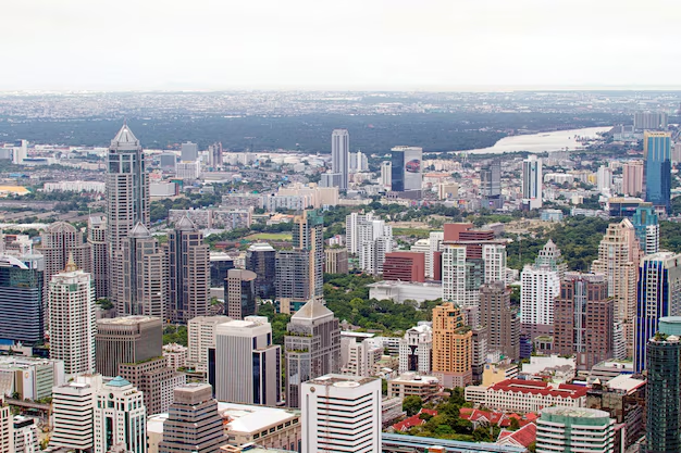
Atlanta isn’t flat. Drive from the Chattahoochee River up to Buckhead or Midtown and you’ll feel the climb.
Here’s a simplified look at how elevation varies across the Atlanta area:
| Area / Landmark | Approx. Elevation (feet above sea level) | Notes |
|---|---|---|
| Chattahoochee River (Atlanta stretch) | ~800–900 | Lowest major natural feature near city |
| Westside (e.g., West End, Westview) | ~900–1,000 | Rolling hills, some lower spots |
| Downtown (Five Points, State Capitol) | ~950–1,020 | On a central ridge |
| Midtown (Piedmont Park area) | ~1,000–1,050 | Gently sloping, high relative to city |
| Buckhead (Lenox / Peachtree corridor) | ~1,000–1,050 | Elevated, with valleys around creeks |
| East Atlanta / Kirkwood / Edgewood | ~900–1,000 | Mix of ridges and small valleys |
| Airport (Hartsfield–Jackson) | ~1,020 | On a broad, relatively flat plateau |
| Highest hills in the metro (not central) | ~1,200–1,400+ | In surrounding counties, especially to the north and west |
These numbers are approximate, but they show a clear pattern: central Atlanta sits on higher, rolling terrain, with lower elevations along rivers and creeks.
Atlanta’s elevation is not extreme, but it does shape local conditions in a few ways:
Compared with lower-lying coastal areas:
Neighborhoods on higher hills (like parts of Buckhead or Midtown’s ridge) can sometimes feel marginally cooler or breezier than nearby low spots, especially at night.
Atlanta’s elevation is not high enough to guarantee frequent snow. The city still:
However, the local topography does matter:
For day-to-day planning, Atlanta’s elevation mostly means mild winters with occasional cold snaps, not mountain weather.
If you own property, rent a home, or plan new construction in Atlanta, elevation is especially important for drainage and flood risk.
Flood-prone locations in and around the city are often:
These areas tend to be tens to a couple hundred feet lower than the surrounding hills and ridges.
Even small elevation differences can change:
If you live in Atlanta and want to understand your property’s elevation and potential risk, a few resources can help:
City of Atlanta Department of Watershed Management
72 Marietta St. NW, Atlanta, GA 30303
Main line (for general inquiries): typically reachable through the City of Atlanta customer service number listed on your water bill.
They can direct you to stormwater and floodplain information and, in some cases, local map resources.
Fulton County Public Works (for areas in unincorporated Fulton)
141 Pryor St. SW, Atlanta, GA 30303
They can provide guidance on drainage and flooding concerns in county-managed areas.
For detailed floodplain status, residents usually reference federal flood maps, then confirm with city or county planning and permitting staff before major projects.
Elevation is built into many city planning decisions, whether you see it or not.
In Atlanta’s hilly neighborhoods (like parts of Candler Park, Virginia-Highland, or west Midtown):
Local building officials and inspectors look at elevation and grading to reduce problems like:
Atlanta’s roads, MARTA rail lines, and interstates had to navigate the city’s ridges and valleys:
Developers working on large projects often need:
The Office of Buildings and City Planning Department in Atlanta review many of these details during permitting.
Atlanta isn’t at high altitude, but its elevation and hills still influence how it feels to move around the city.
Runners and cyclists in Atlanta quickly learn:
Popular outdoor spots like Piedmont Park, Freedom Park, and the Westside BeltLine Connector include a mix of flat and sloped paths. While Atlanta’s elevation won’t cause altitude-related issues typical of mountain towns, the hills can make workouts feel more intense than a flat coastal route.
Along the Chattahoochee River National Recreation Area (including access points in northwest Atlanta and nearby Cobb County):
The difference between river level and nearby ridges can be a few hundred feet, enough to create scenic overlooks and strenuous climbs in some spots.
If you want to know the elevation for your home, business, or a property you’re considering, you can:
For permitting questions about grading and elevation in the City of Atlanta, the Office of Buildings (at 55 Trinity Ave. SW) is the standard starting point.
A quick regional perspective helps put Atlanta’s elevation in context:
So, Atlanta stands higher than coastal Georgia but much lower than the true mountain regions. Day-to-day, this means:
Understanding Atlanta’s elevation helps you better evaluate where you live, how water moves around your property, and what to expect when you’re out exploring the city’s neighborhoods, trails, and parks.