Exploring the Atlanta BeltLine: What Locals and Visitors Need to Know
The Atlanta BeltLine is one of the city’s most defining features—part walking trail, part outdoor art gallery, part transportation corridor, and part neighborhood connector. Whether you live in Atlanta or are just visiting, understanding how the BeltLine works can make it much easier to get around, explore, and enjoy the city.
What Is the Atlanta BeltLine?
The Atlanta BeltLine is a developing network of multi-use trails, parks, and future transit built on old railroad corridors that loop around central Atlanta.
When people say “the BeltLine,” they usually mean:
- The Eastside Trail, Westside Trail, Southside Trail, or Northside Trail segments
- The surrounding neighborhoods, restaurants, and apartment communities that line the paths
- The bigger vision of a 22-mile loop connecting multiple intown neighborhoods
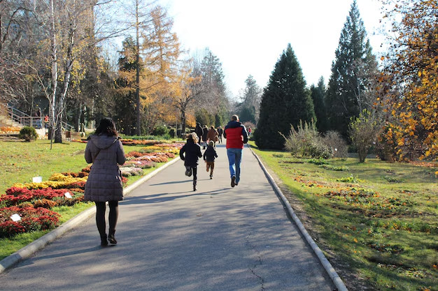
It’s designed for walking, running, biking, scooters, wheelchairs, and strollers, and it connects many of Atlanta’s most popular intown areas without needing a car.
Key BeltLine Sections You’ll Actually Use
Below is a simple overview of the main BeltLine trail segments most people talk about and use.
| BeltLine Segment | General Area | What It’s Known For |
|---|---|---|
| Eastside Trail | Midtown to Reynoldstown | Busiest section, restaurants, bars, Ponce City Market, Krog Street Market |
| Westside Trail | Southwest Atlanta | Neighborhood feel, parks, breweries, growing food scene |
| Southside Trail | Grant Park / Ormewood to West End | Connecting Eastside and Westside, some paved, some still under construction |
| Northside Trail | Buckhead area (Peachtree Hills / Collier Hills) | More residential, green, quieter trail experience |
You do not have to do the whole loop. Most Atlantans use one segment at a time based on where they live, work, or want to hang out.
How to Access the BeltLine
Major Access Points and Landmarks
Some of the most common places people enter the BeltLine include:
Ponce City Market area (Eastside Trail)
675 Ponce De Leon Ave NE, Atlanta, GA 30308
Easy access to the Eastside Trail; very popular, often crowded on weekends.Krog Street Market area (Eastside Trail)
99 Krog St NE, Atlanta, GA 30307
Quick access to Inman Park and the trail, plus food options.Old Fourth Ward Skatepark / Historic Fourth Ward Park (Eastside Trail)
Near 830 Willoughby Way NE, Atlanta, GA 30312
Good spot for families and picnics.West End MARTA Station / Lee & White area (Westside Trail)
640 Whitehall St SW, Atlanta, GA 30310 (station address)
From West End MARTA, you can walk a short distance to the Westside Trail and the nearby Lee + White development.Washington Park area (Westside Trail)
Near 102 Ollie St NW, Atlanta, GA 30314
Connects to parks and residential areas.Piedmont Park connector (Eastside/Near-North)
BeltLine spur paths connect from the Eastside Trail into Piedmont Park, one of Atlanta’s main green spaces.
Getting There Without a Car
Many people use MARTA to reach the BeltLine:
- Inman Park/Reynoldstown Station (Blue/Green Line) – about a 10–15 minute walk to the Eastside Trail
- Midtown Station (Red/Gold Line) – then walk or bike over toward Ponce City Market and join the trail
- West End Station (Red/Gold Line) – short walk to the Westside Trail
Bike and scooter share services are also common along the BeltLine, especially on busier sections.
What You Can Do on the BeltLine
1. Walk, Run, or Bike
The BeltLine is a concrete or paved multi-use trail on most finished segments. Activities include:
- Walking or jogging for daily exercise
- Biking (commuter or recreational)
- Skateboarding and rollerblading
- Scooters and mobility devices
Most sections are relatively flat, making it accessible for a wide range of fitness levels.
Tip: 🚲 If you’re biking, keep right and pass on the left, and use a bell or voice to signal passing. The Eastside Trail can be especially crowded.
2. Eat, Drink, and Hang Out
On the Eastside Trail, especially between Ponce City Market and Krog Street Market, you’ll find:
- Restaurants, coffee shops, and bars right off the trail
- Rooftop and patio spaces overlooking the BeltLine
- Casual food stops for a drink or snack during your walk or ride
On the Westside Trail, businesses around Lee + White, Pittsburgh Yards, and other nodes offer breweries, food halls, and local spots that are easier to enjoy if you want a slightly less hectic atmosphere than the Eastside.
3. Explore Parks and Green Spaces
The BeltLine connects or passes near several parks, including:
- Historic Fourth Ward Park – lakeside area, playgrounds, and open lawns
- Piedmont Park – large central park with paths, fields, and events
- Washington Park – athletic fields and a neighborhood park feel
- Adair Park and Gordon-White Park – green spots along the Westside
These parks create opportunities for picnics, dog walks, and kids’ playtime without needing to drive between different parts of intown Atlanta.
4. See Public Art and Murals
The BeltLine is well-known for public art installations and murals:
- Sculptures, installations, and rotating pieces along the Eastside and Westside
- Notable street art near Krog Street Tunnel and around Reynoldstown, Old Fourth Ward, and West End
Art often changes over time, so each visit can feel different.
When Is the Best Time to Visit the BeltLine?
The BeltLine is open year-round, and different times offer different experiences:
- Weekday mornings: Quieter, good for serious running or biking
- Weekday evenings: After-work crowd, still manageable
- Weekend afternoons: Busiest, especially on the Eastside Trail near Ponce City Market and Krog Street Market
- After dark: Trail is lit in many areas, but foot traffic slows; some people prefer company for safety
Seasonally:
- Spring and fall are especially popular thanks to comfortable temperatures.
- Summer can be hot and humid—hydration and shade breaks help.
- Winter use continues, though crowds thin out except on mild days.
Safety, Etiquette, and Accessibility
Trail Etiquette Basics
To keep the BeltLine enjoyable for everyone:
- Keep to the right, pass on the left
- Use a bell or call out “On your left” when passing
- Keep pets on a short leash and clean up after them
- Avoid blocking the path when stopping; move to the side
- Be mindful of kids, strollers, and wheelchairs
The mix of walkers, runners, and wheeled devices means awareness and patience go a long way.
Accessibility
Much of the developed BeltLine is:
- Paved and relatively flat, suitable for wheelchairs and strollers
- Equipped with ramps and gradual inclines at many access points
Some older or under-construction sections may have uneven surfaces or less formal access points, so if accessibility is important for your visit, focus on the Eastside Trail and major access nodes near established developments and parks.
Parking and Transportation Tips
If you’re driving, typical options include:
- Ponce City Market parking decks and surface lots
- Public or private lots near Krog Street Market
- On-street parking in surrounding neighborhoods (always check signs and restrictions)
- Parking areas near Lee + White and other Westside developments
Because some areas can be crowded—and neighborhood parking is limited—many people prefer:
- Rideshare to a known landmark (Ponce City Market, Krog Street Market, Lee + White)
- MARTA to West End, Inman Park/Reynoldstown, or Midtown and walking a bit to the trail
- Bringing or renting a bike or scooter to extend how far they can go once they’re on the trail
Living Near or Along the BeltLine
Over time, the BeltLine has influenced where many people choose to live. If you’re considering moving to Atlanta or changing neighborhoods, you’ll notice:
- New apartments, townhomes, and condos built close to the trail
- Older neighborhoods like Inman Park, Old Fourth Ward, Reynoldstown, West End, Adair Park, and Grant Park gaining increased attention
- Easy access to car-free commuting for people who bike or walk to nearby offices or coworking spaces
At the same time, rising demand in some BeltLine-adjacent areas has contributed to higher housing prices and property values, especially on the Eastside. The Westside and Southside segments are seeing ongoing development, but still have a more mixed, transitional feel in many spots.
Events and Activities on the BeltLine
The BeltLine frequently serves as a backdrop for:
- Organized runs and charity walks
- Informal fitness classes, pop-up events, and outdoor meetups
- Seasonal or neighborhood festivals based near the trail
If you’re local, it can be helpful to keep an eye on neighborhood association boards, community calendars, or the BeltLine’s official announcements to know when a section might be busier due to scheduled events.
Who Manages the Atlanta BeltLine?
The project is overseen primarily by Atlanta BeltLine, Inc. (ABI) in partnership with the City of Atlanta and other agencies.
For general, non-emergency questions or planning information, you can use:
- Atlanta BeltLine, Inc. (ABI)
112 Krog St NE, Suite 14, Atlanta, GA 30307
Main office line is typically listed on their official site; hours and contacts can change, so it’s best to confirm before visiting.
For issues like trail maintenance, lighting problems, or city service concerns on or near the BeltLine, Atlanta residents often contact:
- City of Atlanta – ATL 311
Dial 3-1-1 inside city limits (or 404-546-0311)
Used for non-emergency service requests, such as reporting damage or hazards on public infrastructure.
For emergencies on the trail, call 911 and provide the closest cross street or landmark.
Practical Tips for Enjoying the BeltLine
A few simple habits can make your BeltLine experience smoother:
- Hydrate and plan for shade, especially in summer
- Wear comfortable shoes if you’ll be walking long stretches
- If biking or scootering, consider lights and a helmet, especially near dusk
- Keep personal belongings secure; treat it like any busy urban public space
- If you’re new, start with a short section—for example, Ponce City Market to Krog Street Market—before exploring longer routes
How the BeltLine Fits Into Getting Around Atlanta
The BeltLine doesn’t replace highways or MARTA, but it adds another way to move through the city:
- Short commutes between nearby neighborhoods can be faster by bike than by car at rush hour
- Residents use it for “last mile” connections between MARTA stations and home or work
- Visitors can see multiple neighborhoods in one day by walking or biking along a single BeltLine segment
If you’re trying to understand modern intown Atlanta, the BeltLine is central to how the city is growing, connecting neighborhoods, and offering alternatives to driving everywhere.
By knowing which segment you’re on, how to access it, and what’s nearby, you can treat the Atlanta BeltLine as both a practical route and one of the city’s most enjoyable public spaces.