Watershed Atlanta: How Water, Creeks, and Green Space Shape Life in the City
When people search for “Watershed Atlanta,” they’re usually looking for one of two things:
- Information about Atlanta’s watersheds – the creeks, rivers, drainage systems, and floodplains that shape how the city handles water.
- Details about local “watershed” programs, groups, or restaurants tied to water, conservation, or neighborhood identity.
This guide walks you through both, keeping everything focused on Atlanta, Georgia – how watersheds affect daily life here, where your water goes when it rains, and which local resources and organizations use “watershed” in their name.
What a Watershed Is – and Why It Matters in Atlanta
A watershed is simply an area of land where all the water drains to a common point – like a creek, river, lake, or storm drain.
In Atlanta, that means:
- Rain on your driveway may flow into a storm drain that feeds a neighborhood creek.
- Water from creeks moves into larger rivers like the Chattahoochee or South River.
- These rivers help supply drinking water, support wildlife, and carry stormwater away from the city.
Because Atlanta has hills, heavy rainstorms, and a lot of pavement, watersheds play a big role in:
- Flooding risk
- Water quality and pollution
- Sewer backups and overflows
- Where parks and green spaces are located
Understanding watersheds can help you make sense of local projects, neighborhood flooding, and why the city pushes stormwater rules and green infrastructure.
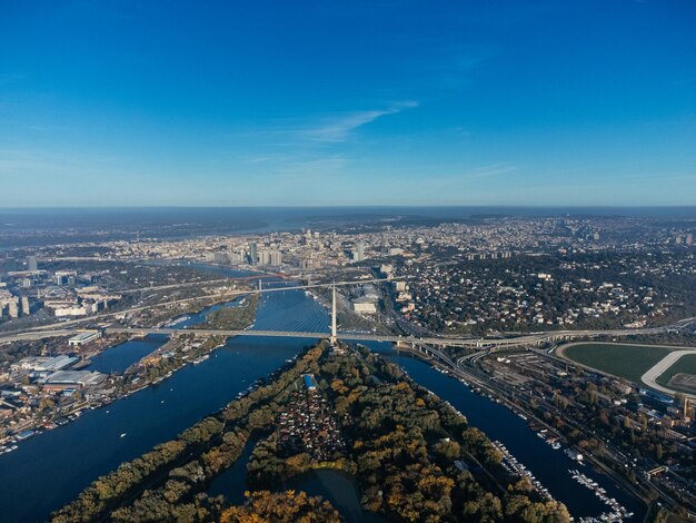
The Major Watersheds of Atlanta
Most of the City of Atlanta sits in three main watershed areas:
1. Chattahoochee River Watershed (West and Northwest Atlanta)
- Covers much of northwest and west Atlanta, including areas near Buckhead, Bolton, and Riverside.
- The Chattahoochee River is a major source of drinking water for metro Atlanta.
- Popular access points include Chattahoochee River National Recreation Area sites and the West Palisades trails.
Why it matters to residents:
- Water quality here affects drinking water and recreation like paddling, fishing, and tubing.
- Heavy development near the river can affect erosion and runoff, which is why there are strict buffers and building rules close to the water.
2. South River Watershed (South and East Atlanta)
- Covers parts of southeast Atlanta, including areas near Custer Avenue, Lakewood, Glenrose Heights, and farther downstream into DeKalb and beyond.
- The South River and its tributaries carry stormwater and treated wastewater away from the city.
Why it matters to residents:
- Neighborhoods in this watershed sometimes experience flooding during intense rain.
- Community groups pay close attention to equity, pollution, and green space access in this corridor.
3. Flint River / Upper Flint & Other Smaller Basins (Southwest Atlanta & Airport Area)
- Parts of southwest Atlanta and the area around Hartsfield-Jackson Atlanta International Airport drain toward the Flint River.
- This region includes several creeks and channels that move water south.
Why it matters to residents and visitors:
- Airport expansions, runways, and parking lots put pressure on stormwater systems.
- Runoff here has to be carefully managed to minimize downstream impacts.
How Watersheds and Stormwater Work in the City of Atlanta
When it rains in Atlanta, water follows a predictable path:
- Lands on roofs, roads, yards, and sidewalks
- Flows into gutters and storm drains
- Moves through underground pipes and channels
- Empties into creeks, streams, and rivers
Because Atlanta has many older neighborhoods and a lot of hard surfaces, the city focuses heavily on stormwater and watershed management.
City Agencies Involved
The main city agency responsible for water and watershed services is:
Department of Watershed Management
72 Marietta St. NW
Atlanta, GA 30303
Customer Service (typical main line): 404‑546‑0311
The Department of Watershed Management generally covers:
- Drinking water treatment and distribution
- Wastewater (sewer) collection and treatment
- Stormwater management, including pipes, culverts, and some green infrastructure
- Watershed protection and planning, including floodplain mapping and restoration projects
For many residents, if something involves water, sewer, or drainage on a city scale, this department is the starting point.
Common Watershed-Related Issues in Atlanta
1. Flooding in Neighborhoods
In Atlanta, flooding can show up as:
- Water pooling in streets or intersections during heavy storms
- Basement seepage in older homes built near creeks or in low-lying areas
- Overflowing drains where leaves or debris block grates
Residents often see more problems in:
- Low-lying areas of south and west Atlanta
- Older neighborhoods developed before modern stormwater standards
- Properties built near daylighted or buried streams
If you experience repeated flooding on a city street or suspect a blocked storm drain, Atlanta residents commonly contact:
- City of Atlanta Watershed Management Customer Service: 404‑546‑0311
(Many people use this number to report drainage and sewer concerns.)
2. Sewer Overflows and Backups
Because Atlanta has an aging system, sewer backups can happen, especially:
- After intense rain
- Where roots invade older sewer lines
- In neighborhoods with combined or older infrastructure
While exact procedures can vary, residents often:
- Call the City of Atlanta’s 311 or Watershed customer service line to report possible city sewer issues.
- Talk with licensed plumbers regarding issues on private property lines.
Keeping grease, wipes, and other non-flushable items out of drains and toilets is a basic step recommended by many utilities to reduce clogs.
3. Water Quality Concerns in Creeks and Streams
Atlanta has many small creeks flowing through neighborhoods, including:
- Proctor Creek (Westside)
- Intrenchment Creek (Southeast)
- Utoy Creek (Southwest)
- Peachtree Creek and its branches (North and central Atlanta)
Common concerns people often raise:
- Cloudy or discolored water after storms
- Litter and dumping in or near streams
- Erosion along creek banks behind homes
Some residents connect with watershed-focused organizations or neighborhood associations to:
- Participate in stream cleanups
- Support trail and greenway projects along creeks
- Advocate for better stormwater controls and buffers
Everyday Things Atlantans Can Do to Help Local Watersheds
You don’t need to be a scientist to protect watersheds. Everyday choices add up, especially in a dense city like Atlanta.
Simple actions that matter:
Limit what goes down storm drains
- Avoid sweeping yard waste or trash into the street.
- Use care with fertilizers and pesticides so they don’t wash into drains.
Use native or drought-tolerant landscaping
- Helps absorb more rainwater.
- Reduces the need for heavy watering and chemicals.
Consider rain-friendly upgrades (where allowed)
- Rain gardens, rain barrels, or permeable pavers can slow runoff.
- Many Atlanta homeowners use these near downspouts or in low garden areas.
Pick up after pets
- Pet waste left on sidewalks or yards can wash into streams during the next storm.
Report obvious pollution or dumping
- If you see someone dumping substances into a storm drain or creek, residents typically contact city or county environmental services or local non-emergency numbers.
“Watershed Atlanta” as a Program, Organization, or Place
Beyond the technical meaning, “watershed” also shows up in program names, advocacy groups, and local destinations.
Some examples of what Atlantans may be looking for when they search “Watershed Atlanta” include:
Watershed-Focused Agencies and Programs
City of Atlanta Department of Watershed Management
- Handles water, sewer, and stormwater services.
- Residents frequently contact this department for:
- Billing questions
- Water service issues (low pressure, leaks in streets)
- Sewer concerns or suspected main line problems
- Storm drain and flooding reports
Regional Water and Planning Bodies
- Agencies in the broader metro Atlanta area work together on long-term water supply, conservation, and watershed planning, especially around the Chattahoochee River and regional reservoirs.
Environmental and Community Watershed Groups
Atlanta has several community-based organizations that focus on watersheds, rivers, and creeks. While specific group names and locations can change over time, many of them:
- Organize river and stream cleanups
- Track water quality in specific creeks
- Support trail building and greenspace projects
- Provide education on flooding, stormwater, and pollution
Residents often find out about these groups through:
- Neighborhood associations
- Local greenway or park projects
- Community events and volunteer postings
Watersheds, Greenways, and Parks in Atlanta
If you’re visiting or living in Atlanta, you’ll notice that many parks and trails follow creeks and rivers – that’s watershed planning in action.
Popular Watershed-Related Destinations
Chattahoochee River corridors (northwest of the city)
- Hiking, fishing, paddling, and river overlooks.
- Managed in part by federal recreation areas and local jurisdictions.
Westside and Proctor Creek areas
- Growing network of trails and green spaces.
- Focus on restoring creeks and improving stormwater resilience in historically underserved neighborhoods.
South River and Intrenchment Creek area
- Forested corridors and waterway-focused advocacy.
- Residents follow discussions closely about land use, parks, and water quality.
Peachtree Creek and tributaries
- Runs through central and north Atlanta, near major roads and neighborhoods.
- Greenway concepts and segments appear along portions of these creeks.
These corridors often serve multiple purposes:
- Floodplain and stormwater management
- Habitat for plants and wildlife
- Recreation and mental health benefits for city residents
- Natural buffers to help filter pollution before it reaches rivers
Quick Reference: Watershed-Related Topics for Atlanta Residents
| If you’re wondering about… | You’re likely dealing with… | Typical next step in Atlanta |
|---|---|---|
| Street flooding or blocked storm drains | Stormwater and drainage | Contact City of Atlanta Watershed customer service or 311 |
| Basement backups or sewer smells | Possible sewer line or backup issue | Call a licensed plumber and/or City Watershed to check main lines |
| Drinking water taste, color, or pressure | Water supply and distribution | Reach out to City of Atlanta Department of Watershed Management |
| Trash in creeks or along riverbanks | Litter and local water quality | Join or organize a cleanup; notify local groups or city services |
| Building near a creek or in a low-lying area | Floodplain and watershed regulations | Check with City of Atlanta planning and watershed departments |
| Volunteering to help rivers and creeks | Community watershed and environmental groups | Look for local cleanup days, greenway projects, or volunteer hubs |
What Visitors Should Know About Watersheds in Atlanta
If you’re visiting Atlanta, “watershed” might come up when you:
- Explore trails and parks along creeks and the Chattahoochee River
- Hear about water use restrictions during dry periods
- See signs near streams about buffer zones or water quality advisories
A few practical tips:
- Respect stream buffers and stay on marked trails near creeks.
- Follow posted notices for swimming, fishing, or boating in rivers and lakes.
- Use park trash and recycling bins, especially at river overlooks and picnic areas.
How to Learn More About Watersheds in Atlanta
If you want to dive deeper into how watersheds affect your specific neighborhood, consider:
- Contacting the City of Atlanta Department of Watershed Management about local drainage or water questions.
- Learning which creek or river your address drains to – many Atlantans discover they live in the Peachtree, Proctor, Intrenchment, Utoy, or South River sub-basins.
- Joining community cleanups or meetings tied to the creek or river closest to your home.
Whether you live in Buckhead, the Westside, East Atlanta, or near the airport, you’re part of a watershed. In Atlanta, that shapes everything from how often your street floods to where new parks and trails appear, and it’s at the heart of how the city plans for its future.