If you’ve ever flown into or out of Hartsfield‑Jackson Atlanta International Airport (ATL) and looked out the window, you know the airport’s aerial view is impressive. Whether you’re a local Atlantan, planning a visit, or just curious what ATL looks like from above, understanding the Atlanta airport aerial view can help you:
Below is a practical guide to ATL from the sky, focused on what you’ll actually see and how to make the most of it.
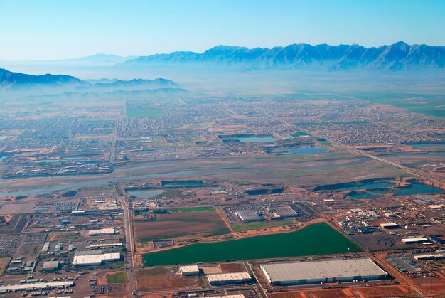
From an aerial perspective, ATL is highly organized and symmetric, which is why it looks so distinctive on approach.
One of the most noticeable features from the air is ATL’s set of parallel runways:
From your window, these runways look like wide gray strips with taxiways (narrower strips) feeding into them.
In the middle of the runways, you’ll see the main terminal area, which appears like a long spine:
From the air, the concourses look like thin rectangular islands with aircraft parked like “spokes” along each side.
Underneath those concourses is the Plane Train tunnel. You can’t see the train itself from the air, but you’ll notice:
If you’re trying to understand the airport’s layout before you land, this aerial view helps you visualize how you’ll move once you’re inside.
Your approach path determines what parts of Atlanta and the airport you’ll see.
Pilots and air traffic controllers may route flights to approach from different directions, but many passengers commonly see:
Approach from the north
Approach from the south
From the sky, you can usually identify:
If you’re landing and want to orient yourself:
If your goal is to enjoy or photograph the Atlanta airport aerial view, a bit of planning helps.
For most travelers:
On many domestic flights into ATL:
Because flight paths can change due to traffic and weather, treat these as general patterns, not guarantees.
To get the most out of your view:
Cloudy or rainy conditions may limit visibility, but you’ll still see the airport itself when breaking through lower clouds on final approach.
Many passengers into ATL hope to see Atlanta’s skyline before landing.
Depending on the route and the side of the plane:
These views are more likely on approaches that swing closer to the city’s core rather than straight in from the south.
From your window, ATL sits in a web of highways:
Nearby areas you might spot around the airport include:
If you live in Atlanta, the aerial view of the airport helps explain flight paths and noise patterns over different neighborhoods.
Although routes vary, many neighborhoods regularly see overflights as aircraft:
Neighborhoods that may notice consistent air traffic patterns (depending on wind and runway use) include:
Seeing ATL from the air gives you a clearer sense of how those routes line up with the runways.
If you’re hoping to capture ATL from above with your camera or phone, consider these practical tips.
While there is no large, elevated public observation deck inside ATL’s main terminals dedicated purely to plane spotting, you still have some options in and around Atlanta to appreciate the airfield.
From inside secure areas:
If you have time between flights, find a less crowded gate area, sit near the windows, and watch aircraft movements from ground level.
In the areas surrounding ATL:
Because locations and accessibility can change, it’s best to stay in clearly public, permitted spaces and respect private property and airport security boundaries.
Understanding the geographic orientation of ATL can make the aerial view more meaningful.
| What You See From the Air | What It Likely Is (ATL Area) |
|---|---|
| Multiple long strips, side by side | Parallel runways of Hartsfield‑Jackson |
| Rectangular “islands” with many planes | Concourses T–F and gates |
| Dense building cluster to the north | Downtown and Midtown Atlanta skyline |
| Major looping highway around the city | I‑285 (The Perimeter) |
| Compact neighborhoods with tree cover | College Park, Hapeville, East Point, and nearby |
Using this table as a mental guide, you can match what you see from your seat with where you are in metro Atlanta.
If the aerial view of Atlanta Airport is part of your travel experience, a few extra steps can help:
When booking:
When arriving in Atlanta:
When departing Atlanta:
Seeing ATL from the air is one of the best ways to grasp just how central the airport is to Atlanta’s layout, economy, and daily life. With a bit of planning, you can enjoy that aerial view as more than just a quick glance out the window—you can use it to understand how the airport fits into the broader Atlanta landscape.