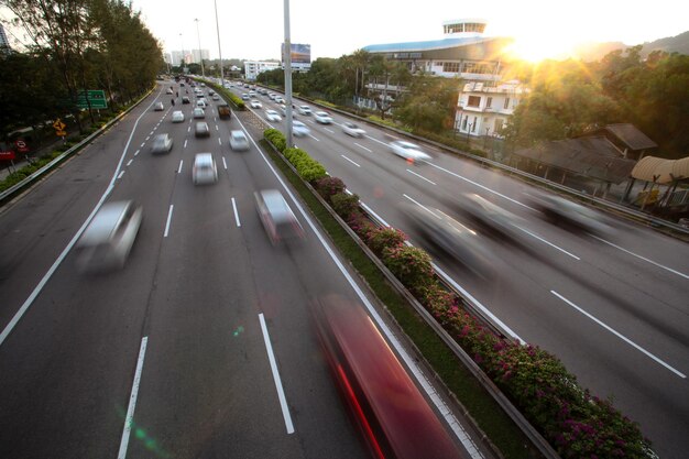
Interstate 285 in Atlanta, Georgia: What Locals and Visitors Need to Know
Interstate 285—often called “The Perimeter”—is one of the most important roads in the Atlanta area. If you live in Atlanta, commute through the metro area, or you’re visiting and trying to understand local traffic, knowing how I‑285 works can make a big difference in your daily driving.
This guide explains what Interstate 285 is, how it’s laid out, where the main interchanges are, common traffic patterns, and practical tips for getting around Atlanta more smoothly.
What Is Interstate 285 (The Perimeter)?
Interstate 285 (I‑285) is a beltway that completely circles the city of Atlanta. It:
- Connects with all major interstates coming into Atlanta
- Serves as a boundary between “ITP” (Inside the Perimeter) and “OTP” (Outside the Perimeter)
- Carries heavy commuter, freight, and airport traffic every day
For many residents, “inside” or “outside” the Perimeter is shorthand for where they live, work, and socialize. If you’re new to the area, understanding this ring road is key to understanding how Atlanta is laid out.
Basic Layout: North, South, East, and West Sides of I‑285
Although I‑285 is a loop, locals often break it into four main sides:
- Northside – from roughly I‑75 on the northwest to I‑85 on the northeast
- Southside – from I‑85 on the southwest to I‑75 on the southeast (includes airport access)
- Eastside – from I‑20 east to I‑85 north (near Doraville/Tucker)
- Westside – from I‑20 west to I‑20 south (near Cobb, Fulton, Douglas Counties)
Here’s a simple overview:
| Segment | General Area | Major Nearby Communities / Landmarks |
|---|---|---|
| North I‑285 | Sandy Springs, Dunwoody | Perimeter Center, medical district, offices |
| South I‑285 | College Park, Forest Park | Hartsfield‑Jackson Atlanta International Airport |
| East I‑285 | Tucker, Panthersville | Access toward Stone Mountain and Decatur |
| West I‑285 | Smyrna, Mableton | Access toward Cobb County, west Atlanta |
Knowing which “side” you’re heading toward helps with navigation and traffic expectations.
Key Interchanges on I‑285 Around Atlanta
Interstate 285 ties the entire metro area together. Some of the most important junctions include:
I‑285 and I‑75 (Northwest & Southeast)
Northwest (Cobb/Fulton line)
- Connects I‑285 with I‑75 North toward Marietta and Chattanooga
- Major route to Truist Park and The Battery Atlanta
- Busy with commuters from Cobb County into Atlanta
Southeast (near Forest Park)
- Connects with I‑75 South toward Macon and Florida
- Common path for trucks and long‑distance travelers bypassing Downtown
I‑285 and I‑85 (Northeast & Southwest)
Northeast (near Doraville/Chamblee)
- Known locally as “Spaghetti Junction” due to its complex ramps
- Connects I‑285 with I‑85 North toward Norcross and Greenville, SC
- Heavy commuter and freight traffic
Southwest (near College Park)
- Connects with I‑85 South toward Newnan, LaGrange, and Alabama
- Frequently used by travelers heading to and from Hartsfield‑Jackson Atlanta International Airport
I‑285 and I‑20 (East & West)
East (near Panthersville/Decatur area)
- Links I‑285 with I‑20 East toward Conyers and Augusta
- Another route for bypassing Downtown when traveling east–west
West (near Six Flags corridor)
- Links with I‑20 West toward Douglasville and Birmingham, AL
- Important for drivers heading to western suburbs and beyond
These interchanges are major traffic pinch points. If your route crosses one of them during rush hour, plan for possible delays.
Inside vs. Outside the Perimeter (ITP vs. OTP)
In Atlanta, ITP/OTP is more than just a map detail—it shapes daily life.
Inside the Perimeter (ITP)
- Generally refers to Atlanta’s core and older, in‑town neighborhoods
- Includes areas like Midtown, Downtown, Buckhead (partially), East Atlanta, Grant Park, and West End
- Many residents commute from ITP neighborhoods onto I‑285 to access jobs, suburbs, and the airport
Outside the Perimeter (OTP)
- Refers to suburbs and outlying communities beyond I‑285
- Includes cities such as Sandy Springs, Dunwoody, Smyrna, Tucker, College Park, and many others
- A large share of daily commuter traffic moves between OTP suburbs and ITP job centers
Whether you live ITP or OTP, I‑285 is likely part of your regular or occasional driving pattern.
Traffic Patterns on I‑285: When It’s Busiest
I‑285 is known locally for congestion and heavy truck traffic, but patterns are fairly predictable.
Typical Rush Hours
While conditions vary by incident and weather, many Atlanta‑area drivers encounter:
- Morning peak: roughly 6:30 a.m. – 9:30 a.m.
- Evening peak: roughly 3:30 p.m. – 7:00 p.m.
The northside and northeast segments (near I‑75 and I‑85) are particularly busy during weekday peaks because of heavy commuter and commercial traffic.
Common Slow Spots
Drivers frequently report slower conditions:
- Around Spaghetti Junction (I‑285/I‑85 NE)
- On North I‑285 near the Perimeter Center/Dunwoody area
- Near the I‑285 and I‑75 NW interchange
- Approaching the airport area on South I‑285, especially when large waves of flights arrive or depart
If you’re planning a time‑sensitive trip, such as catching a flight, build in extra time when using I‑285.
Using I‑285 to Reach Atlanta’s Airport
I‑285 is a primary way to reach Hartsfield‑Jackson Atlanta International Airport, especially from the northern and eastern suburbs.
Main Access Routes
- From North Atlanta / Perimeter Center:
- Typically: I‑285 South → I‑85 North or South to Camp Creek Parkway or Domestic/International terminals, depending on signage
- From East side suburbs (e.g., Tucker, Stone Mountain):
- I‑285 South and West toward the Airport / I‑85 interchanges
- From West side suburbs (e.g., Smyrna, Mableton):
- I‑285 South and East, then follow airport signs near the I‑85 junction
The airport’s main address is:
Hartsfield‑Jackson Atlanta International Airport
6000 N Terminal Pkwy
Atlanta, GA 30320
Main information line: (800) 897‑1910 (commonly listed information number)
Check current directions and signage as terminal routing can change over time.
Safety and Driving Tips for Interstate 285
I‑285 can feel intense, especially if you’re new to Atlanta or less comfortable with multi‑lane interstates. A few practical habits can make driving safer and less stressful:
1. Choose the Right Lane Early
- Right lanes are best if you plan to exit soon or prefer to drive at a more moderate speed.
- Center lanes usually work better for traveling longer distances around the Perimeter.
- Left lanes can involve higher speeds and frequent lane changes near major interchanges.
Avoid last‑second merges; exits can appear quickly, especially around complex interchanges.
2. Watch for Trucks and Commercial Traffic
I‑285 carries substantial freight traffic, including many large trucks using the loop to bypass Downtown. Give heavy vehicles additional space for:
- Lane changes
- On‑ramp merges
- Wider turns near tight interchanges
3. Expect Construction Zones
Major improvements and bridge replacements are periodically scheduled around the Perimeter. In work zones:
- Speeds are often reduced
- Lanes may shift, tighten, or close at off‑peak hours
- Fines for speeding or unsafe driving can be higher
Check traffic updates through local traffic services or navigation apps before major trips.
4. Plan for Incidents and Weather
Atlanta’s storms, heavy rain, or occasional winter ice can quickly worsen conditions on I‑285. Common issues include:
- Sudden slowdowns from minor fender‑benders
- Standing water in low‑lying stretches
- Reduced visibility in heavy rain
If conditions look poor, allowing extra travel time or choosing an alternate route can be helpful.
Major Exits and Access to Popular Areas
Here are a few examples of how I‑285 connects you to widely used destinations:
Perimeter Center / Dunwoody / Sandy Springs
- North I‑285 around GA‑400 and Ashford‑Dunwoody Road
- Large office parks, retail centers, and medical facilities
Cobb County / Truist Park
- I‑285 NW near I‑75 and Cobb Parkway
- Access to the stadium area and major entertainment district
Decatur and East Atlanta neighborhoods
- Use I‑285 East to connect with I‑20 West, then local streets or MARTA stations
South Atlanta / Forest Park / Clayton County
- Exits along South I‑285 link many residential communities, industrial areas, and airport‑related businesses
When visiting a specific neighborhood, cross‑checking the exit number and nearby roads before you drive can prevent sudden lane changes.
Who Manages I‑285 and Where to Get Official Info
Interstate 285 is part of Georgia’s state and federal highway system. For official information—such as construction projects, lane closures, or major detours—residents often turn to:
Georgia Department of Transportation (GDOT)
600 W Peachtree St NW
Atlanta, GA 30308
Main phone: (404) 631‑1990
GDOT publishes updates on:
- Planned roadwork and bridge projects
- Long‑term improvement plans for the Perimeter and connecting interstates
- Incident management programs operated in the Atlanta region
For real‑time incident and congestion information, drivers also commonly use navigation apps and local traffic reports that pull from state and regional traffic systems.
Practical Tips for Atlanta Residents and Visitors
To make the most of I‑285 while reducing stress:
- Time your trips: If possible, avoid the busiest peaks, especially around major junctions.
- Learn a few alternate routes: Surface streets and parallel highways can sometimes save time during heavy delays.
- Follow signage closely: Interchanges such as Spaghetti Junction can be confusing; staying in the correct lane early helps.
- Allow extra time to the airport: Travelers commonly build in a buffer for I‑285 traffic and security lines.
- Stay alert and patient: Lane changes, merging traffic, and trucks are constant; calm driving reduces risk.
Understanding how Interstate 285 functions around Atlanta—its layout, entrances and exits, and typical traffic patterns—can make everyday commuting and occasional trips smoother, whether you live here or are just passing through.