Atlanta’s streets can feel like a puzzle the first few times you drive them—especially with multiple “Peachtree” roads, busy interstates, and neighborhoods that each have their own rhythm. Whether you live here, you’re visiting, or you’re just trying to understand how streets in Atlanta, Georgia are laid out, this guide walks you through what actually matters on the ground.
Atlanta doesn’t follow a simple grid like some cities. Instead, it has:
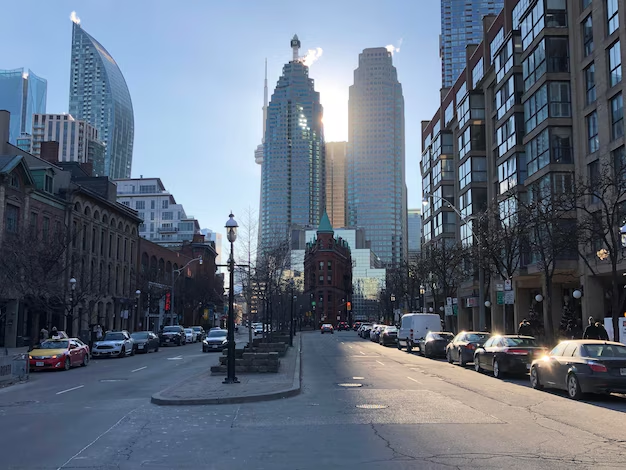
These three business and entertainment hubs sit along a north–south spine:
The Peachtree corridor is Atlanta’s best-known continuous route through all three.
Atlanta might be most famous for having what feels like hundreds of Peachtrees. In reality, there are dozens of streets, roads, and lanes with “Peachtree” in the name.
| Name | General Area | What It Connects / Known For |
|---|---|---|
| Peachtree Street | Downtown–Midtown | Major commercial street, hotels, Fox Theatre, offices |
| Peachtree Street NE | Midtown–Buckhead | Continues north, lined with towers, condos, and shopping |
| Peachtree Road NE | Buckhead–Brookhaven | Major retail corridor, Lenox area, churches, residential |
Locals usually just say “Peachtree”, but mapping apps will show the full names.
You’ll also find:
When navigating, always pay attention to:
Small differences can put you in a very different part of the city.
Most addresses within the City of Atlanta use a quadrant system based on a central reference point in Downtown, near Five Points.
You’ll see streets labeled as:
Two streets with the same name can exist in different quadrants:
If you’re using GPS or giving directions:
Beyond “Peachtree,” several main streets shape how people move through the city.
Ponce de Leon Avenue (Ponce de Leon Ave NE)
Runs from Midtown toward Decatur. A key route for access to Ponce City Market, the BeltLine, and multiple intown neighborhoods.
North Avenue (North Ave NE/NW)
Connects Georgia Tech, Midtown, and Old Fourth Ward.
Memorial Drive SE
Runs east from Downtown, passing near the State Capitol, Oakland Cemetery, and into Kirkwood and beyond.
Donald Lee Hollowell Parkway NW
Main corridor heading west/northwest from Downtown into Westside neighborhoods.
Martin Luther King Jr Drive SW
Major westbound route through Downtown and Southwest Atlanta.
Peachtree Street / Peachtree Road
The spine of Downtown, Midtown, and Buckhead, as noted above.
Piedmont Road NE
Runs parallel to Peachtree through Buckhead and Midtown; busy commercial route with heavy traffic.
Moreland Avenue NE/SE
Marks the eastern boundary of many intown neighborhoods (Inman Park, Little Five Points) and continues south.
Metropolitan Parkway SW
Runs south from near Downtown through Southwest Atlanta.
Atlanta’s surface streets are tightly connected to several large interstates:
I-75 and I-85 (the Connector)
Merge through the center of the city. Locals just call it “the Connector.” Many exits lead directly onto busy Downtown and Midtown streets.
I-20
East–west interstate splitting the city roughly in half. Crosses Downtown just south of the central business district.
GA-400
North–south highway connecting Buckhead to Sandy Springs and north metro suburbs. South end ties into I-85 near Buckhead.
Surface streets often shift names where they cross interstates or jurisdiction lines, so don’t be surprised if one continuous road has different names along the way.
Every neighborhood in Atlanta has its own street pattern and character.
Atlanta has a long history of renaming streets, sometimes to honor civil rights leaders or other important figures. For example:
What this means for you:
Parking rules vary widely from one Atlanta street to another, even within the same neighborhood.
Metered street parking
Common in Downtown, Midtown, Buckhead, and around busy commercial areas. Meters may have different time limits and paid hours.
Residential Permit Parking
Some intown neighborhoods (like Virginia-Highland or near the BeltLine) require resident permits during certain hours. Watch for signs; violations can result in tickets or towing.
Loading and No-Parking Zones
Near hotels, event venues, government buildings, and hospitals, watch curb markings and signage closely.
Parking enforcement is generally handled through City of Atlanta and contracted services. If your car is towed from a city street, information is typically available through:
Always confirm with posted signage; rules can vary block by block.
Atlanta’s streets are gradually becoming more bike- and pedestrian-friendly.
You’ll find dedicated or buffered bike lanes on:
Many intown streets are also popular with cyclists even without marked lanes, but traffic can be heavy. If you’re biking:
The Atlanta BeltLine is a multi-use trail loop connecting many neighborhoods. It intersects or runs alongside city streets at multiple points:
Drivers should be especially cautious and yield to pedestrians and cyclists at BeltLine crossings.
If you need to report a street issue—like a pothole, broken traffic signal, or missing sign—several key offices may be involved.
Handles many city street operations, including:
Main Office (City Hall):
55 Trinity Avenue SW
Atlanta, GA 30303
General info (City of Atlanta): 404-330-6000
Residents can typically report issues through:
Responsible for state routes and interstates running through Atlanta, such as:
GDOT District 7 Office (covers Metro Atlanta):
5025 New Peachtree Road
Chamblee, GA 30341
Main Phone: 770-986-1000
Use GDOT for concerns about interchanges, ramps, and state highways, not local residential streets.
A few practical habits can make navigating Atlanta much easier.
When entering an address or sharing one with a driver:
Example: “123 Peachtree Street NE” is not the same as a similar address in a different quadrant.
Some streets are frequently congested, especially at rush hour:
Planning extra time and using alternate parallel streets can help.
In Downtown Atlanta, several streets are one-way only. This can make quick turns or sudden reroutes difficult. Look for:
Locals often navigate using landmarks:
If you’re unsure, reference a landmark plus a cross street when explaining directions.
Atlanta’s public transit system, MARTA, relies heavily on the surface street network.
When planning a route:
If you live in or are staying in Atlanta and have a practical concern about a street:
Potholes, damaged street signs, traffic signal problems
Issues on interstates or state highways (I-20, I-75, I-85, GA-400, etc.)
Parking tickets or towing from city streets
Understanding how streets in Atlanta, Georgia are organized—by names, quadrants, major corridors, and which agency maintains them—makes it much easier to get around, choose routes, and handle any issues that come up while you’re living in or visiting the city.