Atlanta traffic has a reputation of its own, and if you live here, commute here, or are just visiting, having a good traffic map strategy can save you a lot of stress and time. Instead of staring at brake lights on the Downtown Connector, you can use live traffic tools to choose better routes, time your trips, and understand how Atlanta’s road network really works.
This guide walks through how to read and use a traffic map of Atlanta, Georgia, which roads to watch closely, and local tips that matter specifically in and around the city.
When you open any Atlanta traffic map (on your phone, in your car, or on a computer), you’ll usually see three main layers of information:
Most real-time maps of Atlanta use similar color codes:
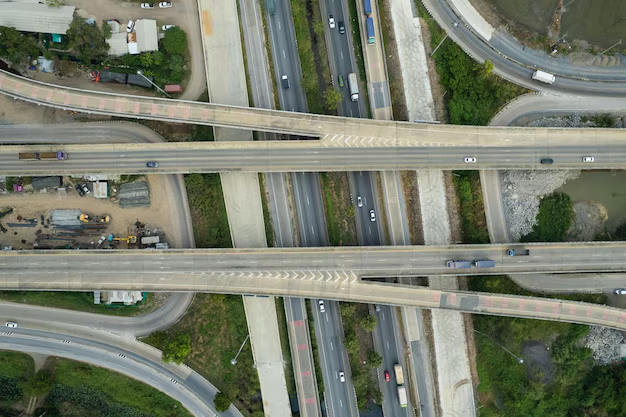
On an Atlanta map, these colored lines will be most dense on and around the Downtown Connector (I‑75/85), the Perimeter (I‑285), and the major spokes in and out of the city.
If you’re new to Atlanta or trying to plan routes, it helps to know the main roads you’ll see on a traffic map:
On a live traffic map, this stretch often shows red during rush hours and around big events.
Drivers use I‑285 both as a bypass to avoid downtown and as a main commuting route, so traffic maps frequently show heavy congestion at interchanges and on the top end (northern arc).
On a daily traffic map of Atlanta, you’ll usually see the worst congestion at:
Traffic maps during these windows typically show red or orange bands on:
Atlanta’s events can reshape the traffic map:
Sports and concerts:
Airport traffic:
Weekend construction:
Most traffic maps of Atlanta add small icons on top of the roads. The exact design varies, but you’ll commonly see:
When you tap or click these icons, many maps will show:
For Atlanta specifically, these incidents frequently cluster:
When traveling across the metro area, traffic maps help you choose between:
General pattern you’ll see:
Midday, late evening, or very early morning:
Rush hours or during events:
Watch the ETA (estimated time of arrival) each route shows and the color bands on the map to make the call.
In Atlanta, cut‑through routes can either save you or slow you more, depending on time of day and signals.
Use the map to inspect:
If the map shows:
…trying the local route might make sense. If both show orange/red, staying on the interstate may still be simpler and just as quick.
Atlanta drivers often use traffic maps to:
A quick scan of morning or afternoon traffic patterns for a few days can help you understand which windows are consistently lighter on your usual route.
Here’s a quick reference for places that frequently show congestion on Atlanta traffic maps:
| Area / Interchange | Typical Issue on Map | When It’s Worst |
|---|---|---|
| Downtown Connector (I‑75/85) | Red/slow in both directions | Rush hours, events, bad weather |
| I‑285 Top End (between I‑75 & I‑85) | Heavy orange/red in both directions | Morning and evening commutes |
| Spaghetti Junction (I‑285/I‑85 NE) | Crash icons, slow ramps, red zones | Weekday rush, bad weather |
| I‑285 / GA‑400 (Sandy Springs) | Construction icons, slow movement | Ongoing; peak in rush hours |
| I‑20 Downtown Interchanges | Red segments and frequent incidents | Rush hours, lane closures |
| I‑75 & I‑285 (Cobb Cloverleaf) | Red segments, game‑day congestion | Weekdays + Braves game days |
| I‑85 South near Airport | Orange/red and incident icons | Travel peaks, weekends, holidays |
Use these as places to double‑check on your map before finalizing your route.
Several agencies and centers feed into the traffic data you see on most maps:
GDOT oversees state highways and interstates, including:
GDOT – Atlanta District Office
600 West Peachtree Street NW
Atlanta, GA 30308
Main phone: (404) 631‑1000
GDOT operates regional centers that monitor traffic cameras, manage message boards, and coordinate incident response around Atlanta‑area interstates. Their input helps inform the real‑time traffic conditions you see in many mapping tools.
ATLDOT manages city streets, signals, and local traffic operations within the City of Atlanta limits. Their work affects how well surface streets handle overflow from interstate congestion.
City of Atlanta Department of Transportation
68 Mitchell Street SW, Suite 4100
Atlanta, GA 30303
Main phone: (404) 330‑6165
Here are simple ways to get more out of any traffic map when driving in or around Atlanta:
1. Turn on live traffic before you leave.
Check the map 5–10 minutes before departure to see if there’s an unexpected crash, closure, or major delay on your usual route.
2. Use voice guidance, not just the map.
Atlanta’s complex interchanges can be confusing, especially downtown or on I‑285. Audio directions help you stay focused on the road.
3. Re-check during long trips.
If you’re crossing the metro (e.g., from Gwinnett to Cobb or airport to North Fulton), glancing at the map during safe stops can help you reroute around new incidents.
4. Pay attention to event schedules.
If a big event is scheduled at Mercedes‑Benz Stadium, State Farm Arena, Georgia Tech, or Truist Park, zoom in on those areas and nearby interstates on the map before deciding your route.
5. Watch for construction alerts.
Persistent orange/red in the same spot at off‑peak times often signals work zones. These can last months, so build extra time into trips that pass through those areas.
6. Zoom in for local detail.
On surface streets in Atlanta’s neighborhoods (Midtown, Buckhead, Westside, East Atlanta, etc.), zooming in shows:
This is especially useful if you’re unfamiliar with the area.
If you’re visiting Atlanta and don’t drive here regularly:
For airport pickups/drop‑offs:
For downtown and Midtown hotels:
For trips to attractions:
Staying aware of color patterns and incident icons will help you avoid getting stuck on a route that Atlanta locals already know to avoid at certain times.
Using a traffic map of Atlanta, Georgia effectively means more than just glancing at red lines. By understanding the city’s major routes, typical congestion patterns, and how local incidents show up on the map, you can plan smarter trips—whether you’re commuting daily, running errands, or visiting the city’s biggest attractions.