Atlanta is famous for its trees, diverse neighborhoods, and booming economy—but it’s also known for sprawl. If you live in the metro area or are thinking about moving here, you’ve probably felt the downsides: long commutes, traffic jams on the Connector, and rapid change in once-quiet communities.
This guide explains how urban sprawl has negatively impacted Atlanta, what it looks like on the ground, and how it affects daily life in and around the city.
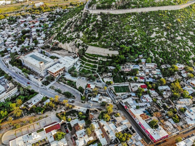
Urban sprawl in Atlanta refers to the spread of low-density development—subdivisions, strip malls, and office parks—far beyond the city’s core.
Instead of most growth clustering around places like Downtown, Midtown, and Buckhead, much of the Atlanta region has expanded outward into counties such as Cobb, Gwinnett, Clayton, Fayette, Cherokee, Henry, and Paulding.
Common features of Atlanta’s sprawl:
This pattern has shaped almost every part of life in the region—from how long you spend in traffic to how much green space is left.
For most Atlantans, the most visible downside of sprawl is traffic.
Sprawl has:
If you live in a far-flung suburb and work inside the Perimeter (ITP), an hour-plus commute each way is common during rush hour. Many residents plan their entire day around peak traffic times.
Because sprawl has led to low-density, spread-out development, it’s hard to serve many areas with frequent transit:
For many workers in areas like Gwinnett, Cherokee, or Henry County, driving is often the only realistic option, which further adds to congestion.
Atlanta has long been known as a “city in a forest,” but sprawl has chipped away at that identity.
New subdivisions, shopping centers, and road widenings have:
Areas on the outer edges of metro Atlanta—such as parts of South Fulton, North Cobb, and Gwinnett—have seen farmland, forest, and wetlands converted to housing and commercial development.
When natural ground is covered with pavement and buildings, stormwater has fewer places to go. That can contribute to:
Residents often notice this as flash flooding during heavy storms, especially in areas that were developed quickly without strong stormwater controls.
Sprawl and car dependence are closely linked to air quality issues in Atlanta.
With long commutes and limited transit, daily life for many Atlantans includes:
This pattern contributes to smog-forming emissions and can worsen days with poor air quality, especially during hot summers.
Replacing trees and grass with asphalt and concrete also contributes to the urban heat island effect:
Residents feel this as hotter streets, warmer nights, and a greater need for air conditioning, which also increases energy use.
As the Atlanta region spreads outward, local governments must stretch services farther—often at high cost.
Urban sprawl requires:
This can strain existing systems, contributing to:
Sprawling development patterns also affect:
Residents in fast-growing areas sometimes find that growth has outpaced services, leading to overcrowded roads and limited public safety coverage until local governments catch up.
Urban sprawl has complicated Atlanta’s housing and affordability picture.
As in many metro areas, people in Atlanta often move farther out to find lower home prices. This can lead to:
What looks affordable on paper can become expensive in time and car costs, especially for families with multiple commuters.
Sprawl can reinforce economic and racial separation across the region:
The result is a region where where you live—inside vs. outside the Perimeter, near transit vs. far from it—can heavily shape your access to opportunities.
Sprawl also changes how communities feel and how people interact.
In many parts of metro Atlanta:
This can make it harder to:
As demand for shorter commutes grows, intown neighborhoods experience intense development pressure:
While this is partly a separate issue from sprawl, the outward spread and inward reinvestment are connected: decades of sprawl made intown locations more attractive later, which has led to fast change.
Here is a simplified view of how sprawl’s impacts may show up in your day-to-day experience:
| Area of Life | How Sprawl Shows Up in Atlanta | What You Might Notice Personally |
|---|---|---|
| Commute | Jobs and homes far apart, highway reliance | Longer drives, unpredictable rush hours |
| Environment | Tree loss, more pavement, more driving | Hotter summers, more smoggy days, flood-prone spots |
| Costs | Cheaper housing far out, higher transport costs | More money on gas and car repairs, tolls on some routes |
| Community | Car-focused design, limited walkable centers | Fewer casual encounters, kids driven everywhere |
| Services & Taxes | More infrastructure to maintain over long distances | Crowded roads, debates over taxes and local budgets |
Individual actions won’t reverse metro-wide sprawl, but you can make choices that lessen its impact on your life and support healthier growth patterns:
Key public agencies involved in land use, transportation, and regional planning include:
Atlanta Regional Commission (ARC) – regional planning for transportation, growth, and land use
City of Atlanta Department of City Planning – zoning, planning, and neighborhood design within city limits
MARTA (Metropolitan Atlanta Rapid Transit Authority) – transit services (rail and bus)
Residents can stay involved by following planning updates, traffic studies, and public hearings in their own city or county.
Atlanta’s urban sprawl has brought growth and opportunity, but it has also created traffic, environmental strain, higher long-term costs, and deeper divides between communities. Understanding these impacts can help you make more informed decisions about where you live, how you commute, and how you engage with the future of the Atlanta region.