If you live in Atlanta, are planning a visit, or are just curious about the city’s geography, you might wonder: What is the elevation of Atlanta, Georgia? Here’s a clear, locally focused guide to how high Atlanta sits, how it varies across the metro area, and why it matters for everyday life.
Atlanta’s elevation is roughly 1,000 feet above sea level.
More specifically:
You’ll sometimes see a single, rounded figure listed (often around 1,050 feet). That number works as a good general reference, but the actual elevation changes as you move around the city.
Even if you’re not a surveyor or pilot, elevation shows up in everyday Atlanta life more than you might think.
Atlanta’s elevation helps shape its climate:
For residents, this usually shows up as:
Atlanta is often called a “city in the forest” and is surrounded by rolling hills. Elevation interacts with this landscape:
While the elevation doesn’t make Atlanta a mountain town, it does give the city a slightly different feel than lower, flat metro areas.
Elevation and slope matter when it comes to stormwater and flooding:
If you’re buying a home or business in Atlanta, you may want to:
The City of Atlanta Department of Watershed Management can provide resources on stormwater and drainage.
Main office: 72 Marietta St NW, Atlanta, GA 30303 | Phone: (404) 330-6000
Atlanta doesn’t sit at one flat level. It’s a landscape of ridges, hills, and valleys. Here’s a simple way to think about it:
| Area of Atlanta / Feature | Typical Elevation (Approx.) | Notes |
|---|---|---|
| Downtown (around Five Points) | ~950–1,050 ft | Historic city center; moderate elevation |
| Midtown | ~1,000–1,100+ ft | Slightly higher, especially near Peachtree St ridge |
| Buckhead | ~1,000–1,200 ft | Some of the higher elevations in the city core |
| Westside (e.g., West Midtown) | ~950–1,100 ft | Rolling terrain with mixed elevations |
| East Atlanta & Decatur area* | ~900–1,050 ft | Gradual variation, pockets of higher ground |
| Along major creeks & valleys | Often lower than ridges | Can sit noticeably below adjacent hilltops |
*Decatur and some close-in suburbs aren’t within the City of Atlanta limits but are part of the immediate metro and share similar elevation patterns.
Elevation changes can be subtle as you drive, but if you pay attention:
While you usually don’t need exact numbers, it can help to know how some familiar places compare:
These figures help show that most of central Atlanta sits near or just above 1,000 feet, with pockets that are slightly lower or higher.
If you want to know the precise elevation of your home, business, or favorite park in Atlanta, you have a few options:
Many widely available map tools let you:
These are rough but usually accurate enough for everyday use.
Some smartphones and weather or hiking apps can display:
These are approximate, can be affected by weather and GPS accuracy, and may vary by a few dozen feet, but they’re convenient for quick checks.
For situations that require exact elevation, such as:
Residents and professionals often use:
Atlanta’s main airport, Hartsfield-Jackson Atlanta International Airport (ATL), sits at a slightly lower elevation than some of the city’s highest neighborhoods.
If you’re curious about the exact numbers used for aviation, they are usually listed on airport diagrams and pilot resources.
If you step beyond the city limits into the broader metro:
From a practical standpoint for daily life—commuting, recreation, or choosing a neighborhood—these elevation differences are noticeable in the shape of the land (more hills, steeper driveways, changing views) rather than in extreme changes in temperature or oxygen levels.
Atlanta’s elevation around 1,000 feet is:
For most people:
If you’re training outdoors, the city’s rolling terrain provides natural variation in effort—especially in neighborhoods like Virginia-Highland, Inman Park, Buckhead, West Midtown, and parts of Southwest Atlanta where hills are common.
Here are a few everyday examples of how elevation quietly shapes the city:
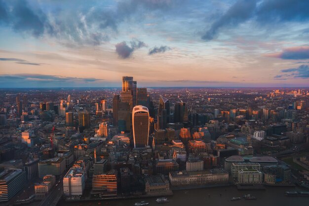
Views and Vistas:
Higher spots in Atlanta can offer skyline views or sightlines over treetops. Some hilltop streets and buildings have long views across the metro area.
Walking and Biking:
Routes that look short on a map can feel more challenging because of steep stretches or long uphill grades.
Home and Yard Design:
Sloped lots may need retaining walls, terracing, or special drainage solutions to manage rainwater and soil movement.
Stormwater Runoff:
In heavy rain, water tends to move quickly downhill, affecting how streets, yards, and parking lots handle standing water.
For questions about how elevation might influence building, grading, or stormwater requirements at a specific address, residents often start with:
Staff can usually direct you to zoning, permitting, and technical resources that take terrain and elevation into account.
In summary, Atlanta’s elevation averages around 1,000 feet above sea level, with modest but important variations across its hills, ridges, and valleys. That height helps define the city’s climate, drainage, and landscape—and it quietly shapes how Atlanta looks, feels, and functions every day.