Atlanta does have public transportation, but it works a bit differently than in some older, denser cities. The system is centered around MARTA (Metropolitan Atlanta Rapid Transit Authority) for trains and buses, supported by local streetcars, regional buses, and shuttles that help you get around the city and the metro area.
If you live in Atlanta, are visiting, or are just trying to understand how getting around works here, this guide walks through the main options and what to expect.
The backbone of public transportation in Atlanta is MARTA, which operates:
MARTA primarily serves the City of Atlanta and several nearby suburbs in Fulton, DeKalb, and Clayton counties.
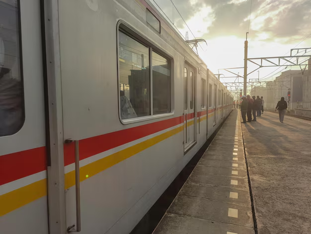
MARTA rail is the fastest way to cross the city without a car. There are four color-coded lines:
Key things to know:
Frequency:
Trains generally run every few minutes at rush hour and less often late nights and weekends. If you’re planning a tight connection or late-night trip, it’s worth checking real-time schedules.
MARTA buses connect neighborhoods, transit stations, shopping areas, and job centers that trains do not reach. Routes cover major corridors in Atlanta, plus parts of:
What to expect:
If you live in-town (especially intown Atlanta neighborhoods), you’re more likely to be near at least one MARTA route.
To use MARTA rail or bus, you’ll typically pay with a Breeze Card or Breeze Ticket.
Breeze Card – A reusable plastic fare card that you can load with:
Breeze Ticket – A disposable paper ticket, often used for short visits or single trips.
You can usually:
When you ride:
💡 Tip: If you plan to stay in Atlanta several days and use transit frequently, a multi-day pass on a Breeze Card is often more convenient than paying for each trip.
MARTA has been expanding mobile and contactless payment options:
MARTA is central, but it’s not the only public transportation in the region. Several other services connect neighborhoods, suburbs, and key destinations.
The Atlanta Streetcar is a light rail/streetcar loop operating in Downtown Atlanta, currently on a single route.
It typically links:
The streetcar is most useful for:
You pay a separate fare, though it’s still part of the city’s broader transit network.
For commuters traveling between the suburbs and the city, there are regional and county transit systems:
These services are especially relevant if you:
Fares, schedules, and routes differ from MARTA, and transfers may not always be seamless or free. If you commute from outside MARTA’s core area, it’s good to look up your county’s transit provider along with MARTA.
Atlanta’s public transportation includes services for riders with disabilities and mobility challenges.
MARTA Mobility is a paratransit door-to-door service for eligible riders who cannot use regular buses or trains due to a disability.
Key points:
Most MARTA stations and many buses are designed to be accessible:
If you or someone you travel with has specific accessibility needs, checking station layouts and current elevator status before travel can make trips smoother.
One of Atlanta’s biggest transit advantages is easy rail access to the airport.
The Airport Station is located directly in the Domestic Terminal, near baggage claim.
From the airport, you can ride directly to:
This is often faster and more predictable than driving during rush hour.
In addition to MARTA:
If you prefer not to drive at all, it’s possible to combine MARTA rail + short walk or rideshare for many neighborhoods.
Whether Atlanta public transportation “works” for you depends heavily on where you live, work, and visit.
Transit is typically most practical if you:
In these areas, you can often rely on trains and buses for daily commuting and many errands.
Public transportation becomes more challenging when you:
Many Atlanta residents use a mixed approach:
| Service | Area Covered | Best For |
|---|---|---|
| MARTA Rail | City of Atlanta + nearby suburbs | Airport trips, commuting, major attractions |
| MARTA Bus | Atlanta + parts of Fulton, DeKalb, Clayton | Neighborhood connections, last-mile access |
| Atlanta Streetcar | Downtown Atlanta loop | Short downtown trips, visitor sightseeing |
| Xpress Buses | Regional suburbs to job centers | Suburban–city commuting |
| CobbLinc, Ride Gwinnett, others | Individual counties | County-level transit, park-and-ride commutes |
| MARTA Mobility | Within MARTA service area | Accessible, eligibility-based trips |
A few simple habits make using transit in Atlanta much easier:
Plan around stations and routes
If you’re choosing a hotel or apartment and want to rely on transit, look for places near a MARTA rail station or a major bus stop.
Allow extra time for transfers
Buses and trains don’t always line up perfectly. Build in a buffer if you have an appointment or flight.
Know your backup
For late-night trips or routes with limited service, it’s helpful to have a backup option like rideshare, taxi, or a friend on call.
Check service updates
Construction, special events, or weather can affect routes and frequency, especially around major venues like Mercedes-Benz Stadium or State Farm Arena.
Here are a few central, widely used locations and contacts if you need in-person help or want a clear reference:
MARTA Headquarters & Customer Service (Downtown)
2424 Piedmont Road NE
Atlanta, GA 30324
Customer service is typically available by phone to answer route and fare questions.
Five Points Station (Central Hub)
30 Alabama Street SW
Atlanta, GA 30303
Major transfer point for all MARTA rail lines and several bus routes.
Hartsfield–Jackson Atlanta International Airport MARTA Station
Domestic Terminal, near baggage claim
Atlanta, GA 30320
If you’re unsure which service covers your area (MARTA, Xpress, CobbLinc, Ride Gwinnett, etc.), searching by your county name + “transit” is a reliable starting point, and customer service lines can walk you through options.
In summary, yes, Atlanta does have public transportation, centered on MARTA trains and buses with support from the streetcar and regional systems. It works best in and around the city core and along major corridors. With a bit of route planning and realistic expectations, many residents and visitors successfully use Atlanta transit for commuting, airport access, and getting to key destinations without a car.