Main Driving Route: Atlanta to Asheville by Car
For most Atlanta drivers, the fastest and simplest route is:
- Start on I-85 North from downtown or the Perimeter (I-285)
- Merge onto I-985 North near Suwanee/Buford
- Continue as I-985 becomes US-23/US-441 North toward Clayton, GA
- Cross into North Carolina and pick up US-23/US-74 West
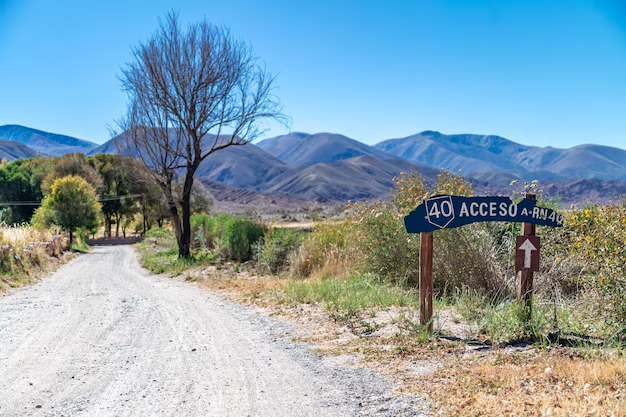
- Merge onto I-40 East briefly into Asheville
Approximate Segment Breakdown
| Segment | Approx. Distance | Approx. Time* |
|---|
| Downtown Atlanta → I-985 split | 35–40 miles | 35–45 minutes |
| I-985 → Clayton, GA | 70–80 miles | 1–1.25 hours |
| Clayton → Asheville | 80–90 miles | 1.5–2 hours |
| Total | 200–210 miles | 3.5–4 hours |
*Times assume typical conditions, not rush hour or severe weather.
How Traffic From Atlanta Affects Your Trip
Because you’re starting in Atlanta, when you leave can have a big impact on your drive time.
Best Times To Leave Atlanta
Weekdays
- 👍 Best: Mid-morning (10 a.m.–11 a.m.) or early afternoon (1 p.m.–3 p.m.)
- 👎 Avoid: 7 a.m.–9 a.m. (morning rush) and 4 p.m.–7 p.m. (evening rush)
Fridays
- Expect heavier traffic leaving Atlanta, especially:
- On I-85 North near Midtown, Brookwood, and Spaghetti Junction
- Around major suburbs like Norcross, Duluth, Buford
Weekends
- Mornings are usually smoother, especially before 10 a.m.
If you’re coming from areas like Sandy Springs, Decatur, Marietta, or College Park, add 20–45 minutes to account for metro-area driving before you clear the I-285 loop and get solidly on I-85/I-985.
Alternate Routes From Different Parts of Metro Atlanta
Where you live or stay in Atlanta can slightly change your best route.
From In-Town Atlanta (Midtown, Downtown, Old Fourth Ward)
- Most direct: I-85 North → I-985 → US-23/US-441 → US-74 → I-40 → Asheville
- Simple, well-marked, and the standard choice for most in-town residents and visitors.
From the West Side (West Midtown, Smyrna, Marietta)
You have two main options:
Cut across to I-85 North
- Use I-75 South/I-85 North through downtown, then follow the main route.
- Often a bit faster in total mileage, but downtown traffic can slow things down.
Go Around on I-285 East → I-85 North
- Avoids driving straight through downtown.
- Better during heavy traffic or major downtown events.
From the East Side (Decatur, Stone Mountain, Tucker)
- Hop on I-285 North to I-85 North, then follow I-985 and the standard route.
- Your access to I-285 is usually easier and a little faster than crossing town to pick up I-85 inside the Perimeter.
From South of the City (Hartsfield-Jackson, College Park, Fayetteville)
- Expect to:
- Take I-85 North all the way through Atlanta, or
- Use I-285 East or West around the city, then merge onto I-85 North.
- Add 30–60 minutes for the metro portion depending on traffic.
Driving Conditions: Mountains, Weather, and What to Expect
As you get closer to Asheville, the terrain changes from rolling hills to mountain roads.
Road & Terrain Overview
- The Georgia portion (I-85 / I-985) is mostly straightforward highway driving.
- US-23/US-441 and US-74 through northeast Georgia and western North Carolina:
- Have curves, some grades, and scenic stretches
- Are generally well-maintained major routes, not remote backroads
- Near Asheville, brief segments on I-40 are multi-lane divided highway again.
Weather Considerations for Atlantans
- Winter (Dec–Feb):
- Asheville and the surrounding mountains can be colder and snowier than Atlanta.
- Check mountain forecasts and possible road advisories before leaving.
- Fall:
- Leaf season is beautiful but can mean heavier traffic near prime scenic spots.
- Summer:
- Often clear and dry, but pop-up storms can reduce visibility on mountain stretches.
Other Ways to Get From Atlanta to Asheville
1. Driving Your Own Car
- Most flexible and usually the most common choice for Atlantans.
- Good if you:
- Want to stop in northeast Georgia (like Clayton or Tallulah Gorge)
- Plan to explore around Asheville once you arrive
2. Rental Car From Atlanta
If you’re visiting Atlanta and don’t have a car:
- Rental options are abundant near:
- Hartsfield-Jackson Atlanta International Airport
- Major commercial areas like Midtown, Buckhead, and Perimeter Center
A rental can be practical if you’re planning:
- A combined Atlanta + Asheville trip
- Visits to Blue Ridge Parkway or nearby small mountain towns
3. Bus Options
Schedules and routes can change, but travelers sometimes:
- Take an intercity bus from Atlanta to western North Carolina cities
- Then use local or regional transportation to reach Asheville
This usually:
- Takes longer than driving
- Involves transfers rather than a single direct ride
Because services change, it’s best to confirm current schedules and stops when planning.
4. Flying Options
There is no major commercial airport in Asheville directly connected to MARTA, and nonstop Atlanta–Asheville flights can be limited or seasonal.
Even when flights are available:
- Total door-to-door time (airport travel, security, boarding, etc.) often rivals or exceeds the 3.5–4 hour drive
- You may still need to rent a car in Asheville for local transportation
For most people in Atlanta, driving remains the most practical option.
How Far Is Asheville From Key Atlanta Landmarks?
If you’re trying to plan from a specific Atlanta spot, here are rough one-way driving distances and times to downtown Asheville:
Hartsfield-Jackson Atlanta International Airport
- Distance: ~215–225 miles
- Time: ~4–4.5 hours (depending on route and traffic)
Downtown Atlanta (Five Points / State Capitol)
- Distance: ~200–210 miles
- Time: ~3.5–4 hours
Buckhead (Lenox/Phipps area)
- Distance: ~195–205 miles
- Time: ~3.25–3.75 hours
Perimeter Center / Dunwoody
- Distance: ~190–200 miles
- Time: ~3.25–3.75 hours
These are approximations; actual time will depend on:
- Time of day
- Weather
- Construction or delays along I-85, I-985, or US-23/441
Practical Road-Trip Tips for Atlantans Driving to Asheville
Use these tips to make the most of the ~4-hour trip:
Fuel and Food Stops
Common stop areas along the way include:
- Buford / Gainesville area (along I-985)
- Cornelia / Clarkesville (US-441 corridor)
- Clayton, GA – a frequent stop:
- Gas, quick food, and restrooms
- Good place to stretch before more mountainous stretches
What to Pack in the Car
- ✅ Layers or a light jacket – Asheville is typically cooler than Atlanta
- ✅ Snacks and water, especially if traveling with kids
- ✅ Charging cables and a mount if you rely on your phone for navigation
- ✅ Printed directions or offline maps in case of spotty mountain reception
Timing Your Arrival in Asheville
If you’re staying overnight:
- Check when hotel or lodging check-in begins.
- Consider planning a late-morning or early-afternoon arrival so you:
- Miss the worst of Atlanta rush-hour traffic
- Have daylight for the mountain portion of the drive
Is Asheville a Realistic Day Trip From Atlanta?
It can be, but it’s a long day:
- Driving: About 7–8 hours round trip
- Time in Asheville: Maybe 4–6 hours depending on your pace
A same-day trip can work if you:
- Leave Atlanta very early (around 6–7 a.m.)
- Focus on just a few key activities (like walking downtown, grabbing a meal, and a quick scenic drive)
- Are comfortable driving back in the evening
For most people, a 1–3 night stay is more relaxed and lets you enjoy:
- Downtown Asheville’s restaurants and breweries
- Nearby hiking trails and scenic overlooks
- A slower-paced mountain environment compared to Atlanta
Key Takeaways for Atlanta Travelers
- Distance: Around 200–210 miles from Atlanta to Asheville by road
- Driving time: Usually 3.5–4 hours one way in typical conditions
- Best route: I-85 North → I-985 → US-23/US-441 → US-74 → I-40 → Asheville
- Main factors: Atlanta traffic, weather in the North Carolina mountains, and your starting point in the metro area
- Most practical option:Driving is usually faster and more flexible than other forms of transportation
If you’re in or around Atlanta and want mountain scenery, cooler temperatures, and a walkable city center, Asheville is close enough to be very doable—yet far enough to feel like you’ve truly gotten away.