If you’re in Atlanta, Georgia and thinking about a quick trip to Greenville, South Carolina, you’re in luck: it’s one of the easier regional getaways from the city. Here’s exactly how far it is from Atlanta to Greenville, SC, plus drive times, route options, and what to expect along the way.
From downtown Atlanta (around Five Points/Centennial Olympic Park) to downtown Greenville, SC, the trip is roughly:
Most travelers use Interstate highways for the entire trip, which keeps the drive straightforward and relatively fast.
For most people leaving from central or north Atlanta, the fastest and simplest route is:
| Segment | Approx. Distance | Typical Drive Time* |
|---|---|---|
| Downtown Atlanta → I‑85 at I‑285 (north) | 10–15 miles | 15–25 minutes |
| I‑285 (north) → GA/SC State Line | 90–100 miles | 1.5–1.75 hours |
| GA/SC State Line → Downtown Greenville | 35–45 miles | 35–45 minutes |
| Total (typical) | 145–155 miles | 2.5–3 hours |
*Times assume normal traffic and weather; Atlanta rush hours can add significant delays.
From the perspective of someone living in or visiting Atlanta, timing your departure matters almost as much as the distance.
Downtown / Midtown Atlanta
Expect about 2.5 to 3 hours in normal conditions via I‑85 North.
Buckhead / Brookhaven / Sandy Springs
You’re already closer to I‑85 or GA‑400, so the trip may be slightly faster: roughly 2.25 to 2.75 hours, depending on traffic getting to I‑85.
Hartsfield–Jackson Atlanta International Airport area
Add time to get through or around downtown. Often 2.75 to 3.25 hours, especially if you hit downtown congestion.
Gwinnett County (Duluth, Norcross, Lawrenceville)
If you’re already near I‑85 North, Greenville can be as close as 2 to 2.5 hours.
From an Atlanta driver’s point of view, the most unpredictable part of the trip is within the metro area, especially:
Once you’re past the I‑285 perimeter and into far northeast metro or rural Georgia, traffic usually thins out, and the drive becomes much more consistent.
If you’re less worried about arriving as fast as possible and more interested in a scenic drive from Atlanta toward Greenville, there are a few options:
Via US‑441 / Northeast Georgia towns (slower, more scenic)
You can head northeast from metro Atlanta through areas like Athens or Commerce, then cut back toward Greenville. This adds time and distance, but you’ll avoid long stretches of interstate and pass through more small towns.
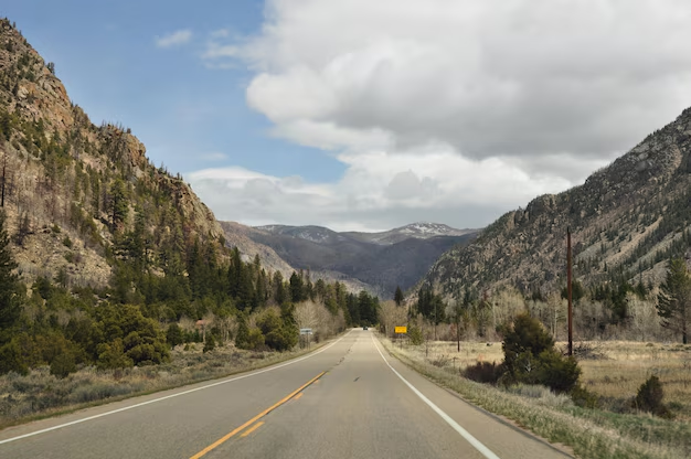
Via North Georgia mountains (substantial detour)
If you want to pair Greenville with a North Georgia stop (like Helen, Dahlonega, or Clayton), you’ll be leaving the direct corridor of I‑85. This can turn a 2.5‑hour drive into a 4+ hour trip, but it gives you mountain scenery and state park access.
For most Atlanta-based travelers, the I‑85 route is the best blend of speed and simplicity, especially for same-day round trips.
For Atlantans, driving is by far the most common and practical way to get to Greenville.
Pros:
Cons:
Regional bus services commonly run between Atlanta and Greenville, SC along the I‑85 corridor.
Common experience for Atlanta travelers:
If you’re staying near downtown Atlanta, it’s easier to connect to bus departure points using MARTA (rail or bus), rideshare, or taxis.
There is Amtrak service that covers the general corridor between Georgia and South Carolina, but for most travelers starting in Atlanta, the direct car or bus route is faster and more straightforward for this specific Atlanta–Greenville trip.
If you are committed to train travel, you would typically need to plan well in advance and be flexible about schedules and transfer points.
There is typically no practical nonstop commercial flight between Hartsfield–Jackson Atlanta International Airport and Greenville, SC for such a short distance.
By the time you:
…you could usually have driven there already from Atlanta.
For nearly all city-to-city trips between Atlanta and Greenville, driving wins on time, cost, and flexibility.
For most Atlanta-based plans, it helps to think in round-trip blocks:
Day trip:
Weekend trip:
From Downtown / Midtown:
From Hartsfield–Jackson Airport (ATL):
From North Atlanta (Sandy Springs, Dunwoody, Norcross):
The main route is almost entirely interstate highway (I‑85):
From an Atlanta traveler’s standpoint, some common spots along the way to take a break include:
Summer:
Winter:
Is Greenville, SC close enough for a same‑day round trip from Atlanta?
Yes. At around 2.5–3 hours each way, many Atlantans do day trips to Greenville, especially on weekends. Just plan an early start and consider traffic when returning.
How far is Greenville, SC from the Atlanta city limits versus downtown?
Once you cross the Atlanta city limit line (for example, in northeast Atlanta), you’ve shaved off a few miles, but the practical difference is small. From the edge of the city to downtown Greenville is still about 2.25–2.75 hours, depending on where you start and how you connect to I‑85.
Is the drive from Atlanta to Greenville, SC scenic?
Parts of I‑85 aren’t especially scenic in the way mountain routes are, but as you move away from Atlanta’s dense metro area, you’ll pass more wooded stretches and rolling hills. For truly scenic mountain vistas, you’d need to detour north of the direct route.
Can I rely on Atlanta-area public transit (like MARTA) to get me to Greenville?
No. MARTA serves the Atlanta metro area only. To get to Greenville, you’d need to combine MARTA with a bus, rideshare, or train that operates outside the MARTA network.
In summary, Greenville, SC is about 145–155 miles from Atlanta, and you can usually expect a 2.5–3 hour drive each way via I‑85 North. For someone living in or visiting Atlanta, that makes Greenville close enough for a day trip and convenient for a weekend getaway, with driving as the most practical and flexible way to go.