How Long Does It Take to Get From Atlanta to Asheville?
For most Atlanta drivers, the trip to Asheville feels like a 3.5 to 4 hour drive, depending on traffic, route, and weather.
Here’s a quick reference:
| Travel Type | Typical Time From Atlanta to Asheville |
|---|
| Driving (normal traffic) | 3.5–4 hours |
| Driving (rush hour or heavy weekend traffic) | 4–5+ hours |
| Bus (with a transfer) | Often 5–7 hours total |
| Flight (no direct commercial nonstop) | Varies; usually not time-efficient once you add connections and airport time |
For most Atlanta residents and visitors, driving is the simplest, fastest, and most flexible way to get to Asheville.
Best Driving Routes From Atlanta to Asheville
There are two main driving routes that people in Atlanta commonly use.
1. Fastest Route: I‑85 to I‑26 via Greenville/Spartanburg
This is the most direct and frequently used route.
Typical path:
- Start on I‑85 North from Atlanta (e.g., from downtown or the I‑285 perimeter).
- Continue into South Carolina, passing cities like Greenville and Spartanburg.
- Near Spartanburg, take I‑26 West toward Asheville.
- Follow I‑26 into North Carolina and on to Asheville.
Why Atlanta drivers use this route:
- Usually the fastest overall driving time
- Wide interstate highways most of the way
- Plenty of rest stops, gas stations, and food options along I‑85 and I‑26
This route is especially convenient if you’re starting from areas like Downtown Atlanta, Midtown, Buckhead, or the airport area, where getting onto I‑85 North is straightforward.
2. Scenic Route: Via U.S. 23/441 and the North Georgia Mountains
Some drivers from Atlanta prefer a more scenic, mountainous route through north Georgia and western North Carolina.
A common variation is:
- Take GA‑400 North or I‑85 North / I‑985 North toward Gainesville.
- Connect to U.S. 23/441 through the north Georgia region.
- Continue into western North Carolina, then head toward Asheville via regional highways.
Why some Atlantans choose this route:
- More mountain scenery and small towns
- Can pair the trip with stops in northeast Georgia or western NC
- Popular for people who want the drive to be part of the getaway
Tradeoff:
This route is often slightly longer and can be slower, especially behind slower traffic on two-lane mountain roads. It’s better if you care more about scenery than saving time.
Driving From Different Parts of Metro Atlanta
Where you start in metro Atlanta can change your total drive time.
From Hartsfield–Jackson Atlanta International Airport (ATL):
- Distance: typically around 205–215 miles
- Time: about 3.5–4 hours in normal traffic
- Usual path: get on I‑85 North from the airport area and follow it toward South Carolina
From Downtown / Midtown Atlanta:
- Distance: about 200–210 miles
- Time: around 3.5–4 hours
- Simple: just connect to I‑85 North and stay on it most of the way
From the Northern Suburbs (e.g., Sandy Springs, Roswell, Alpharetta):
- Distance: similar or slightly less, depending on your exact location
- Time: often 3–3.5 hours in light traffic if you’re already closer to I‑85, GA‑400, or I‑985
- These areas can also connect well to the scenic route through north Georgia
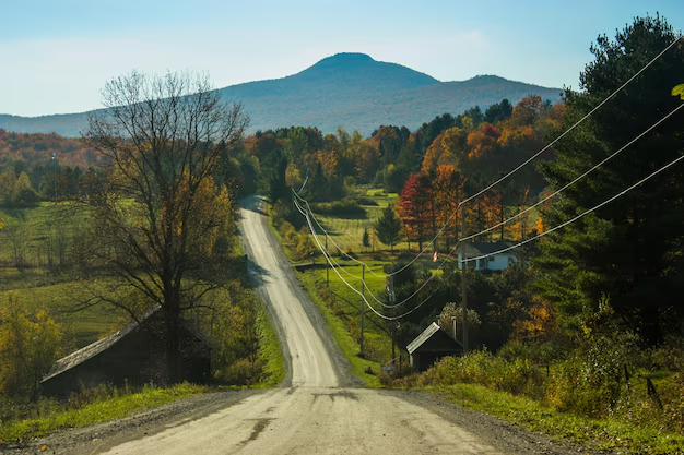
What to Expect on the Drive From Atlanta to Asheville
Terrain and Road Conditions
- The route involves interstate driving followed by mountain grades and curves as you approach Asheville.
- Weather can shift quickly in the mountains, especially in late fall, winter, and early spring.
- In winter, there can occasionally be snow or ice on elevated stretches of I‑26 and nearby roads.
If you’re used to Atlanta’s generally flatter highways, expect more curves and elevation changes near Asheville, but the main interstate routes are still designed for regular passenger vehicles.
Typical Traffic Patterns From Atlanta
Leaving Atlanta, traffic is often the biggest variable:
- Weekday mornings and late afternoons:
I‑85 and surrounding interstates can be slow leaving the metro area. - Friday afternoons and holiday weekends:
Travel toward the mountains and neighboring states can be heavier, extending your drive time.
If you can, many Atlanta drivers find it easier to:
- Leave early in the morning, or
- Depart after the main rush hour (for example, after 9:30–10:00 a.m. on weekdays)
Can You Do a Day Trip From Atlanta to Asheville?
Yes, but it’s a long day.
From Atlanta, a round trip to Asheville in one day means:
- 7–8+ hours of total driving time, plus
- Whatever time you plan to spend in Asheville itself
This can work if you:
- Leave very early from Atlanta
- Focus on one or two main activities in Asheville (such as a downtown visit, a short hike, or a scenic drive)
- Are comfortable with a longer driving day
Many Atlantans prefer to stay at least one night in or near Asheville so the trip feels more relaxed.
Is There a Bus or Train From Atlanta to Asheville?
Bus Options
There is no major direct Atlanta–Asheville bus line that works like a simple point‑to‑point commuter route. However, some travelers piece together a trip using:
- Intercity bus services (such as routes through Greenville, Spartanburg, or Charlotte)
- Then a regional bus or rideshare into Asheville
This can take significantly longer than driving and involves transfers, but it’s possible for travelers who don’t want to drive.
If you want to explore bus options, you can check schedules and routes departing from:
- Atlanta Bus Station – Greyhound / Intercity services
232 Forsyth St SW
Atlanta, GA 30303
Always verify updated schedules and routing, as connections and times can change.
Train Options
There is no direct passenger train from Atlanta to Asheville.
- Atlanta is served by Amtrak’s Peachtree Station:
1688 Peachtree St NW
Atlanta, GA 30309 - Asheville does not currently have regular Amtrak passenger service.
Some travelers combine train travel to larger hubs (like Charlotte) with buses or car rentals, but this is rarely faster or simpler than just driving from Atlanta.
Flying From Atlanta to Asheville
From an Atlanta-based perspective, flying between Atlanta and Asheville is usually not the most efficient way to travel because:
- The driving distance is relatively short (around 200 miles).
- By the time you get to Hartsfield–Jackson, clear security, wait at the gate, fly, and then get from the airport into Asheville, the total travel time is often similar to or longer than driving.
- There may not always be convenient nonstop options between Atlanta and Asheville via major commercial carriers, and flights can involve connections.
Flying is more likely to make sense if:
- You’re connecting through Atlanta from another city and continuing on to Asheville, or
- You strongly prefer not to drive and find a flight schedule that works for you
If you are considering flying, your starting point in Atlanta would almost always be:
- Hartsfield–Jackson Atlanta International Airport (ATL)
6000 N Terminal Pkwy
Atlanta, GA 30320
Practical Tips for Atlanta Travelers Driving to Asheville
A few Atlanta-specific pointers can make the trip smoother:
1. Plan Your Departure Around Atlanta Traffic
- Try to avoid peak rush hours on weekdays (roughly 6:30–9:30 a.m. and 3:30–7:00 p.m.).
- If you’re leaving on a Friday, consider departing earlier in the day to avoid weekend getaway traffic.
2. Consider Your Starting Side of the City
- If you’re in south or west Atlanta or near the airport, heading straight to I‑85 North is usually your cleanest route.
- If you’re in north or northeast metro areas, you may have better options via GA‑400 or I‑985 if you prefer a scenic or alternative route.
3. Prepare for Mountain Driving
- Fuel up before you hit the more mountainous stretches; there are service areas, but they can be more spread out.
- In cooler months, keep an eye on weather forecasts closer to Asheville since conditions there can differ from what you see in Atlanta.
Key Takeaways for Atlanta Travelers
- Distance: Around 200–210 miles by road from Atlanta to Asheville, NC.
- Drive time: Typically 3.5–4 hours, longer in heavy traffic or poor weather.
- Best route: Most Atlantans take I‑85 North to I‑26 West via Greenville and Spartanburg for the fastest, most straightforward drive.
- Other options: Scenic mountain routes are available but can take longer. There’s no direct train, and bus or flight options are typically less convenient than driving.
If you’re in Atlanta and want a nearby mountain destination with arts, food, and outdoor access, Asheville is close enough for a weekend and reachable in half a day by car.