How Far Is It From Atlanta to Alabama? A Local’s Guide to Distance, Routes, and Travel Time
If you’re in Atlanta, Georgia and wondering how far it is to Alabama, the answer depends on where in Alabama you’re headed. Alabama is Atlanta’s western neighbor, so some parts of the state are very close, while others are a longer drive.
Below is a clear breakdown tailored to people living in or visiting Atlanta who want to understand real-world distances, drive times, and the best ways to get from Atlanta to Alabama.
Quick Answer: Distance From Atlanta to Alabama
From downtown Atlanta:
- To the Alabama state line (I-20 West): about 85–90 miles, around 1.5 hours by car in normal traffic.
- To major Alabama cities (approximate driving distance and time):
- Birmingham: ~147 miles, about 2–2.5 hours
- Montgomery: ~160–170 miles, about 2.5–3 hours
- Mobile: ~320–330 miles, about 5–5.5 hours
- Huntsville: ~190–200 miles, about 3–3.5 hours
- Tuscaloosa: ~200 miles, about 3 hours
These times assume typical conditions leaving from the Atlanta city center (around Downtown/Midtown).
At-a-Glance Distance & Drive Time From Atlanta to Popular Alabama Destinations
| From Atlanta (Downtown) | Approx. Distance | Typical Drive Time | Main Route(s) |
|---|---|---|---|
| Alabama State Line (west) | 85–90 miles | 1.5 hours | I-20 W |
| Birmingham, AL | ~147 miles | 2–2.5 hours | I-20 W |
| Montgomery, AL | ~160–170 miles | 2.5–3 hours | I-85 S → I-65 S |
| Huntsville, AL | ~190–200 miles | 3–3.5 hours | I-75 N / I-575 N → US-411 / AL- routes (varies) |
| Tuscaloosa, AL | ~200 miles | ~3 hours | I-20 W / I-59 S |
| Mobile, AL | ~320–330 miles | 5–5.5 hours | I-85 S → I-65 S |
| Gulf Shores / Orange Beach, AL | ~350–370 miles | 5.5–6.5 hours | I-85 S → I-65 S → AL coastal routes |
Times can stretch significantly during rush hour or holiday weekends, especially as you leave or re-enter the Atlanta metro.
How You Can Get From Atlanta to Alabama
1. Driving From Atlanta to Alabama
For most people in Atlanta, driving is the most straightforward way to get to Alabama.
Common Driving Routes
Atlanta to Birmingham
- Route: I-20 West straight from Atlanta
- Approx. time: 2–2.5 hours
- This is one of the simplest and most direct routes. You’ll pass through cities like Douglasville and Anniston.
Atlanta to Montgomery
- Route: I-85 South from Atlanta toward Columbus/LaGrange, then connect to I-65 South toward Montgomery
- Approx. time: 2.5–3 hours
Atlanta to Huntsville
- Routes vary; a common option is to head north via I-75 or GA-400 and connect through US highways into northern Alabama.
- Approx. time: 3–3.5 hours
Atlanta to Mobile or Gulf Coast Beaches
- Route: I-85 South → I-65 South, then local highways toward Mobile, Gulf Shores, or Orange Beach
- Approx. time: 5–6+ hours
Traffic Considerations Leaving Atlanta
Leaving Atlanta can be the hardest part of the trip:
- Expect slowdowns on:
- I-20 West past Downtown, Westside, and Douglasville
- I-85 South around Downtown Connector, Hartsfield-Jackson Atlanta International Airport, and Union City
- Heaviest congestion windows typically include:
- Weekday mornings (roughly 6:30–9:30 a.m.)
- Weekday evenings (roughly 3:30–7:00 p.m.)
- Holiday weekends (especially Friday afternoon and Monday evening)
If you can, leave Atlanta outside rush hour to keep the Alabama drive closer to the “typical” times listed above.
2. Flying From Atlanta to Alabama
If you’re heading to cities farther into Alabama—like Mobile or Huntsville—or you simply prefer to fly, Hartsfield-Jackson Atlanta International Airport (ATL) is your main hub.
Hartsfield-Jackson Atlanta International Airport (ATL)
6000 N Terminal Pkwy, Atlanta, GA 30320
General information: (800) 897-1910
From ATL, there are usually nonstop or one-stop flights to several Alabama airports, including:
- Birmingham-Shuttlesworth International Airport (BHM)
- Huntsville International Airport (HSV)
- Mobile Regional Airport (MOB) or Mobile International
- Occasionally other regional airports depending on airline schedules
Flying can make sense when:
- You’re traveling to south or coastal Alabama
- You want to avoid a 5–6 hour drive
- You’re connecting through Atlanta anyway
However, for Birmingham and Montgomery, many Atlanta travelers still find driving faster and more flexible once you factor in airport check-in and security time.
3. Bus and Other Ground Transportation Options
If you don’t want to drive yourself, there are intercity bus services that run between Atlanta and Alabama cities, especially Birmingham and Montgomery.
Intercity Buses
Buses generally:
- Depart from central or near-central locations in Atlanta (often near Downtown or Midtown)
- Travel along major interstates like I-20 and I-85
- Take similar or slightly longer times than driving yourself, depending on stops
Before you go, check:
- The departure location in Atlanta (some providers use separate terminals or curbside stops)
- Check-in time requirements
- Whether you can bring luggage or bikes, if relevant
Rideshare and Car Rentals
If you don’t own a car while in Atlanta:
- Rideshare for the full trip to Alabama can be expensive but might work for shorter hops near the state line.
- Car rentals are widely available:
- At Hartsfield-Jackson Airport
- Around Downtown, Midtown, Buckhead, and other neighborhoods
For multi-day visits to Alabama, many Atlanta residents and visitors find renting a car to be the most economical and flexible option.
Which Alabama City Feels “Closest” to Atlanta?
From a practical Atlanta perspective, the Alabama destinations that feel closest are:
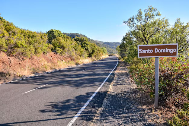
The Alabama state line on I-20 West
Roughly 1.5 hours from central Atlanta. This is the fastest way to be technically “in Alabama” from Atlanta by car.Birmingham, Alabama
Often considered the most accessible major Alabama city from Atlanta:- ~2–2.5 hours via I-20 West
- Simple, mostly straight interstate drive
- Popular for weekend trips, events, and conferences
Montgomery, Alabama
Slightly farther, but still a reasonable day or weekend trip:- ~2.5–3 hours via I-85 South → I-65 South
- Common for history tourism or state government visits
Tips for Planning Your Trip From Atlanta to Alabama
1. Time Your Departure From Atlanta ⏰
To keep your drive consistent with the times listed above:
- Try to leave:
- After 9:30 a.m. on weekdays, or
- Before 3:00 p.m. in the afternoon
- For weekend trips, early morning departures often mean smoother traffic out of Atlanta.
2. Know Your Starting Point in Metro Atlanta
If you’re not starting from downtown, travel time will vary:
- From Westside, Cascade, or Southwest Atlanta, you’re often closer to I-20 West.
- From Decatur, Stone Mountain, or East Atlanta, expect extra time to cross the city to reach I-20 West or I-85 South.
- From North Fulton or Gwinnett, factor in the time to reach your chosen interstate.
For many travelers, using a real-time navigation app from your neighborhood gives a more precise estimate than just mileage.
3. Rest Stops Between Atlanta and Alabama
On your way to Alabama, you’ll find:
- Rest areas and welcome centers on interstates like:
- I-20 West (toward Birmingham)
- I-85 South (toward Montgomery)
- Gas stations and food options clustered around major exits near:
- Douglasville, Villa Rica, and Bremen (west on I-20)
- Newnan, LaGrange, and West Point (south on I-85)
Many Atlanta travelers plan a quick stop just before or just after crossing the Alabama state line to stretch and refuel.
Is Alabama a Reasonable Day Trip From Atlanta?
Yes, in many cases:
- Day trips are realistic for:
- Birmingham (2–2.5 hours each way)
- Montgomery (2.5–3 hours each way)
- Areas close to the state line on I-20 or I-85
You can:
- Leave Atlanta in the morning
- Spend 5–7 hours in an Alabama city
- Drive back to Atlanta the same evening
For destinations like Mobile or the Gulf Coast, an overnight or weekend trip is more comfortable, given the 5–6+ hour one-way drive.
How Far Is Alabama If You’re Just Crossing the Border?
If your goal is simply to know “How far is it from Atlanta to the Alabama border?”, here’s the simplest view:
- From Downtown Atlanta:
- To the Alabama state line on I-20 West:
- About 85–90 miles
- Roughly 1.5 hours in steady traffic
- To the Alabama state line near I-85 South:
- Slightly farther, typically 90–100 miles
- About 1.5–2 hours, depending on traffic around the airport and south metro
- To the Alabama state line on I-20 West:
So, for most Atlanta residents and visitors, Alabama is roughly a 1.5- to 2-hour drive away at its closest points.
Key Takeaways for Atlanta Travelers
- Closest part of Alabama from Atlanta: around 85–90 miles, about 1.5 hours by car.
- Most accessible major Alabama city: Birmingham, roughly 2–2.5 hours via I-20 West.
- Other major cities:
- Montgomery: about 2.5–3 hours
- Huntsville: about 3–3.5 hours
- Mobile: about 5–5.5 hours
- Best way to travel for most people: driving from Atlanta, with flying as an option for longer-distance Alabama destinations.
- Your actual travel time will depend heavily on where in metro Atlanta you start and when you hit the road relative to rush hour.
In practical terms, if you’re in Atlanta, Alabama is close enough for a short road trip and, for many destinations, even a long day trip—especially if you plan your route and timing carefully.