How Far Is Blue Ridge From Atlanta? Your Easy North Georgia Getaway Guide
If you’re in Atlanta, Georgia and dreaming of mountain views, rivers, and cooler air, Blue Ridge, GA is one of the most popular quick escapes. Knowing how far Blue Ridge is from Atlanta—and the best way to get there—helps you plan everything from a Saturday day trip to a long weekend in the mountains.
The Short Answer: Distance and Drive Time
Blue Ridge is in Fannin County in North Georgia, near the Tennessee and North Carolina borders.
- Distance from Downtown Atlanta to Blue Ridge:
About 90–100 miles one way (depending on your starting point). - Typical driving time:
1 hour 45 minutes to 2 hours 15 minutes in normal traffic.
Most Atlantans travel from:
- Downtown / Midtown / Old Fourth Ward: ~90–95 miles
- Buckhead / Brookhaven: ~85–90 miles
- Cobb County (Vinings, Smyrna, Marietta area): ~80–90 miles
Actual time can vary based on:
- Rush hour on I-75 / I-285
- Construction or accidents
- Weather in the mountains (fog, rain, winter conditions)
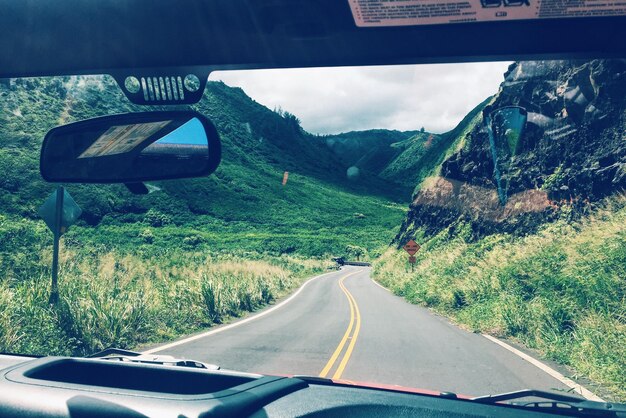
Main Driving Routes From Atlanta to Blue Ridge
For most people in metro Atlanta, driving is the simplest and fastest way to get to Blue Ridge.
1. The Most Common Route (I-75 / I-575 / GA-515)
This is the typical route for many Atlanta neighborhoods, especially if you’re coming from Downtown, Midtown, Buckhead, or the airport area.
General directions:
- Take I-75 North out of Atlanta.
- If you’re on the east side of the city, first take I-85 or I-20 to connect to I-75 / I-285.
- Merge onto I-575 North (which becomes GA-515 / Zell Miller Mountain Parkway).
- Stay on GA-515 through Woodstock, Canton, Jasper, Ellijay, and Cherry Log.
- Continue on GA-515 until you reach Blue Ridge.
Why people like this route:
- Mostly four-lane divided highway once you’re on GA-515.
- Fewer sharp curves compared to some older mountain roads.
- Many places to stop for gas, food, and restrooms in Woodstock, Canton, Jasper, Ellijay.
Approximate time from popular Atlanta areas (via I-575 / GA-515):
| Starting Area (Atlanta) | Approx. Distance | Typical Drive Time |
|---|---|---|
| Downtown / Five Points | ~93 miles | 2 hours |
| Midtown / Georgia Tech | ~90–92 miles | 1 hr 50–2 hrs |
| Buckhead (Lenox / Phipps area) | ~88–90 miles | 1 hr 45–2 hrs |
| Vinings / Cumberland / Truist Park | ~85–88 miles | 1 hr 40–2 hrs |
| Hartsfield–Jackson Airport area | ~100–105 miles | 2–2.25 hrs |
Times assume moderate traffic and usual stops limited to quick breaks.
2. Alternative Scenic Options
Some drivers prefer more scenic two-lane routes once they get closer to the mountains, especially if they’re already on the north side of Atlanta.
A few common variations (after you’re generally headed toward the Jasper/Ellijay area):
- Using certain county or state roads to bypass small-town traffic areas
- Combining Blue Ridge with nearby stops like Dahlonega, Amicalola Falls, or Suches
These may:
- Add a little time but increase mountain scenery
- Involve more curves, elevation changes, and slower speeds
- Be better suited for daylight driving if you’re unfamiliar with the area
If you’re new to North Georgia driving, many locals recommend staying on GA-515 as long as possible for your first trip.
How Long Should You Plan For the Trip?
When planning from Atlanta to Blue Ridge, think about:
1. Rush Hour Considerations
Traffic leaving Atlanta can significantly change your timing:
Morning weekday departures (6:30–9:00 a.m.):
Heavier traffic on I-75 North and approaching I-575, especially if you’re starting from Downtown or the connector.Afternoon weekday returns (3:30–7:00 p.m.):
Expect slowdowns around Cobb County, I-285 junctions, and into Downtown / Midtown.
To avoid frustration:
- Aim to leave Atlanta after 9:30 a.m. or midday if possible.
- For weekend trips, try to leave Blue Ridge before late afternoon on Sunday to avoid the worst return traffic into the city.
2. Time for Stops
Most people from Atlanta like to build in:
- One brief stop each way (gas, restrooms, or a quick snack)
- Extra time if traveling with kids, pets, or a larger group
If the direct driving time is around 2 hours, many Atlanta travelers loosely plan for:
- 2.5 hours door to door to account for traffic and a short stop.
Is Blue Ridge a Day Trip From Atlanta?
Yes. For many Atlanta residents and visitors, Blue Ridge works well as either:
- A day trip (morning departure, evening return), or
- A weekend getaway (Friday–Sunday or Saturday–Monday)
Day Trip Considerations
From most Atlanta neighborhoods, you can realistically:
- Leave around 8:00–9:00 a.m.
- Get to Blue Ridge by 10:00–11:00 a.m.
- Spend 5–7 hours exploring
- Be back in Atlanta by early or mid-evening
A day trip works especially well if you:
- Are starting from North Atlanta areas like Buckhead, Sandy Springs, Dunwoody, Roswell, or Marietta, which are already closer to I-575.
- Plan just 1–2 main activities (for example, a hike and a meal, or a train ride and time in town).
Getting From the Atlanta Airport (ATL) to Blue Ridge
If you’re flying into Atlanta and heading straight to Blue Ridge, your main option is to rent a car at Hartsfield–Jackson Atlanta International Airport.
Airport to Blue Ridge Distance & Route
- Distance: ~100–110 miles, depending on the exact terminal and route.
- Normal travel time: Around 2 to 2.5 hours.
You’ll typically:
- Take local roads or I-85 to connect with I-75 / I-285.
- Head north on I-75.
- Continue on I-575 North, which becomes GA-515, then follow to Blue Ridge.
Because the airport is on the south side of Atlanta, your drive will often be a bit longer than if you were starting from Midtown or Buckhead.
Are There Public Transit or Shuttle Options?
For most people, driving is the only practical option from Atlanta to Blue Ridge.
MARTA and Intercity Buses
- MARTA: Does not run to Blue Ridge or other North Georgia mountain towns.
- Intercity buses (such as those leaving from downtown Atlanta or the area around Midtown): Some may serve North Georgia hubs like Gainesville or Dalton, but they typically do not go directly to Blue Ridge and schedules/availability are limited.
You would almost always need:
- A rental car
- A friend or family member driving
- Occasionally, a private driver or rideshare, though that can be costly and less predictable for the return trip.
Driving Tips for Atlantans Heading to Blue Ridge
Even if you’re used to Atlanta traffic, mountain-area driving can feel a bit different once you’re off the main highways.
1. Weather and Seasonal Conditions
Summer:
Generally easy driving, but watch for afternoon thunderstorms and wet roads.Fall (leaf season):
Heavier traffic on weekends as leaf peepers head to the mountains. Build in extra time.Winter:
Blue Ridge and nearby areas can get ice, snow, or fog, especially on smaller mountain roads.
If conditions are bad, many Atlanta travelers stick closely to GA-515, which tends to be treated and cleared more quickly than rural roads.Spring:
Rain and changing temperatures are common. Some travelers watch for fog in higher elevations in the early morning hours.
2. Fuel and Food Stops on the Way
Convenient places along I-575 / GA-515 for gas, snacks, and restrooms include:
- Woodstock
- Canton
- Ball Ground / Jasper area
- Ellijay
Many Atlanta families plan their primary stop in Ellijay:
- It’s roughly three-quarters of the way to Blue Ridge.
- Offers several grocery options if you’re stocking up for a cabin stay.
3. Rideshare and Taxi Considerations
Rideshare services like Uber and Lyft:
- Are widely available across metro Atlanta, including areas like Buckhead, Sandy Springs, East Cobb, and the airport.
- Become much less reliable or unavailable as you get deeper into the mountains, including Blue Ridge.
If you ride from Atlanta to Blue Ridge using a rideshare, you may have difficulty:
- Finding a return ride to Atlanta
- Getting rides for short trips around Blue Ridge
Most visitors rely on:
- Their own car
- A rental car
- In some cases, pre-arranged private transportation for special events
How Blue Ridge Fits Into a North Georgia Trip From Atlanta
For someone living in or visiting Atlanta, Blue Ridge can be:
- A primary destination for a cabin, hiking, or mountain town experience.
- One stop on a North Georgia loop, combined with places like:
- Ellijay (apple orchards, especially in the fall)
- Dahlonega (wine country, historic square)
- Helen (Alpine-style town)
- Amicalola Falls State Park (major waterfall and hiking destination)
Many Atlantans structure trips like:
- Day trip: Atlanta → Blue Ridge → back to Atlanta
- Weekend: Atlanta → Ellijay → Blue Ridge → back to Atlanta
- Long weekend: Atlanta → Dahlonega → Blue Ridge → maybe Murphy or Copperhill → back to Atlanta
Knowing that Blue Ridge is only about 2 hours from most of Atlanta makes it easy to add to your itinerary without spending your whole day in the car.
Key Takeaways for Atlanta Travelers
- Distance: About 90–100 miles from most Atlanta neighborhoods to Blue Ridge.
- Drive time: Typically 1 hour 45 minutes to 2 hours 15 minutes, depending on where you start and traffic.
- Fastest, most common route:
I-75 North → I-575 North → GA-515 straight into Blue Ridge. - Best way to travel:
Driving your own car or a rental—public transit options are extremely limited. - Feasible as:
Both a day trip and a weekend getaway from Atlanta.
With a manageable drive and straightforward route, Blue Ridge is one of the most accessible mountain escapes for anyone starting in Atlanta, Georgia.