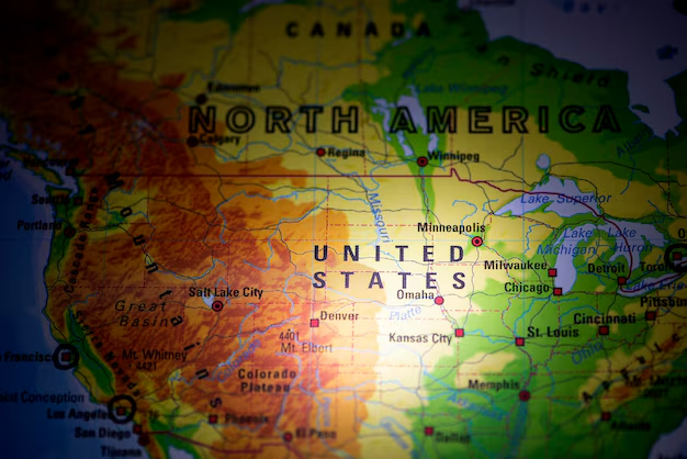
Where Atlanta Is in America (And How It Fits Into the Bigger Picture)
If you’re wondering “Where is Atlanta in America?”, you’re not alone. Whether you’re planning a trip, moving here, or helping someone understand where you live, it helps to know exactly how Atlanta fits into the map of the United States—and how that location affects travel, weather, culture, and getting around.
This guide breaks it down in clear, local terms.
Atlanta’s Place in the United States
Atlanta is a major city in the Southeastern United States. More specifically:
- Country: United States of America
- Region:Southeast (often called the “Deep South”)
- State:Georgia
- Role in State:Capital city of Georgia and its largest metropolitan area
Atlanta sits in north-central Georgia, not on the coast and not at the very top of the state, but slightly above the middle.
Atlanta’s Location in Georgia
Within Georgia, Atlanta is:
- Roughly 1–1.5 hours south of the Tennessee border by car
- Roughly 2.5–3 hours from the Atlantic coast (near Savannah)
- West of the Georgia mountains (such as in Dahlonega and Blue Ridge)
- East of the Alabama state line
So if you picture Georgia as a rough rectangle, Atlanta is a bit above center, leaning toward the west side.
Key Distances to Other Major U.S. Cities
Here’s a simple look at where Atlanta sits compared to other well-known American cities.
| City | Direction from Atlanta | Approx. Travel Time by Air* |
|---|---|---|
| New York City | Northeast | ~2–2.5 hours |
| Washington, D.C. | Northeast | ~1.5 hours |
| Miami | South / Southeast | ~1.5–2 hours |
| Chicago | North / Northwest | ~2 hours |
| Dallas | West / Southwest | ~2 hours |
| Los Angeles | West | ~4–4.5 hours |
| Denver | Northwest | ~3 hours |
*Times are general estimates from Hartsfield-Jackson Atlanta International Airport and can vary.
This central position in the Southeast is one reason Atlanta is often viewed as a transportation crossroads for America.
Atlanta’s Geography: What It’s Like on the Ground
Atlanta is not a coastal or desert city. It’s:
- In the Piedmont region of Georgia, a hilly area between the mountains and the coastal plain
- Known for rolling hills, lots of trees, and a relatively high elevation compared to many Southern cities
Some quick geographic notes:
- Elevation: Around 1,000 feet (305 meters) above sea level in many areas
- Nicknames: Often called a “city in a forest” because of its extensive tree canopy
- Nearby nature: The Chattahoochee River runs through the metro area, and the North Georgia mountains are a short drive away
If you live here, this explains why Atlanta has leafy neighborhoods, mild winters (with occasional ice), and hot, humid summers, but not the flat, coastal feel of cities like Miami or New Orleans.
How Atlanta’s Location Shapes Travel and Transportation
Hartsfield-Jackson: Atlanta’s Global Gateway
Atlanta is home to Hartsfield-Jackson Atlanta International Airport (ATL), one of the busiest airports in the world.
- Location: Just south of downtown Atlanta
- Address: 6000 N Terminal Pkwy, Atlanta, GA 30320
- Why it matters:
- Major hub for domestic flights across the U.S.
- Strong connections to Europe, Latin America, and other regions
Because of Atlanta’s central location in the Southeast, many connecting flights across America pass through ATL, making it a convenient jumping-off point whether you live here or are visiting.
Highways and Driving Into Atlanta
Several major Interstate highways converge in Atlanta, reflecting its central role in the region:
- I‑75: Runs north-south (Detroit to Florida), passing directly through Atlanta
- I‑85: Runs northeast-southwest, also crossing through the city
- I‑20: Runs east-west, connecting Atlanta to Birmingham (west) and Augusta (east)
- I‑285: The loop around Atlanta (often called “The Perimeter”)
If you’re driving from:
- Charlotte, NC: Generally southwest into Atlanta (via I‑85)
- Birmingham, AL: East into Atlanta (via I‑20)
- Savannah, GA: Northwest into Atlanta (commonly via I‑16 then I‑75)
- Florida cities (like Orlando/Tampa): North into Atlanta (often via I‑75)
Atlanta’s location makes it a natural road hub for the Southeast.
Atlanta’s Role in the Southeast
Because of where it sits in America, Atlanta functions as:
- A regional business and logistics center
- A transportation hub for flights, trucking, and rail
- A cultural center for music, film, sports, and higher education in the Southeast
Many people from neighboring states—Alabama, South Carolina, Tennessee, Florida—travel to Atlanta for:
- Big concerts and sports events
- Shopping and dining
- Specialized medical care
- Major universities and conventions
This is closely tied to both its central location in the region and its role as the capital of Georgia.
How Atlanta’s Location Affects Weather and Seasons
Knowing where Atlanta sits in America also helps explain its climate:
- Regionally: In the humid subtropical zone common to much of the Southeast
- Summers: Hot and humid, with frequent afternoon thunderstorms
- Winters: Generally mild, but with occasional cold snaps and rare snow/ice events
- Spring and Fall: Often comfortable, with popular outdoor festival seasons
Because Atlanta is inland and at a higher elevation than many Southern cities, it tends to be:
- Less impacted by direct coastal hurricanes, but
- Still affected by remnants of tropical systems, heavy rain, and storms that move inland
Understanding “Metro Atlanta” vs. the City of Atlanta
When people say “Atlanta,” they sometimes mean different things:
- City of Atlanta: The official city limits within Fulton and DeKalb counties
- Metro Atlanta (Atlanta metropolitan area): A much larger region including surrounding counties like Cobb, Gwinnett, Clayton, DeKalb, and others
This larger metro area stretches across a big part of north-central Georgia, but it is still all centered on Atlanta’s location in the Southeastern U.S.
Helpful Local Reference Points
If you’re trying to place Atlanta more precisely:
- Downtown Atlanta is near where I‑75, I‑85, and I‑20 intersect
- Midtown Atlanta sits just north of downtown and is a major cultural and business district
- Buckhead is farther north and is known as a major commercial and residential area
All of these are within the broader Atlanta area in north-central Georgia.
Government and Administrative Location Details
For official or mailing purposes, it helps to know Atlanta’s place in different systems:
State Capital:
- The Georgia State Capitol is in downtown Atlanta
- Address: 206 Washington St SW, Atlanta, GA 30334
County Seats:
- Much of Atlanta lies in Fulton County, whose main government complex is in downtown
- Example: Fulton County Government Center, 141 Pryor St SW, Atlanta, GA 30303
- Parts of Atlanta extend into DeKalb County
- Much of Atlanta lies in Fulton County, whose main government complex is in downtown
Federal Presence:
- As a major U.S. city, Atlanta hosts several regional federal offices and courts, reflecting its importance within the Southeastern region of the United States
These details matter if you’re handling legal, governmental, or business paperwork that asks for Atlanta’s state, county, or regional location.
Practical Tips for Visitors and Newcomers
If you’re just starting to get oriented:
- ✅ Remember the basics: Atlanta is in Georgia, in the Southeastern United States, in north-central Georgia.
- ✅ Think of it as a hub: Flights and highways radiate out to much of the U.S. from here.
- ✅ Use landmarks: Downtown, Midtown, and Buckhead all sit along a north–south axis just east of where I‑75 and I‑85 run together.
- ✅ Know your region: When forms or services ask for your U.S. region, Atlanta is generally grouped as “Southeast” or “Southern United States.”
Once you understand where Atlanta sits in America—physically and regionally—it becomes much easier to plan travel, understand the weather, navigate the highways, and explain to others exactly where “Atlanta, Georgia” is on the map.