Flooding in Atlanta: Where It Happens and How to Get Around Safely
Atlanta’s heavy rainstorms can create sudden, dangerous flooding, especially in certain low-lying and fast-draining parts of the city. If you live in Atlanta, are visiting, or are just trying to move around town during bad weather, it helps to know where flooding usually happens, which routes to avoid, and how to check current conditions.
Understanding Flooding in Atlanta
Atlanta doesn’t have a single “flood zone.” Instead, flooding tends to pop up:
- Along creeks and streams (like Peachtree Creek and Proctor Creek)
- In low-lying underpasses and viaducts
- On busy arterial roads and interstates where storm drains get overwhelmed
- In neighborhoods with older drainage systems or lots of pavement and hills
Most problems fall into two types:
- Flash flooding: Fast, intense water on streets and in underpasses during or right after heavy rain
- River/creek flooding: Rising water along creeks and floodplains that can last longer
Common Flood-Prone Areas in and Around Atlanta
This is not an emergency alert, and flooding conditions can change with each storm. But Atlantans often see flooding reported in the following general areas and corridors:
1. Central Atlanta & Intown Neighborhoods
Downtown & Midtown
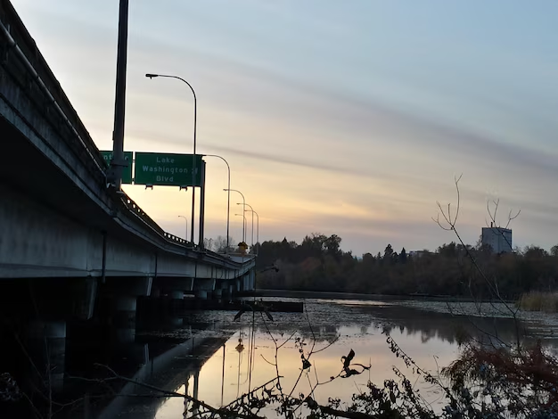
- Underpasses and viaducts near the Downtown Connector (I‑75/85) can collect water quickly.
- Low spots around Northside Drive, Spring Street, and Courtland Street are sometimes closed during intense storms.
- Some MARTA rail and bus access areas can be affected by localized ponding, especially near large stations.
Peachtree Creek Corridor
Neighborhoods and roads near Peachtree Creek are known areas to watch:
- Parts of Buckhead, including low-lying sections near Peachtree Road, Piedmont Road, and Lenox Road
- Areas along Northside Drive NW, Moore’s Mill Road, and cross streets near the creek
- Sections near Peachtree Creek Greenway and nearby residential streets
2. Westside & Proctor Creek Areas
The Westside of Atlanta has several creeks and low-lying neighborhoods that can flood:
- Areas along Proctor Creek and its tributaries
- Spots in and around Bankhead, West Midtown, and English Avenue/Vine City that sit in lower elevations
- Underpasses and railroad crossings where water can collect quickly during storms
3. South and Southwest Atlanta
- Low sections along Metropolitan Parkway, Cleveland Avenue, and roads near I‑75/I‑85 south of Downtown
- Neighborhoods near airport-area creeks and drainage channels (Hartsfield-Jackson Atlanta International Airport is designed with major stormwater systems, but nearby streets and lots can experience ponding)
4. Eastside & DeKalb-Area Corridors
While many eastside areas drain reasonably well, flooding can still pop up:
- Near creeks and streams that feed into the South Fork and North Fork of Peachtree Creek
- Low spots around Moreland Avenue, Memorial Drive, Flat Shoals Road, and some intown eastside neighborhoods, especially where storm drains are blocked
Street Flooding and Traffic Hotspots
Certain road types and locations in Atlanta are more prone to flooding:
Underpasses, Viaducts, and Low Spots
These are often blocked off with barricades during storms:
- Railroad underpasses throughout the city
- Viaducts connecting downtown streets over rail lines
- Low points on older roads where drainage pipes are smaller or partially clogged
When it’s raining hard, avoid:
- “Dips” in the road with no easy way to turn around
- Roads with standing water you can’t see the bottom of
- Any barricade or “Road Closed – High Water” sign (never drive around it)
Interstates and Major Highways
Flooding on interstates is often short-lived but dangerous:
- I‑75/85 Downtown Connector: Heavy water can build up in some lanes during intense storms
- I‑20, especially at interchanges and low-lying stretches
- On- and off-ramps with poor drainage or debris over drains
Traffic may slow sharply, and crashes increase when people hit unexpected standing water at highway speeds.
How to Check Where Flooding Is Right Now
Because flooding is highly time- and storm-specific, the most accurate way to know where it is right now is to use real-time local resources:
City of Atlanta & Fulton County Resources
City of Atlanta Department of Watershed Management
- Main office: 72 Marietta St. NW, Atlanta, GA 30303
- Phone (general inquiries): 404-330-6000
- Can offer information about drainage issues, blocked inlets, and long-term flood concerns.
Fulton County Emergency Management Agency (EMA)
- 141 Pryor St. SW, Atlanta, GA 30303
- Main switchboard: 404-612-4000
- Coordinates emergency alerts and severe weather information for much of the Atlanta area.
These offices won’t function like breaking-news outlets, but they are key points for floodplain mapping, mitigation projects, and long-term planning.
Real-Time Weather and Traffic Tools
When heavy rain is in the forecast:
- Use local TV/radio stations for specific street closures and creek-overflow reports.
- Check real-time traffic maps for red/closed segments, especially:
- Downtown Connector (I‑75/85)
- I‑20 through Atlanta
- I‑285 segments where heavy rain is hitting
- Look at radar and severe weather alerts on your preferred weather app to see which part of the metro is getting the heaviest rainfall.
Getting Around Atlanta Safely During Flooding
When you suspect flooding in Atlanta, adjust how you move around the city:
If You’re Driving
Key rules Atlantans are encouraged to follow:
- Turn around, don’t drive through water. Even a few inches can hide potholes, open manholes, or strong currents.
- Stick to higher ground when possible:
- Use hillier routes instead of low creek roads.
- Avoid known underpasses and viaducts during intense storms.
- Slow down on interstates. Hydroplaning is common when rain first hits oil-covered pavement.
- Watch for blocked storm drains. Water tends to pool around clogged grates at intersections and at the bottom of hills.
If You’re Using MARTA or Other Transit
MARTA generally runs through heavy rain, but access points and routes can be affected:
- Bus routes may be detoured around flooded streets or blocked intersections.
- Some station entrances or surrounding sidewalks may have standing water.
Check service alerts through MARTA’s official channels (app, phone line, station announcements) if storms are severe.
Areas More Likely to Be in Official Flood Zones
Beyond street flooding, parts of Atlanta sit in mapped floodplains associated with creeks and streams. These areas may:
- Require flood insurance for certain property owners
- Be subject to building and development limits
- Be targeted for stormwater improvements by the City of Atlanta
If you live or are considering moving near:
- Peachtree Creek (and its North/South forks)
- Proctor Creek and its tributaries
- Other creeks cutting through residential areas
…it’s wise to:
- Look up floodplain maps for your address through city or county planning departments.
- Talk to your insurance agent about whether your home is at risk of flooding (even if you’re not in an official floodplain).
Simple Reference: Where Flooding Often Shows Up in Atlanta
| Type of Area | Examples in/around Atlanta | What to Watch For |
|---|---|---|
| Creek corridors | Peachtree Creek, Proctor Creek | Rising water, flooded yards/roads nearby |
| Downtown & Midtown low spots | Viaducts, underpasses, parts of Northside Dr., Spring St. | Sudden deep water, road closures |
| Westside neighborhoods | Areas near Proctor Creek, Bankhead, West Midtown | Street flooding, overwhelmed drains |
| Airport/south side roads | Metropolitan Pkwy, Cleveland Ave, near I‑75/I‑85 S | Ponding water, temporary lane closures |
| Interstate trouble spots | I‑75/85 Connector, I‑20, some ramps and interchanges | Standing water in lanes, hydroplaning risk |
Practical Next Steps if You’re Worried About Flooding
If you’re trying to understand where flooding is in Atlanta today and how it affects getting around:
- Check radar and traffic maps to see which part of the metro is getting hit hardest.
- Avoid known low-lying routes: underpasses, viaducts, creekside roads, and dips.
- Listen to local radio or TV during major storms for specific streets and neighborhoods with closures.
- If you live near a creek or low area, contact:
- City of Atlanta Dept. of Watershed Management (404-330-6000) for drainage and floodplain questions.
- Your county’s emergency management office for alert systems and preparedness info.
Flooding in Atlanta is highly localized and changes from one storm to the next. Knowing the city’s typical trouble spots, using real-time tools, and choosing higher, safer routes will help you get around more confidently whenever heavy rain hits.