Why Atlanta Has So Much Traffic (And What You Can Do About It)
Atlanta’s traffic reputation is legendary—for locals who battle I‑285 every day and visitors surprised by gridlock at noon on a Tuesday. If you’re wondering why Atlanta has so much traffic, the answer isn’t just “too many cars.” It’s a mix of geography, growth, planning decisions, and daily habits that all collide on the highway.
Here’s a clear breakdown of what causes Atlanta traffic, plus practical tips for getting around the city with less frustration.
The Big Picture: Why Atlanta’s Roads Feel So Packed
Several factors combine to make traffic in Atlanta unusually intense:
- Regional hub with limited alternatives
- Rapid growth outpacing infrastructure
- Sprawling suburbs and long commutes
- High dependence on cars
- Bottlenecks at key interchanges and chokepoints
- Weather, crashes, and events making it worse
Each of these plays out in a uniquely Atlanta way.
Geography: A Regional Hub With All Roads Leading to Atlanta
Atlanta sits at the center of North Georgia and much of the Southeast. It’s a transportation crossroads:
- Interstates converging downtown: I‑75, I‑85, and I‑20 all meet in the core.
- Perimeter loop (I‑285): Circles the city but also carries a lot of through-traffic that never stops in Atlanta.
- Hartsfield‑Jackson Atlanta International Airport: One of the world’s busiest airports, right off I‑75 and I‑85, adds heavy traffic from travelers, hotel shuttles, and freight.
Because of this, Atlanta’s highways carry:
- Local commuters
- Suburban and exurban drivers
- Freight trucks moving through the Southeast
- Travelers headed to and from the airport
Result: Even if Atlanta had no commuters, it would still carry a lot of regional and interstate traffic. Layer in daily local use, and congestion builds quickly.
Growth and Sprawl: More People, Longer Drives
Rapid Population Growth
Over recent decades, metro Atlanta has grown much faster than its road network. While some new roads and lanes have been added, population and job growth in the region have frequently outpaced these changes.
Low-Density Development
Atlanta’s metro area is known for sprawl:
- Many people live far from where they work.
- Neighborhoods, shopping, and offices are often spread out instead of clustered.
- Some areas lack sidewalks or bike lanes, making driving the default.
This leads to longer average commutes and a larger number of cars on the road at the same time.
Car Culture: Why So Many People Drive
Limited Everyday Transit Options for Many Areas
Atlanta does have public transit, including:
- MARTA rail and bus (covering the City of Atlanta and some surrounding counties)
- Xpress commuter buses (overseen by the State Road and Tollway Authority)
- Local bus systems in counties like Cobb and Gwinnett
However, not all parts of the metro are served well by transit:
- Some suburbs and outlying counties have no rail stations and limited bus routes.
- Many jobs are in office parks or commercial areas that are not directly on a transit line.
- Some people work varying hours, late-night shifts, or multiple jobs, making scheduled transit less convenient.
So for a large share of residents, driving is the only practical way to get from home to work, school, and errands.
Parking and Driving Habits
In many parts of metro Atlanta:
- Parking is still relatively available and expected.
- Many errands—grocery stores, schools, kids’ activities—are spread out, encouraging multiple car trips per day.
- Carpooling is less common compared to some other large cities.
This daily pattern keeps the number of vehicles per household high and traffic volumes heavy throughout the week.
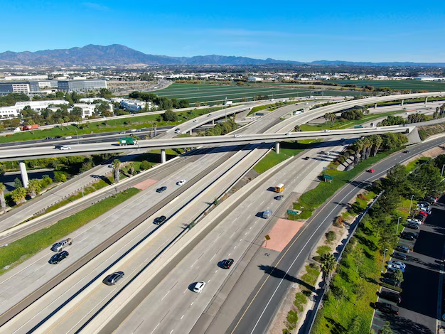
Road Design: Chokepoints, Interchanges, and Lane Drops
Certain design features of Atlanta’s highways make congestion almost inevitable at times.
The Downtown Connector (I‑75/85)
The Downtown Connector is the stretch where I‑75 and I‑85 combine through central Atlanta. It:
- Carries north–south traffic for much of the region in both directions.
- Has many on- and off‑ramps in short distances.
- Is used by commuters, freight trucks, and event traffic (Stadiums, Georgia State University, downtown offices).
This creates frequent stop‑and‑go conditions, especially at:
- The I‑20 interchange
- Exits for 10th/14th Streets, Courtland, and Williams
- On‑ramps with short merge zones
The Perimeter (I‑285)
I‑285 forms a loop around the city and is both a bypass and a commuter beltway. Several spots are particularly congested:
- Top End (north side) near GA‑400 and I‑75
- East side around I‑20 East and Moreland
- West side near I‑20 West and the Chattahoochee River area
Because so many people live outside the Perimeter and work inside it (or vice versa), I‑285 carries intense rush‑hour traffic, plus trucks trying to bypass downtown.
Lane Drops and Short Merges
Drivers often encounter:
- Lanes that disappear near exits
- Short acceleration lanes, especially near older interchanges
- Complex weaves where drivers must cross several lanes quickly
These design elements force people to brake, hesitate, or swerve across lanes, which slows the entire corridor.
Timing: When Atlanta Traffic Is Worst
Weekday Rush Hours
Typical heavy traffic periods in Atlanta include:
- Morning: roughly 6:30 a.m. – 9:30 a.m.
- Evening: roughly 3:30 p.m. – 7:00 p.m.
During these windows, you can expect slowdowns on:
- I‑75, I‑85, I‑285, and I‑20
- GA‑400, I‑675
- Major surface roads like Peachtree Street, Ponce de Leon Avenue, Memorial Drive, Northside Drive, and Piedmont Road
Midday and Weekend Surprises
Traffic can also be unexpectedly heavy:
- Midday weekdays near major job centers (Midtown, Buckhead, Perimeter, Cumberland)
- Weekends around:
- Major malls (Lenox, Perimeter, Cumberland, Atlantic Station)
- Stadiums and arenas (Mercedes‑Benz Stadium, State Farm Arena, Truist Park)
- Popular intown neighborhoods (Inman Park, Virginia‑Highland, Old Fourth Ward)
In these cases, event traffic, shopping traffic, and tourism all pile onto already-busy streets.
Weather, Crashes, and Construction
Rain and Storms
Even light rain can significantly slow Atlanta traffic:
- Reduced visibility and slick roads cause cautious driving and more fender‑benders.
- Flooding in low‑lying areas, especially underpasses and near creeks, can shut down lanes or entire roads temporarily.
Crashes and Stalled Vehicles
Because many highways are already near capacity, one crash or disabled vehicle can quickly:
- Block a lane
- Create a backup that lasts long after the incident is cleared
- Spill traffic onto local streets as drivers exit early to avoid delays
Construction and Maintenance
Ongoing projects—such as interchange rebuilds, toll lane expansions, or bridge work—can cause:
- Night and weekend lane closures
- Shifted lanes and reduced shoulders
- Confusing detours that slow drivers
In metro Atlanta, there always seems to be at least one major corridor under construction or repair.
Common Bottlenecks and “Hot Spots” Locals Talk About
While conditions change over time, some consistently busy areas include:
- I‑285/GA‑400 (Perimeter Center area) – A major job hub with heavy commuter and through-traffic.
- I‑75/I‑285 on the northwest side (Cumberland/Truist Park area) – Busy with office, residential, and event traffic.
- Downtown Connector (I‑75/85) – Central chokepoint for the entire region.
- I‑20 East and West near I‑285 – Heavy merging plus commuter traffic.
- GA‑400 from I‑285 north toward Roswell/Alpharetta – Intense rush‑hour traffic from northern suburbs.
Even if you’re just visiting, planning your route to avoid these at peak times can save a lot of time.
How Public Agencies in Atlanta Manage Traffic
Several official agencies work on traffic operations, planning, and improvements:
Georgia Department of Transportation (GDOT)
- Oversees interstate and state highways
- Manages traffic cameras, electronic message signs, and many construction projects
- Headquarters: 600 W Peachtree St NW, Atlanta, GA 30308
- General info: (404) 631‑1990
Atlanta Department of Transportation (ATLDOT)
- Manages city streets, signals, and some local projects within the City of Atlanta
- Main office: 55 Trinity Ave SW, Atlanta, GA 30303
Metropolitan Atlanta Rapid Transit Authority (MARTA)
- Operates rail and bus services across the City of Atlanta, Fulton, DeKalb, Clayton, and parts of other counties
- Headquarters: 2424 Piedmont Rd NE, Atlanta, GA 30324
- Customer service: (404) 848‑5000
State Road and Tollway Authority (SRTA)
- Manages toll lanes (like the I‑75/I‑575 and I‑85 Express Lanes) and Xpress commuter buses
- Office: 245 Peachtree Center Ave NE, Suite 2200, Atlanta, GA 30303
These agencies coordinate to monitor incidents, adjust signal timing, and plan long‑term congestion relief projects such as interchange improvements or transit expansions.
Key Reasons Atlanta Has So Much Traffic (Quick Reference)
| Factor | How It Shows Up in Atlanta |
|---|---|
| Regional hub | Multiple interstates, airport, and freight routes all intersect in the metro area. |
| Fast growth & sprawl | More residents living farther from job centers, increasing daily commute distances. |
| Car dependence | Limited transit coverage in some suburbs; driving is often the only practical option. |
| Road design issues | Dense interchanges, lane drops, short merges, and a heavily used downtown connector. |
| Rush-hour patterns | Morning and evening peaks, plus midday and weekend spikes near malls and stadiums. |
| Incidents & weather | Crashes, stalled cars, rain, and construction quickly turn heavy traffic into standstills. |
Practical Tips for Dealing With Atlanta Traffic
Whether you live in Atlanta or are just visiting, there are ways to make getting around more manageable.
1. Time Your Trips Strategically
⏱ Whenever possible:
- Avoid the Downtown Connector and I‑285 during peak rush hours.
- If you must travel during rush, leave extra time—often 20–30 minutes more than the “no traffic” estimate.
- Try to schedule medical appointments, airport trips, or meetings outside the peak windows.
2. Use Transit Where It Works Well
In certain corridors, MARTA rail or bus can be faster and less stressful than driving:
- Airport access: MARTA’s Red and Gold rail lines go directly to the Airport Station inside Hartsfield‑Jackson.
- Events downtown or in Midtown: Taking the train to Five Points, Peachtree Center, GWCC/CNN Center, or Midtown Station can help you avoid parking and game‑day traffic.
- Commuting along rail lines: If you live or stay near a station (e.g., Brookhaven, Decatur, Sandy Springs), riding MARTA into downtown or Midtown can bypass some of the worst congestion.
Some suburban commuters also use:
- Xpress buses from park‑and‑ride lots into downtown, Midtown, and Perimeter job centers, especially from outer counties.
3. Choose Routes Wisely
🗺 For many Atlanta trips:
- Consider surface street alternatives to avoid a clogged section of interstate—though remember, side streets can back up too.
- Use traffic apps to see real-time conditions and adjust as needed.
- If you’re unfamiliar with the city, let your navigation guide you but check for large events near your destination (games, concerts, festivals).
4. Plan for Parking and “Last Mile” Connections
In busy areas like Midtown, Downtown, Buckhead, and around stadiums:
- Look up parking options before you go so you’re not circling blocks.
- For shorter distances once parked, consider:
- Walking where sidewalks are available
- Using bike or scooter share in intown neighborhoods
- Using neighborhood shuttles where offered (some developments and campuses provide them)
5. If You’re New to Atlanta or Visiting
For newcomers and visitors:
- Learn the main corridors you’ll use most: which interstates, which major surface roads, and which exits relate to your home, hotel, or workplace.
- Ask locals (host, employer, or hotel staff) which routes are usually best for specific times of day.
- If you’re staying near a MARTA station or along a busy corridor, consider not renting a car for every day of your trip—sometimes a mix of transit and occasional rideshares works better.
Long-Term Changes: Is Atlanta Traffic Getting Better?
Traffic in Atlanta may feel worse or better at different times, depending on:
- Ongoing construction and completed projects
- Shifts in remote and hybrid work patterns
- New housing and job centers opening in different parts of the region
Over time, efforts such as:
- Improved interchanges and added lanes
- Managed toll lanes
- Transit expansions and better bus networks
- Mixed-use developments that reduce commute distances
aim to relieve the worst congestion and give residents more choices than driving alone.
For anyone living in or visiting Atlanta, understanding why traffic is so heavy—and where and when it’s worst—can help you plan smarter routes, use transit when it makes sense, and adjust your schedule to spend more time enjoying the city and less time stuck on the Connector.