Why Atlanta Traffic Feels So Bad (And What You Can Do About It)

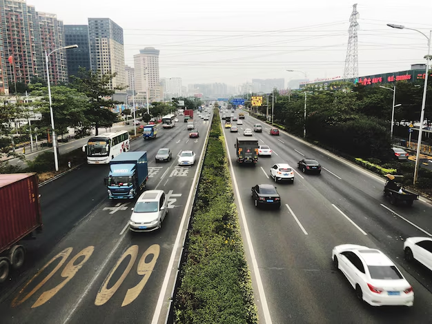
Atlanta is famous for many things: Southern food, movie production, championship sports teams—and frustrating traffic. Whether you live inside the Perimeter, commute from the suburbs, or are visiting for a weekend, it can feel like the roads are always clogged and the GPS is always red.

Here’s a clear look at why Atlanta traffic is so bad, what makes it unique, and how you can realistically get around the city with less stress.

The Big Picture: Why Atlanta Traffic Is So Intense

Several factors come together to make driving in Atlanta especially challenging:

  • Heavy dependence on cars
  • Highways designed as a hub, not a grid
  • Explosive metro-area growth
  • Limited east–west alternatives
  • Weather, crashes, and work zones that quickly snowball into gridlock

Atlanta wasn’t built as a compact, transit-first city. It grew as a sprawling metro region centered on a few major highway corridors, and that design decision still shapes your daily drive today.

1. A Car-Dependent Metro Area

Most people drive, even for short trips

In Atlanta, the default way to get around is by car. Many neighborhoods—especially in the suburbs—have limited sidewalks, spread-out destinations, and few transit connections.

For daily life in and around Atlanta, people commonly drive for:

  • Commuting to downtown, Midtown, or Perimeter Center
  • School drop-offs and activities
  • Grocery runs and errands
  • Visiting friends and family across the metro region

When most residents choose cars at the same times of day, the result is congested interstates and arterials.

Transit exists—but doesn’t reach everyone

Atlanta does have MARTA rail and bus service, along with other local systems, but coverage is uneven:

  • MARTA Rail mainly serves Fulton, DeKalb, and parts of Clayton County. Large areas in Gwinnett, Cobb, and outer suburbs have no rail service.
  • MARTA Bus routes connect many neighborhoods to rail stations, but trips can be slow and require transfers.
  • Outside central areas, walking from home to a bus or rail station is often impractical or unsafe, so many people keep driving.

Because transit doesn’t cover the entire metro area, the default remains driving, which keeps traffic volumes high.

2. Highway Design: A Hub That Bottlenecks

All roads lead to downtown

Look at a map of Atlanta and you’ll notice a pattern: interstates radiate out from downtown like spokes on a wheel:

  • I-75 (north–south)
  • I-85 (north–south)
  • I-20 (east–west)
  • I-285 (the “Perimeter,” a beltway around the core)

Many commutes funnel through the same central chokepoints, especially the Downtown Connector (where I‑75 and I‑85 merge). When thousands of drivers need the same stretch of road at the same time, backups are almost guaranteed.

Limited parallel routes

In some cities, you can easily choose from multiple parallel highways or surface streets to avoid a jam. In Atlanta:

  • Long east–west alternatives are limited, especially outside I‑285.
  • Dense development and rail lines can make “cut-through” routes slow or confusing.
  • Major arteries like Peachtree Road, Cobb Parkway, Roswell Road, and Memorial Drive often back up during rush hours too.

So when the main interstate is blocked, escape options are few, and even local streets quickly clog.

3. Rapid Growth Outpacing Infrastructure

Metro Atlanta keeps expanding

Over the past few decades, the Atlanta metro area has grown rapidly, with new neighborhoods and job centers spreading far beyond the city limits. Major employment hubs now include:

  • Downtown and Midtown Atlanta
  • Perimeter Center (Sandy Springs/Dunwoody area)
  • Buckhead
  • Cumberland/Vinings (near Truist Park)
  • Atlanta Airport area (Hartsfield–Jackson)
  • Alpharetta, Roswell, and other “edge cities”

This “multi-center” pattern means people are commuting in every direction, not just into downtown. That adds strain to interstates like GA‑400, I‑285, I‑75, I‑85, and I‑20, as well as major surface roads.

Development arrives faster than road improvements

New housing and businesses often appear before roads and transit are upgraded. This leads to:

  • More cars feeding into older highway designs
  • Local roads carrying regional traffic that they weren’t designed for
  • Frequent construction projects trying to catch up—which temporarily worsens congestion

The result is a constant feeling that everything is under construction, but nothing is fixed yet.

4. Common Trouble Spots and “Pain Times”

While traffic can be bad almost anywhere at peak times, some corridors in Atlanta are notoriously challenging.

Typical rush-hour patterns

Weekday rush hours often look like this:

  • Morning (6:30 a.m.–9:30 a.m.)

    • Heavy inbound traffic toward Downtown, Midtown, Buckhead, Perimeter Center, and the Airport
    • Congestion on I‑75, I‑85, GA‑400, I‑20, and I‑285, especially approaching major interchanges
  • Evening (3:30 p.m.–7:00 p.m.)

    • Heavy outbound traffic leaving job centers
    • Backups at critical merges and lane drops on I‑285, I‑75, I‑85, and GA‑400

Event and weekend traffic

Even outside rush hour, Atlanta traffic can spike because of:

  • Sports games and concerts (Mercedes-Benz Stadium, State Farm Arena, Truist Park)
  • Major events at the Georgia World Congress Center or Georgia Tech
  • Busy weekends in Midtown, Buckhead, Eastside BeltLine, and Downtown

On these days, local streets surrounding venues may gridlock well before and after events, and interstates can slow earlier than usual.

5. Weather, Work Zones, and Crashes

How small problems become big gridlock

Atlanta’s traffic is sensitive to disruptions. A single crash or stalled vehicle can quickly gum up an entire corridor, because:

  • Interstates already run near capacity at peak times
  • There are few easy detours for long-distance routes
  • Rubbernecking slows even the unaffected lanes

When it rains—which is common—drivers often slow dramatically, and fender-benders increase. Any incident during rush hour can easily add 30 minutes or more to a commute.

Construction and lane closures

Improvements are constantly being made by agencies such as Georgia Department of Transportation (GDOT) and Atlanta Department of Transportation (ATLDOT). But construction zones can mean:

  • Narrowed lanes and reduced shoulders
  • Night and weekend lane closures
  • Sudden speed changes that cause bottlenecks

These projects aim to improve traffic flow long-term, but in the short term, they contribute to the feeling that Atlanta traffic is always under pressure.

6. Transit, MARTA, and Other Options

Even if Atlanta is car-heavy, you do have alternatives to driving everywhere, especially in and near the city.

MARTA rail and bus

The Metropolitan Atlanta Rapid Transit Authority (MARTA) operates:

  • Four rail lines (Red, Gold, Blue, Green) serving:
    • Downtown, Midtown, Buckhead
    • Hartsfield–Jackson Atlanta International Airport
    • Key corridors in Fulton and DeKalb counties
  • Bus routes that connect many neighborhoods to rail stations and employment centers

MARTA can be a smart choice if you’re:

  • Going to or from the airport
  • Attending a Downtown/Midtown event
  • Commuting along corridors already served by rail

You can visit the MARTA headquarters at 2424 Piedmont Rd NE, Atlanta, GA 30324 or call their main line at 404‑848‑5000 for route, fare, and service information.

Local and regional transit agencies

Depending on where you live or stay, you might also encounter:

  • Xpress (operated by the State Road and Tollway Authority) – regional commuter buses connecting suburbs to job centers
  • CobbLinc – serving Cobb County
  • Gwinnett County Transit – serving parts of Gwinnett
  • Clayton County routes (operated by MARTA)

These services mainly help with commuter trips during peak times, reducing the need to drive alone.

7. How to Survive (and Outsmart) Atlanta Traffic

Even if you can’t change the road network, you can adjust your approach to make getting around easier.

Smart timing and routing

  • Avoid peak windows when you can
    • Aim for before 7:00 a.m. or after 9:30 a.m. for morning trips
    • In the evening, after 6:30–7:00 p.m. is usually easier than 5:00 p.m.
  • Use real-time navigation apps to:
    • Check traffic conditions before you leave
    • Reroute around major incidents or lane closures
  • If you must travel during a known bottleneck, build in a buffer of 20–30 minutes, especially for:
    • Flights out of Hartsfield–Jackson Airport
    • Events in Downtown, Midtown, Buckhead, or Cobb (Truist Park)

Choose modes strategically

  • Use MARTA when:
    • Your origin or destination is near a station
    • You’re heading to an event where parking is expensive or limited
  • Consider park-and-ride lots along MARTA or Xpress routes to skip the worst segments of your commute.
  • For short trips in dense neighborhoods like Midtown, Inman Park, Old Fourth Ward, Little Five Points, or parts of Buckhead, walking, biking, or using scooters can be easier than driving and parking.

Plan around events and construction

  • Check event schedules for major venues if your route passes nearby.
  • Pay attention to GDOT and ATLDOT construction alerts, especially on:
    • I‑285 (top end and south side)
    • GA‑400
    • Interchanges like “Spaghetti Junction” (I‑285/I‑85) and the Downtown Connector

8. Atlanta Traffic at a Glance

Here’s a quick reference to the main reasons Atlanta traffic feels so difficult:

FactorHow It Affects You on the Road
Car-dependent lifestyleMost people drive, even for short trips, filling highways and main roads.
Hub-shaped highway networkMany routes converge on the same interstates and interchanges, creating chokepoints.
Rapid metro growthMore residents, jobs, and suburbs mean more long-distance commutes in all directions.
Limited alternativesFew parallel highways and incomplete transit coverage limit your options when traffic is bad.
Weather and incidentsRain, crashes, and stalled vehicles quickly cause large backups.
Construction workOngoing improvements narrow lanes and close ramps, causing temporary but frequent slowdowns.

9. Who Manages Atlanta’s Roads and Traffic?

Knowing which agencies handle traffic and roads can help when you need information, reports, or planning resources.

  • Georgia Department of Transportation (GDOT)

    • Oversees most interstates and state routes
    • Main Office: 600 W Peachtree St NW, Atlanta, GA 30308
    • General information: 404‑631‑1990
  • Atlanta Department of Transportation (ATLDOT)

    • Manages city streets, signals, and local projects within the City of Atlanta
  • MARTA

    • Handles transit service (rail and bus) across parts of the metro
    • Headquarters: 2424 Piedmont Rd NE, Atlanta, GA 30324
    • Customer information: 404‑848‑5000

These organizations provide maps, construction updates, and service details that can help you plan smarter routes.

10. What This Means If You Live In or Visit Atlanta

If you’re living in Atlanta, expect:

  • Commutes that can vary widely in time day-to-day
  • The need to plan around rush hours and big events
  • Strong incentives to live near work or near a MARTA station if possible

If you’re visiting Atlanta:

  • Don’t underestimate travel time between neighborhoods; a 10-mile drive can take 30–45 minutes at peak times.
  • Use MARTA for airport trips and central-city destinations when convenient.
  • If you’re driving a rental car, give yourself extra time and rely on navigation apps for live traffic.

Atlanta’s traffic is challenging because of how the city grew, how its highways are laid out, and how much the region depends on cars. With realistic expectations and some strategic planning—timing your trips, using transit when it makes sense, and watching for hot spots—you can still move around the city efficiently, whether you call Atlanta home or you’re just passing through.