Where Is Clark Atlanta University? A Local’s Guide to Location, Directions, and Getting Around
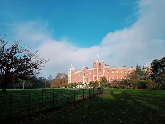
Clark Atlanta University is located in the heart of Atlanta, Georgia, in the historic Atlanta University Center (AUC) district just west of Downtown.
Main campus address:
If you live in Atlanta, visit regularly, or are coming into the city for the first time, knowing exactly where Clark Atlanta University sits and how to get there can save time and frustration. Here’s how it fits into the city and how to navigate to and around campus.
Where Clark Atlanta University Is in Atlanta
Neighborhood and surrounding area
Clark Atlanta University is in Southwest Atlanta, in the Vine City / Ashview Heights area, within the larger Atlanta University Center consortium of historically Black colleges and universities (HBCUs).
Nearby landmarks and institutions include:
- Morehouse College
- Spelman College
- Morris Brown College
- Mercedes-Benz Stadium (to the northeast)
- Downtown Atlanta (just a short drive or train ride away)
From a city perspective, the campus is just west of Northside Drive NW and south of MLK Jr. Drive SW, placing it close to:
- The Downtown Connector (I-75/I-85)
- I-20 (to the south)
Quick Location Snapshot
| Item | Details |
|---|---|
| City | Atlanta, Georgia |
| Area | Southwest Atlanta / Atlanta University Center |
| Main Address | 223 James P. Brawley Dr SW, Atlanta, GA 30314 |
| Nearest Major Downtown Hub | Downtown Atlanta (about 5–10 minutes by car) |
| Nearby MARTA Rail Stations | Vine City Station, Ashby Station |
| Nearby Stadium | Mercedes-Benz Stadium |
Getting to Clark Atlanta University by Car
From Downtown Atlanta
If you’re starting in Downtown near Peachtree Street or Five Points:
- Head west toward Northside Drive NW.
- Take Northside Drive SW south or use MLK Jr. Drive SW heading west.
- Follow signs toward the Atlanta University Center.
- Look for campus signage for Clark Atlanta University along James P. Brawley Dr SW and adjacent streets.
This is typically a 5–10 minute drive, depending on traffic and events (especially game days at Mercedes-Benz Stadium).
From Midtown Atlanta
From areas like Midtown, Georgia Tech, or Atlantic Station:
- Take I-75/I-85 South and exit toward Northside Drive / Georgia Dome / Mercedes-Benz Stadium, then head south and follow signs toward the AUC.
OR
- Take surface streets via 10th Street, Northside Drive, or Spring Street toward Downtown, then continue west and south to the AUC area.
From Hartsfield-Jackson Atlanta International Airport
From the airport, you have a fairly direct drive:
- Take I-75/85 North (Downtown Connector).
- Exit toward I-20 West.
- Use an exit such as Joseph E. Lowery Blvd or Ashby St/Abernathy Blvd and head north toward the Atlanta University Center.
- Follow neighborhood signage to Clark Atlanta University.
In normal traffic, the drive from the airport is often in the 15–25 minute range.
Using MARTA to Reach Clark Atlanta University
If you prefer public transit, MARTA is a practical option for both residents and visitors.
Closest MARTA Rail Stations
The two main MARTA rail stations closest to Clark Atlanta University are:
- Vine City Station (Blue/Green Line)
- Ashby Station (Blue/Green Line)
Both stations are within a short walk or quick bus ride of the campus, depending on where you’re going within Clark Atlanta.
From the Airport via MARTA
From Hartsfield-Jackson:
- Board the Red or Gold Line northbound from the Airport Station.
- At Five Points Station, transfer to the Westbound Blue or Green Line.
- Get off at Vine City or Ashby.
- Walk or use connecting bus routes toward the Atlanta University Center.
This route is popular with visitors who want to avoid renting a car or dealing with downtown parking.
Bus Options Near Campus
Several MARTA bus routes serve or pass near the Atlanta University Center, connecting to:
- Downtown and Five Points
- West End
- Nearby neighborhoods in Southwest Atlanta
Routes and numbers can change over time, so it’s smart to check the latest MARTA bus maps or smartphone app before you go.
Walking and Biking Around the Area
For those already in the AUC area, West End, or Vine City, walking or biking can be practical.
- The core of Clark Atlanta’s campus is pedestrian-friendly, with walkways between academic buildings, residence halls, and AUC neighbors.
- Crossing between Clark Atlanta, Spelman College, and Morehouse College is manageable on foot for many people.
- For bikes and scooters, streets around James P. Brawley Dr SW, Fair St SW, and Lawton St SW are commonly used, but traffic can vary, especially on game days and during campus events.
⚠️ As with much of central Atlanta, it’s wise to stay aware of traffic, cross only at crosswalks when possible, and pay attention to one-way streets.
Parking and Drop-Off Near Clark Atlanta University
Visitor Parking
Parking options can vary by time of day and event schedule, but visitors typically look for:
- Campus visitor lots or decks near the main academic areas
- Street parking on nearby roads where permitted
Check any posted signs carefully; some streets around the AUC area have time limits, permit-only sections, or event-related restrictions.
Rideshare and Drop-Off
If using rideshare or taxi services, many people set their drop-off location to:
- The main campus address
- A specific building name (such as the main administrative building, admissions office, or a residence hall)
- A nearby landmark like Morehouse College or Spelman College when meeting friends in the AUC
Drivers frequently use Northside Drive, MLK Jr. Drive, and adjacent streets for approach, so allow a little extra time during peak class hours or major events.
Landmarks and Orientation Tips
To get your bearings once you’re in the area, it helps to remember:
- If you can see Mercedes-Benz Stadium, you’re just to the west of it.
- Downtown skyscrapers will generally be to the east/northeast.
- The cluster of campuses—Clark Atlanta, Spelman, Morehouse—forms the Atlanta University Center, so wayfinding signs that mention AUC will guide you toward Clark Atlanta as well.
- Major east-west streets like MLK Jr. Drive SW and Fair St SW are useful reference points when navigating.
When to Plan Extra Travel Time
Because of its central location, travel times to Clark Atlanta University can change quickly based on what’s happening in the city. It’s smart to allow extra time if:
- There’s a Falcons, United, or large event at Mercedes-Benz Stadium.
- You’re traveling during weekday rush hours (roughly 7–9 a.m. and 4–7 p.m.).
- There are campus events such as homecoming, commencement, or large conferences in the AUC.
On heavy event days, many Atlanta residents and students prefer MARTA or rideshare over driving themselves and searching for parking.
Key Takeaways for Finding Clark Atlanta University in Atlanta
- Clark Atlanta University is in Southwest Atlanta, in the Atlanta University Center near Downtown.
- The full address is 223 James P. Brawley Dr SW, Atlanta, GA 30314.
- It’s easily reachable by car, MARTA rail (Vine City or Ashby), and connecting bus routes.
- The campus sits just west of Mercedes-Benz Stadium and Downtown, near I-20 and the Downtown Connector.
- Whether you’re a local, a prospective student, or a visitor, planning your route, mode of transportation, and parking or drop-off ahead of time will make your visit much smoother.