Where Exactly Is East Atlanta? A Local Guide to Location, Borders, and Getting Around
If you live in metro Atlanta or you’re planning a visit, you’ll hear people talk about East Atlanta a lot—especially if you’re looking for neighborhoods, nightlife, or places to live. But where is East Atlanta, exactly?
Below is a clear, locally grounded guide to where East Atlanta is on the map, how people use the term, and how to get to and around the area.
What People Mean by “East Atlanta”
In Atlanta, “East Atlanta” can mean two slightly different things:
- East Atlanta Village (EAV) – A specific, historic neighborhood with its own small commercial district, bars, restaurants, venues, and homes.
- The broader east side of the city – Sometimes people casually say “East Atlanta” to mean any neighborhood on the eastern side of the city, from Inman Park to Kirkwood to East Lake.
When locals say “I’m going to East Atlanta”, they usually mean East Atlanta Village, not the entire east side.
Where Is East Atlanta Village on the Map?
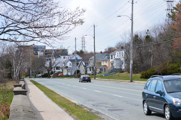
East Atlanta Village (EAV) is a neighborhood on the southeast side of the City of Atlanta, in DeKalb County.
In simple terms, it sits:
- Southeast of Downtown Atlanta
- South of I-20
- East of Moreland Avenue
- West of Gresham Road
- North of Bouldercrest Road
Key Intersections and Landmarks
The heart of East Atlanta Village is the small commercial triangle around:
- Flat Shoals Avenue SE
- Glenwood Avenue SE
- Moreland Avenue SE (just to the west)
If you plug “East Atlanta Village” into a GPS, it will take you to this core area, usually around:
- Flat Shoals Ave SE & Glenwood Ave SE, Atlanta, GA 30316
This is the walkable area packed with restaurants, bars, coffee shops, and small businesses.
East Atlanta vs. Other Eastside Neighborhoods
East Atlanta is part of a cluster of popular eastside Atlanta neighborhoods, but it’s distinct from them. Here’s a simple local-style overview:
| Area / Name | What It Usually Refers To | Rough Location in Relation to East Atlanta Village |
|---|---|---|
| East Atlanta Village | Specific neighborhood & business district | — (the reference point) |
| Ormewood Park | Residential neighborhood, tree-lined, historic homes | Directly west and southwest |
| Grant Park | Neighborhood around Zoo Atlanta & the park | Northwest |
| Kirkwood | Historic, walkable eastside neighborhood | Northeast |
| Edgewood | Residential + retail, near Edgewood Retail District | North/Northeast |
| East Lake | Neighborhood around East Lake Golf Club | East |
People sometimes casually say “East Atlanta” when they mean the whole eastside or when grouping these neighborhoods together. But if you’re looking for the specific neighborhood with the Village nightlife and shops, you want East Atlanta Village in ZIP code 30316.
Official Boundaries vs. What Locals Say
Like many Atlanta neighborhoods, East Atlanta doesn’t have a single universal “map line” everyone agrees on, but there are generally accepted boundaries used by the neighborhood association and the City of Atlanta.
Commonly referenced approximate boundaries for East Atlanta include:
- North: I-20 (Interstate 20)
- West: Moreland Avenue SE
- South: Around Bouldercrest Road SE / Custer Avenue SE area
- East: Around Gresham Road SE
Within that area, you’ll find mostly residential streets with a mix of bungalows, cottages, and newer infill homes, plus the commercial strip that makes up East Atlanta Village itself.
How Far Is East Atlanta From Other Major Atlanta Spots?
If you’re trying to understand travel time and distance from common points in the city, here’s a rough guide by car in light to moderate traffic:
From Downtown Atlanta (Five Points area):
About 3–4 miles southeast, roughly 10–15 minutes via I-20 or surface streets.From Midtown (near Peachtree & 10th):
About 5–6 miles southeast, typically 15–20 minutes, depending on traffic.From Hartsfield–Jackson Atlanta International Airport:
About 11–13 miles northeast, typically 20–25 minutes, using I-85/I-75 to I-20 or surface routes.
Timing can change significantly during rush hour, especially where I-20, I-75/85, and Moreland Avenue converge, so it’s helpful to build in extra time.
Getting to East Atlanta by Car
If you’re driving, you’ll probably come in on I-20 or Moreland Avenue.
From Downtown or Midtown
- Take I-20 East.
- Exit at Moreland Avenue SE (Exit 60).
- Turn right (south) on Moreland Avenue.
- Turn left (east) onto Flat Shoals Ave SE or Glenwood Ave SE to go into the heart of East Atlanta Village.
From Decatur / East Lake
- Head south or southwest on Candler Road, 2nd Avenue, or Gresham Road.
- Use Glenwood Ave SE or Flat Shoals Ave SE to head into the Village.
Parking Tips
Parking around East Atlanta Village is mostly:
- Street parking on Flat Shoals Ave SE and Glenwood Ave SE
- Various side-street parking spots
- Some private lots near businesses
Pay attention to posted signs—some areas are time-limited or reserved after certain hours, especially in front of businesses and around busy nightlife spots.
Getting to East Atlanta by MARTA and Transit
East Atlanta does not have its own MARTA rail station, but you can reach it by bus from nearby stations.
Closest MARTA Rail Stations
- Inman Park/Reynoldstown Station (East/West Line – Blue/Green)
- King Memorial Station (just east of Downtown)
- Edgewood/Candler Park Station
From these stations, you typically transfer to a MARTA bus that heads into or near East Atlanta.
Using MARTA Buses
Routes and numbers can change, but in general:
- Buses serving Moreland Avenue SE or Gresham Road SE can put you within walking distance or a short ride-share of East Atlanta Village.
- Some routes run more frequently during peak commute times, less often late at night.
To plan the best route on the day you travel, use:
- MARTA system maps posted at stations
- MARTA’s phone-based customer information line
- Real-time schedules via official transit planning tools
Walking and Biking Around East Atlanta
Inside East Atlanta Village and the immediate neighborhood, walking is very common:
- The Village core is compact, with shops, bars, and restaurants close together.
- Many nearby streets are residential with sidewalks, though sidewalk quality varies by block.
For biking:
- Glenwood Avenue SE and Flat Shoals Ave SE are common routes, though traffic can be busy during peak times.
- Some riders use quieter side streets to avoid heavier traffic on Moreland Avenue.
Always consider:
- Visibility (especially at night)
- Shared-road conditions (cars, buses, and bikes together)
- Using helmets and lights if you’re cycling
How People Use the Term “East Atlanta” in Daily Life
When someone in metro Atlanta says “East Atlanta,” context matters:
- Looking for nightlife or music?
They probably mean East Atlanta Village itself. - Talking about where they live?
They might mean they live in the broader 30316 area, which can include East Atlanta and nearby spots. - Real estate or rentals?
Listings might say “East Atlanta” loosely, sometimes including areas just outside the traditionally accepted boundaries.
If you’re unsure what someone means, it’s common to ask, “Do you mean East Atlanta Village or just the eastside?”
Helpful Reference Points and Nearby Services
If you’re trying to orient yourself or meet someone near East Atlanta, these general reference areas can help:
- Moreland Avenue SE Corridor – Major north–south road west of East Atlanta, running from Little Five Points down past I-20.
- Glenwood Park – A mixed-use area just west of East Atlanta along Glenwood Ave SE, closer to I-20.
- Zoo Atlanta / Grant Park – A large landmark neighborhood northwest of East Atlanta; many people navigate by this area.
For traffic and road information in and around East Atlanta, the Georgia Department of Transportation (GDOT) and City of Atlanta transportation services provide updates and resources. Their main offices are typically in or near Downtown, within a short drive of East Atlanta.
Quick Summary: What You Need to Know
- East Atlanta usually refers to East Atlanta Village, a neighborhood and nightlife hub on Atlanta’s southeast side, mostly in ZIP code 30316.
- It’s located southeast of Downtown, south of I-20, east of Moreland Ave SE, roughly centered around Flat Shoals Ave SE & Glenwood Ave SE.
- People sometimes use “East Atlanta” more loosely to describe the broader eastside, including nearby neighborhoods like Ormewood Park, Kirkwood, and East Lake.
- You can reach East Atlanta by car via I-20 East and Moreland Ave, and by MARTA bus from nearby rail stations like Inman Park/Reynoldstown and Edgewood/Candler Park.
- Once you’re there, the Village area is very walkable, with residential streets surrounding a compact commercial core.
Understanding these local uses and reference points will help you navigate East Atlanta more confidently—whether you’re choosing a neighborhood, planning a night out, or just trying to understand Atlanta’s eastside geography.