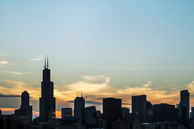
Atlanta’s Elevation: How High Above Sea Level Is the City?
Atlanta isn’t just the capital of Georgia—it’s also one of the highest major cities in the eastern United States. If you live here, visit often, or are planning a trip, you might wonder: how high above sea level is Atlanta, really, and does it matter for everyday life?
Below is a clear breakdown tailored to Atlanta, Georgia, with local landmarks, neighborhood differences, and what the elevation means for weather, outdoor activities, and more.
Atlanta’s Elevation in a Nutshell
Most of Atlanta sits roughly between 800 and 1,050 feet above sea level.
A few quick reference points:
| Location / Area | Approx. Elevation Above Sea Level |
|---|---|
| Downtown Atlanta (Five Points) | ~1,000 ft |
| Midtown & Georgia Tech area | ~950–1,050 ft |
| Buckhead | ~950–1,050 ft |
| Hartsfield–Jackson Atlanta Intl. | ~1,020 ft |
| Chattahoochee River (city limits) | ~750–900 ft (varies by spot) |
These numbers are rounded, but they give you a realistic sense of how high the city is overall.
Why Is Atlanta’s Elevation Relatively High?
Atlanta is built on part of the Piedmont Plateau, a region of rolling hills that stretches across the middle of Georgia. You’ll notice this in:
- The steady hills along Peachtree Street
- The ridges and slopes in neighborhoods like Virginia-Highland, Inman Park, and Druid Hills
- The way roads rise and fall around I-75, I-85, and I-20
Unlike many coastal cities in the Southeast, Atlanta is well inland and elevated. This is one reason it developed as a major rail and transportation hub: the ground is relatively solid and above coastal flood zones.
Do Different Parts of Atlanta Sit at Different Elevations?
Yes. Not every part of Atlanta is at the same height.
Higher-Elevation Areas Around Atlanta
Some of the higher spots in and near the city generally include:
- Midtown & Buckhead ridges – many parts are close to or just above 1,000 feet
- Northwest Atlanta hills – areas near Bolton Road and Marietta Road can feel noticeably hilly
- Eastern neighborhoods near Decatur – parts of Druid Hills and North Decatur are also fairly elevated
These areas aren’t “mountain high,” but they often sit higher than the river valleys and can get slightly breezier conditions.
Lower-Elevation Areas Near Water
Anywhere close to major creeks and rivers tends to be lower:
- Chattahoochee River corridor on the city’s northwest side
- Low-lying creek areas such as Peachtree Creek, Utoy Creek, and Proctor Creek
These spots can sit 100–250 feet lower than neighboring hills, which sometimes matters for drainage, flooding risk, and fog.
How Atlanta’s Elevation Affects Weather and Climate
You might not feel the height change from 900 to 1,000 feet when walking around, but Atlanta’s elevation compared with lower coastal areas does have some subtle effects.
Temperature
Atlanta is often described as having a humid subtropical climate, but its elevation gives it:
- Slightly cooler temperatures than coastal Georgia and parts of south Georgia
- Occasional cooler nights, especially on clear evenings
Within the city, the difference between one neighborhood and another is usually small, but when you compare Atlanta to cities closer to sea level, Atlanta can feel a bit less oppressive in extreme heat.
Rain and Storms
Tall elevation changes inside the city are modest, so rainfall doesn’t vary dramatically just because one neighborhood is 100 feet higher. However:
- Higher spots may drain faster during heavy rain
- Lower-lying areas near creeks and the Chattahoochee River may see water pool or rise more quickly
If you live or stay near a creek corridor, it can be useful to pay closer attention to flash flood advisories.
Snow and Ice
Atlanta’s elevation is high compared with the coast but low compared with North Georgia mountains. That’s why:
- Atlanta does get occasional light snow or ice, but not as much as mountainous areas like Dahlonega or Blue Ridge
- Elevation inside the city isn’t typically the deciding factor for snow; storm track and temperature matter more
Elevation and Outdoor Activities in Atlanta
For most people, Atlanta’s elevation doesn’t cause altitude-related issues the way mountain towns might. But it does shape the feel of outdoor recreation.
Hiking and Biking
Because the city is built on rolling Piedmont hills, you’ll notice:
- Hilly biking routes along streets like Peachtree Road, DeKalb Avenue hills, and Many intown neighborhoods
- Trail variations in places like:
- Chattahoochee River National Recreation Area (various units in Sandy Springs and beyond)
- Freedom Park Trail and BeltLine Eastside Trail
- Stone Mountain Park (east of the city, rising well above local terrain)
You’re still only around 800–1,000+ feet above sea level on most of these, so breathing difficulty from altitude is not usually an issue. The challenge comes more from heat, humidity, and hills than from elevation itself.
Running and Outdoor Sports
Runners training on the BeltLine, in Piedmont Park, or at Grant Park are dealing primarily with:
- Rolling grades (small ups and downs)
- Weather conditions (especially summer humidity)
Elevation is high enough to avoid coastal swampiness but not high enough to feel like mountain air. Many local athletes focus on heat management, hydration, and sun protection more than anything related to altitude.
Does Atlanta’s Elevation Affect Flooding?
Atlanta’s position above sea level helps protect it from coastal storm surge and sea-level rise impacts that threaten some coastal cities. Still, elevation differences inside the city influence local flooding patterns.
Higher Ground vs. Low Spots
Within city limits:
Higher areas (many Midtown, Buckhead, and eastside hills) are often less prone to direct creek flooding but can still experience:
- Street flooding from intense storms
- Storm drain backups
Lower areas near waterways can be more vulnerable to:
- Creek and river flooding
- Flash floods during heavy downpours
If you’re concerned about flood risk around your home, rental, or business, it can be useful to look at floodplain maps and topographic information when making decisions.
How to Check the Elevation of Your Specific Atlanta Address
If you want to know how high your particular spot in Atlanta is:
- Look up your address in an online mapping service that allows elevation view.
- Drop a pin or point on your exact location.
- Check the listed elevation, usually shown in feet or meters above sea level.
This is especially helpful if you:
- Live near the Chattahoochee River or a major creek
- Are considering construction, landscaping, or drainage improvements
- Are just curious how your neighborhood compares with others across the city
Local Agencies and Resources That Use Elevation Data
Several Atlanta-area agencies rely on elevation information for planning, safety, and infrastructure. Knowing who handles what can help if you’re looking for more detailed or official insights.
City and County Planning & Flood Information
City of Atlanta Department of Watershed Management
Handles stormwater systems, drainage, and related infrastructure within the city.Atlanta Department of City Planning
Uses elevation and topography data for zoning, development, and infrastructure planning.Fulton County and DeKalb County government offices
Maintain property records, some of which may reference topography and floodplain details for parcels within their areas.
You can contact these agencies if you’re exploring building plans, permits, or flood concerns at a specific site in Atlanta.
Elevation and Travel: Flying In and Out of Atlanta
If you’re flying through Hartsfield–Jackson Atlanta International Airport, you’re still around 1,000 feet above sea level—similar to much of the city.
This matters mostly to:
- Pilots and airlines, who factor elevation into aircraft performance
- Airport planners, who consider drainage and runway design
For most passengers, the airport’s elevation doesn’t affect comfort or health in a noticeable way.
What Atlanta’s Elevation Means for You Day to Day
To sum up how high Atlanta is above sea level and what it means in practice:
- Most of Atlanta sits around 800–1,050 feet above sea level.
- The city lies on rolling Piedmont hills, giving you gentle elevation changes rather than flat coastal terrain.
- Elevation contributes slightly to cooler conditions than coastal areas at the same latitude, but heat and humidity still dominate the climate.
- Within the city, lower creek and river areas are more sensitive to flooding than hilltop or ridge neighborhoods.
- For outdoor activities, hills and humidity matter more than altitude, since Atlanta isn’t high enough for true “high-altitude” effects.
If you’re living in Atlanta, visiting, or planning a move, you can think of the city as comfortably elevated but not mountainous—high enough to be away from the coast, low enough that you won’t feel altitude the way you would in the high Appalachians or out West.